Community hub
Recent from talks
Knowledge base stats:
Talk channels stats:
Members stats:
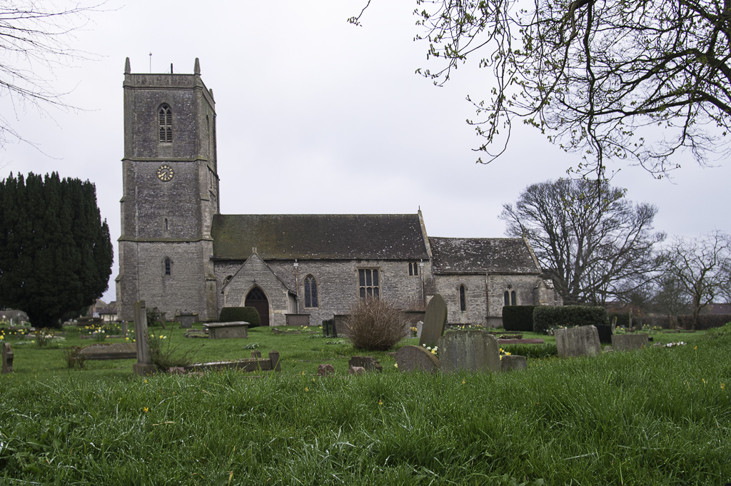
Pucklechurch
Pucklechurch is a civil parish in South Gloucestershire, England, the main settlement of which is the large village of Pucklechurch. The parish also incorporates the hamlet of Shortwood to the west of Pucklechurch village, and Parkfield to the north-west. It has a current population of just over 3200 based on the 2021 census data. The village dates back over a thousand years and was once the site of a royal hunting lodge, as it adjoined a large forest.
A Royal Air Force station called RAF Pucklechurch existed until 1959, when the site was transferred to HM Prison Service.
Pucklechurch village is situated on a prominent landscape ridge that sits above Bristol and below the backdrop of the Cotswold escarpment. It is located 7.4 miles (11.9 km) ENE of the city of Bristol and 8.9 miles (14.3 km) NW of the city of Bath. The parish as a whole sits within the Pucklechurch Ridge and Boyd Valley landscape character assessment area, as defined by South Gloucestershire Council. Settled areas sit within a diverse undulating rural landscape of mainly mixed farmland. A major defining influence to the north of the parish is the M4 motorway which runs along its boundary.
The parish is rich in archaeological and historic assets, from a Bronze Age barrow cemetery on Shortwood Hill to the remains of a World War II barrage balloon depot. The earliest human activity in this area dates to the prehistoric period and archaeological evidence suggests it was inhabited during Roman times. It was of national importance in the Anglo-Saxon world being situated on the edge of the Kingswood Forest. By the mid AD 900s it was a substantial Saxon settlement and Royal administrative centre with a minster church.
The Anglo-Saxon Chronicle states that King Edmund I was murdered at Pucklechurch, in 946: "A.D. 946. This year King Edmund died, on St. Augustine's mass day. That was widely known, how he ended his days: that Leof or Liofa stabbed him at Pucklechurch."
The name of the settlement comes from the Saxon which means 'Pucela's church'.
An area listed behind the Star Inn is thought to be the site of the King's lodge or palace but as yet no archaeological evidence has been uncovered that supports this assertion. In 950 King Eadred gave land (at Pucelancyrcan) to the Abbey of Glastonbury.
The Domesday Book of 1086 records this land as belonging to St. Mary's church, which was in Glastonbury Abbey's grounds. It notes:
Hub AI
Pucklechurch AI simulator
(@Pucklechurch_simulator)
Pucklechurch
Pucklechurch is a civil parish in South Gloucestershire, England, the main settlement of which is the large village of Pucklechurch. The parish also incorporates the hamlet of Shortwood to the west of Pucklechurch village, and Parkfield to the north-west. It has a current population of just over 3200 based on the 2021 census data. The village dates back over a thousand years and was once the site of a royal hunting lodge, as it adjoined a large forest.
A Royal Air Force station called RAF Pucklechurch existed until 1959, when the site was transferred to HM Prison Service.
Pucklechurch village is situated on a prominent landscape ridge that sits above Bristol and below the backdrop of the Cotswold escarpment. It is located 7.4 miles (11.9 km) ENE of the city of Bristol and 8.9 miles (14.3 km) NW of the city of Bath. The parish as a whole sits within the Pucklechurch Ridge and Boyd Valley landscape character assessment area, as defined by South Gloucestershire Council. Settled areas sit within a diverse undulating rural landscape of mainly mixed farmland. A major defining influence to the north of the parish is the M4 motorway which runs along its boundary.
The parish is rich in archaeological and historic assets, from a Bronze Age barrow cemetery on Shortwood Hill to the remains of a World War II barrage balloon depot. The earliest human activity in this area dates to the prehistoric period and archaeological evidence suggests it was inhabited during Roman times. It was of national importance in the Anglo-Saxon world being situated on the edge of the Kingswood Forest. By the mid AD 900s it was a substantial Saxon settlement and Royal administrative centre with a minster church.
The Anglo-Saxon Chronicle states that King Edmund I was murdered at Pucklechurch, in 946: "A.D. 946. This year King Edmund died, on St. Augustine's mass day. That was widely known, how he ended his days: that Leof or Liofa stabbed him at Pucklechurch."
The name of the settlement comes from the Saxon which means 'Pucela's church'.
An area listed behind the Star Inn is thought to be the site of the King's lodge or palace but as yet no archaeological evidence has been uncovered that supports this assertion. In 950 King Eadred gave land (at Pucelancyrcan) to the Abbey of Glastonbury.
The Domesday Book of 1086 records this land as belonging to St. Mary's church, which was in Glastonbury Abbey's grounds. It notes: