| Quisa | |
|---|---|
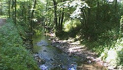
 Quisa in the Parco dei Colli di Bergamo | |
 | |
| Location | |
| Country | Italy |
| Physical characteristics | |
| Source | |
| • location | Canto Alto |
| Mouth | Brembo |
• coordinates | 45°41′20″N 9°35′18″E / 45.6889°N 9.5882°E |
| Length | 13 km (8.1 mi) |
| Basin features | |
| Progression | Brembo→ Adda→ Po→ Adriatic Sea |
Quisa[1][2] is a 13-kilometre (8 mi) river in the province of Bergamo, Lombardy, northern Italy. Its source is located at the foothill of Canto Alto in the municipality of Sorisole; the river subsequently crosses the municipality of Almè, Paladina, Mozzo and Ponte San Pietro where its waters enter in the Brembo.
| History of Bergamo | |
|---|---|
| Monuments and places | |
| Personalities |
|
| Neighborhoods | |
| Transportation | |