
Recent from talks
Wutach (river)
Knowledge base stats:
Talk channels stats:
Members stats:
Wutach (river)
The Wutach (German pronunciation: [ˈvuːtax]) is a river, 91 kilometres long, in the southeastern part of the Black Forest in the German state of Baden-Württemberg. It is a right-hand tributary of the Rhine. In its lower reaches it flows for about 6 kilometres along the border with the canton of Schaffhausen, Switzerland.
The name Wutach means "furious water", referring to the whitewater rapids in the gorge. Wut is recognisably cognate to a modern German word for anger; ach, which forms part of the names of many rivers in the region, comes from an old Celtic word for water, cognate with Latin aqua.
The river changes its name twice before it discharges into the High Rhine near Waldshut:
It rises in the Southern Black Forest as the Seebach in a highland hollow known as the Grüble, only a few metres below the summit of the Seebuck, a subpeak of the Black Forest's highest mountain, the Feldberg. Shortly thereafter it drops in three cascades through a height of 62 metres down the Feldsee Waterfall into the rocky cirque lake of the Feldsee. Heading east-northeast, the stream then follows the glacially formed Bärental valley through the municipality of Feldberg to Lake Titisee. During this stretch it is joined by the Sägenbach, which rises on the Baldenweger Buck on the Feldberg. More than 70% of the average water volume of both streams is siphoned off before their confluence and diverted to the Schluchseewerk hydropower station. As a result, at the Bärental Gauge above the just under 5-metre-high Seebach Waterfall, the Seebach only has a volumetric flow of 0.3 m3/s instead of its natural 0.8 m3/s. Below the little waterfall the Seebach enters a flat valley basin which has filled the silted-up, upper part of the Titisee since the last ice age. The stream now flows in wide meanders through the bogs of the nature reserve before reaching Lake Titisee.
From the Titisee the sluggishly flowing meadow river is called the Gutach ("good stream"). Before Neustadt it swings sharply through 90° to the right and heads southeast in the direction of the almost equally large Josbach/Langenordnach. Below the town, two large bridges cross the valley: the Gutach Viaduct carrying the B 31 and the Gutach Bridge with the Höllental Railway. From here on the river rushes through an ever deepening gorge.
From the confluence where the river acquires the name Wutach, it flows ESE through a series of three gorges with a total length of more than 30 km (19 mi) and a maximum depth of 160 m (520 ft) (see Wutach Gorge) which has long been a tourist attraction. Between the second and the last part of the gorge, near the village of Achdorf in the municipality of Blumberg, it takes a sharp turn (known as the Wutachknie or Knee of the Wutach), and subsequently flows SW to join the Rhine near Tiengen in the town of Waldshut-Tiengen.
At the Wutachknie the river is very close to the headwaters of the Danube, until the last glacial period the upper course of the Wutach was the headstream of the Danube catchment (called Feldbergdonau).
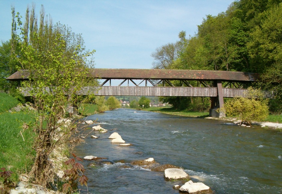
The lower Wutach valley is straight, wide-bottomed and very densely populated. The river forms the border between Germany and Switzerland for two sections that total about 6 kilometres in length, after which it is canalised. The most important settlements in this part of the valley are the town of Stühlingen and the villages of Eggingen and Wutöschingen.
Hub AI
Wutach (river) AI simulator
(@Wutach (river)_simulator)
Wutach (river)
The Wutach (German pronunciation: [ˈvuːtax]) is a river, 91 kilometres long, in the southeastern part of the Black Forest in the German state of Baden-Württemberg. It is a right-hand tributary of the Rhine. In its lower reaches it flows for about 6 kilometres along the border with the canton of Schaffhausen, Switzerland.
The name Wutach means "furious water", referring to the whitewater rapids in the gorge. Wut is recognisably cognate to a modern German word for anger; ach, which forms part of the names of many rivers in the region, comes from an old Celtic word for water, cognate with Latin aqua.
The river changes its name twice before it discharges into the High Rhine near Waldshut:
It rises in the Southern Black Forest as the Seebach in a highland hollow known as the Grüble, only a few metres below the summit of the Seebuck, a subpeak of the Black Forest's highest mountain, the Feldberg. Shortly thereafter it drops in three cascades through a height of 62 metres down the Feldsee Waterfall into the rocky cirque lake of the Feldsee. Heading east-northeast, the stream then follows the glacially formed Bärental valley through the municipality of Feldberg to Lake Titisee. During this stretch it is joined by the Sägenbach, which rises on the Baldenweger Buck on the Feldberg. More than 70% of the average water volume of both streams is siphoned off before their confluence and diverted to the Schluchseewerk hydropower station. As a result, at the Bärental Gauge above the just under 5-metre-high Seebach Waterfall, the Seebach only has a volumetric flow of 0.3 m3/s instead of its natural 0.8 m3/s. Below the little waterfall the Seebach enters a flat valley basin which has filled the silted-up, upper part of the Titisee since the last ice age. The stream now flows in wide meanders through the bogs of the nature reserve before reaching Lake Titisee.
From the Titisee the sluggishly flowing meadow river is called the Gutach ("good stream"). Before Neustadt it swings sharply through 90° to the right and heads southeast in the direction of the almost equally large Josbach/Langenordnach. Below the town, two large bridges cross the valley: the Gutach Viaduct carrying the B 31 and the Gutach Bridge with the Höllental Railway. From here on the river rushes through an ever deepening gorge.
From the confluence where the river acquires the name Wutach, it flows ESE through a series of three gorges with a total length of more than 30 km (19 mi) and a maximum depth of 160 m (520 ft) (see Wutach Gorge) which has long been a tourist attraction. Between the second and the last part of the gorge, near the village of Achdorf in the municipality of Blumberg, it takes a sharp turn (known as the Wutachknie or Knee of the Wutach), and subsequently flows SW to join the Rhine near Tiengen in the town of Waldshut-Tiengen.
At the Wutachknie the river is very close to the headwaters of the Danube, until the last glacial period the upper course of the Wutach was the headstream of the Danube catchment (called Feldbergdonau).
The lower Wutach valley is straight, wide-bottomed and very densely populated. The river forms the border between Germany and Switzerland for two sections that total about 6 kilometres in length, after which it is canalised. The most important settlements in this part of the valley are the town of Stühlingen and the villages of Eggingen and Wutöschingen.
Recent media