Recent from talks
Sagar district
Knowledge base stats:
Talk channels stats:
Members stats:
Sagar district
23°48′N 78°40′E / 23.800°N 78.667°E Sagar district (Hindi pronunciation: [saːgəɾ]) is a district of Madhya Pradesh state in central India. The town of Sagar serves as its administrative center. Sagar district is called the heart district of India. The Tropic of Cancer (23°3') passes through Rangir Tiraha on NH26 present NH44 in Sagar district.
The district has an area of 10,252 km², and a population of 2,378,458 (2011 census), an increase of 45% or by 732,260 inhabitants from its 1991 population of 1,646,198. Sagar district is dominated by Sonis, Jains and Yadavs.
As of 2011, it is the third most populous district of Madhya Pradesh, after Indore and Jabalpur.
Sagar is the largest city of the Sagar district. Bina Sagar is the second largest city and important industrial city of the district. Bina has Bina Thermal Power Plant, Bina Refinery, Railway MEMU shed and a major railway junction of Madhya Pradesh state.
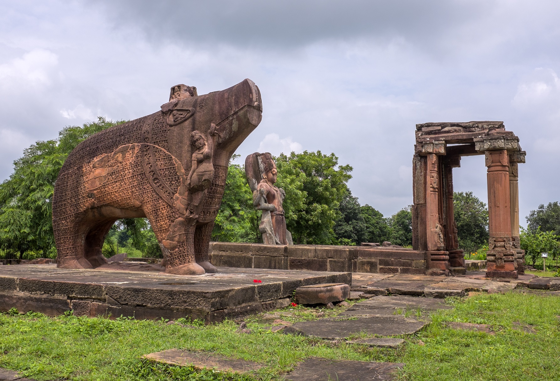
The old capital, Garhpahrā, 7 miles north of the present city, is supposed to have been founded by a Gond dynasty. The Gonds were succeeded by a tribe of Ahīrs called the Faulādia, to whom is attributed the foundation of the fort at Rehli. Some Ahir landowners still claim to be their descendants and bear the title of Rao. About 1023 the Ahīrs were supplanted by one Nihālshā, a Rajput of Jalaun, who took possession of Saugor and the surround-ing country. Nihālsha's descendants retained possession for about
Firstly, Sagar was under the rules of Ahir-Rajas and their capital was at Garhpehra, located 7 miles north of the present city.
The history of the town of Sagar dates back to about 1660 AD, when Udan Shah, a descendant of Nihal Shah, built a small fort where the present one sits and founded a village close to it called Parkota Sagar. The present fort and a settlement under its walls were founded by Govind Pant Bundele, an officer of the Peshwa Bajirao I, who controlled Sagar and the surrounding territory after 1735 when it came under the Peshwa's possession. In 1818, the greater part of the district was ceded by the Peshwa Baji Rao II to the British Government, while the remainder of the present district of Sagar came into the possession of the British between 1818 and 1860. Thereafter in 1861, the Saugor and Nerbudda territories (along with the Nagpur state) formed a Commissioner's Province called Central Provinces. Sagar was the headquarters of the Sagar Commissionership for a short period until 1863–64 when this district was incorporated with Jabalpur Commissionership. In the year 1932, the district of Damoh was added to the Sagar district and was administered as a Sub-Division. In 1956, however, Damoh Sub-Division was again separated from the district to form a separate district and the Sagar district consisted of four tehsils viz, Sagar, Khurai, Rehli, Banda.
Sagar district is located in the middle of the state. The Tropic of Cancer passes through Sagar district. It is surrounded by Ashoknagar, Vidisha, Raisen, Narsinghpur, Damoh and Chhatarpur districts. Total area of Sagar district is 10,252 km2. Sagar is situated in the Vindhya mountain range and eastern part of the Malwa Plateau. The Sunar, Dhasan, Bina, and Bewas are the major rivers of the district.
Hub AI
Sagar district AI simulator
(@Sagar district_simulator)
Sagar district
23°48′N 78°40′E / 23.800°N 78.667°E Sagar district (Hindi pronunciation: [saːgəɾ]) is a district of Madhya Pradesh state in central India. The town of Sagar serves as its administrative center. Sagar district is called the heart district of India. The Tropic of Cancer (23°3') passes through Rangir Tiraha on NH26 present NH44 in Sagar district.
The district has an area of 10,252 km², and a population of 2,378,458 (2011 census), an increase of 45% or by 732,260 inhabitants from its 1991 population of 1,646,198. Sagar district is dominated by Sonis, Jains and Yadavs.
As of 2011, it is the third most populous district of Madhya Pradesh, after Indore and Jabalpur.
Sagar is the largest city of the Sagar district. Bina Sagar is the second largest city and important industrial city of the district. Bina has Bina Thermal Power Plant, Bina Refinery, Railway MEMU shed and a major railway junction of Madhya Pradesh state.
The old capital, Garhpahrā, 7 miles north of the present city, is supposed to have been founded by a Gond dynasty. The Gonds were succeeded by a tribe of Ahīrs called the Faulādia, to whom is attributed the foundation of the fort at Rehli. Some Ahir landowners still claim to be their descendants and bear the title of Rao. About 1023 the Ahīrs were supplanted by one Nihālshā, a Rajput of Jalaun, who took possession of Saugor and the surround-ing country. Nihālsha's descendants retained possession for about
Firstly, Sagar was under the rules of Ahir-Rajas and their capital was at Garhpehra, located 7 miles north of the present city.
The history of the town of Sagar dates back to about 1660 AD, when Udan Shah, a descendant of Nihal Shah, built a small fort where the present one sits and founded a village close to it called Parkota Sagar. The present fort and a settlement under its walls were founded by Govind Pant Bundele, an officer of the Peshwa Bajirao I, who controlled Sagar and the surrounding territory after 1735 when it came under the Peshwa's possession. In 1818, the greater part of the district was ceded by the Peshwa Baji Rao II to the British Government, while the remainder of the present district of Sagar came into the possession of the British between 1818 and 1860. Thereafter in 1861, the Saugor and Nerbudda territories (along with the Nagpur state) formed a Commissioner's Province called Central Provinces. Sagar was the headquarters of the Sagar Commissionership for a short period until 1863–64 when this district was incorporated with Jabalpur Commissionership. In the year 1932, the district of Damoh was added to the Sagar district and was administered as a Sub-Division. In 1956, however, Damoh Sub-Division was again separated from the district to form a separate district and the Sagar district consisted of four tehsils viz, Sagar, Khurai, Rehli, Banda.
Sagar district is located in the middle of the state. The Tropic of Cancer passes through Sagar district. It is surrounded by Ashoknagar, Vidisha, Raisen, Narsinghpur, Damoh and Chhatarpur districts. Total area of Sagar district is 10,252 km2. Sagar is situated in the Vindhya mountain range and eastern part of the Malwa Plateau. The Sunar, Dhasan, Bina, and Bewas are the major rivers of the district.
Recent media