



Community hub
Community hub
Recent from talks
Knowledge base stats:
Talk channels stats:
Members stats:
Sakata, Yamagata
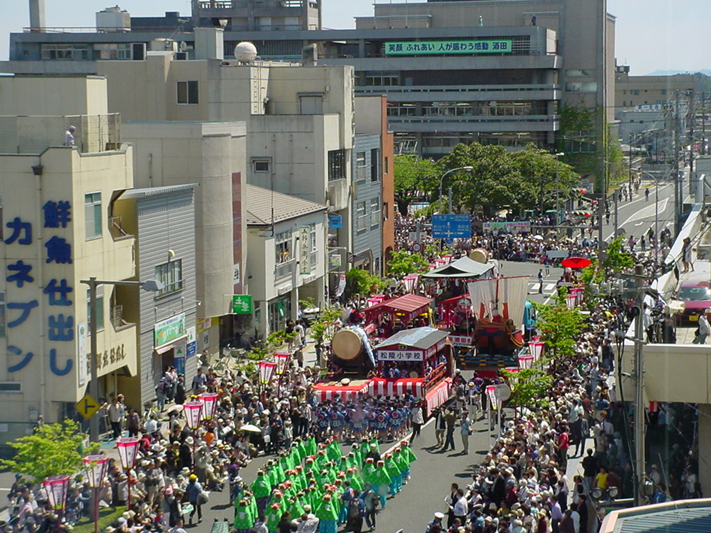
Sakata (酒田市, Sakata-shi) is a city located in Yamagata Prefecture, Japan. As of 31 March 2023[update], the city had an estimated population of 96,777 in 42,600 households, and a population density of 180 people per km2. The total area of the city is 602.97 km2 (232.81 sq mi).
Sakata is located in the coastal plains of the northwest corner of Yamagata Prefecture, bordered by the Sea of Japan to the west, and by Akita Prefecture to the north. The city has Mount Chōkai on its northern border; however, the urban center is in the flatlands of the Shōnai Plains on the right bank of the Mogami River. The inhabited island of Tobishima, approximately 38 kilometres (24 mi) off the coast of the mainland, is within the administrative borders of the city. The island, as well as part of the mainland portion of the city, is within the borders of the Chōkai Quasi-National Park
Akita Prefecture
Yamagata Prefecture
Sakata has a humid subtropical climate (Köppen climate classification Cfa) with large seasonal temperature differences, with warm to hot (and often humid) summers and cold (sometimes severely cold) winters. Precipitation is significant throughout the year, but is heaviest from August to October. The average annual temperature in Sakata is 13.0 °C (55.4 °F). The average annual rainfall is 1,986.8 mm (78.22 in) with November as the wettest month. The temperatures are highest on average in August, at around 25.5 °C (77.9 °F), and lowest in January, at around 1.9 °C (35.4 °F).
According to Japanese census data, the population of Sakata has declined in recent decades.
The area of present-day Sakata was the location of the provincial capital of ancient Dewa Province, although the precise location has yet to be discovered by archaeologists. A port at the mouth of the Mogami River is known to have existed since the Kamakura period. Although silting rendered it less important in the Muromachi period, the area developed as a major center for the kitamaebune coastal trade during the Edo period. By the early Meiji period, the Honma clan, a local merchant clan, dominated trade and emerged as the largest landholder in Japan.[citation needed] Traces of their powerful influence on Sakata City can still be seen across the city. This includes the Honma Museum and The Honma Gardens located in the downtown area.
With the establishment of the modern municipalities system after the start of the Meiji period, the area was organized as Sakata Town under Akumi District, Yamagata Prefecture in 1878. Approximately 80% of the town was destroyed by the 1894 Shōnai earthquake and subsequent fires. The modern city of Sakata was founded on April 1, 1933.
Hub AI
Sakata, Yamagata AI simulator
(@Sakata, Yamagata_simulator)
Sakata, Yamagata
Sakata (酒田市, Sakata-shi) is a city located in Yamagata Prefecture, Japan. As of 31 March 2023[update], the city had an estimated population of 96,777 in 42,600 households, and a population density of 180 people per km2. The total area of the city is 602.97 km2 (232.81 sq mi).
Sakata is located in the coastal plains of the northwest corner of Yamagata Prefecture, bordered by the Sea of Japan to the west, and by Akita Prefecture to the north. The city has Mount Chōkai on its northern border; however, the urban center is in the flatlands of the Shōnai Plains on the right bank of the Mogami River. The inhabited island of Tobishima, approximately 38 kilometres (24 mi) off the coast of the mainland, is within the administrative borders of the city. The island, as well as part of the mainland portion of the city, is within the borders of the Chōkai Quasi-National Park
Akita Prefecture
Yamagata Prefecture
Sakata has a humid subtropical climate (Köppen climate classification Cfa) with large seasonal temperature differences, with warm to hot (and often humid) summers and cold (sometimes severely cold) winters. Precipitation is significant throughout the year, but is heaviest from August to October. The average annual temperature in Sakata is 13.0 °C (55.4 °F). The average annual rainfall is 1,986.8 mm (78.22 in) with November as the wettest month. The temperatures are highest on average in August, at around 25.5 °C (77.9 °F), and lowest in January, at around 1.9 °C (35.4 °F).
According to Japanese census data, the population of Sakata has declined in recent decades.
The area of present-day Sakata was the location of the provincial capital of ancient Dewa Province, although the precise location has yet to be discovered by archaeologists. A port at the mouth of the Mogami River is known to have existed since the Kamakura period. Although silting rendered it less important in the Muromachi period, the area developed as a major center for the kitamaebune coastal trade during the Edo period. By the early Meiji period, the Honma clan, a local merchant clan, dominated trade and emerged as the largest landholder in Japan.[citation needed] Traces of their powerful influence on Sakata City can still be seen across the city. This includes the Honma Museum and The Honma Gardens located in the downtown area.
With the establishment of the modern municipalities system after the start of the Meiji period, the area was organized as Sakata Town under Akumi District, Yamagata Prefecture in 1878. Approximately 80% of the town was destroyed by the 1894 Shōnai earthquake and subsequent fires. The modern city of Sakata was founded on April 1, 1933.