Community hub
Recent from talks
Knowledge base stats:
Talk channels stats:
Members stats:
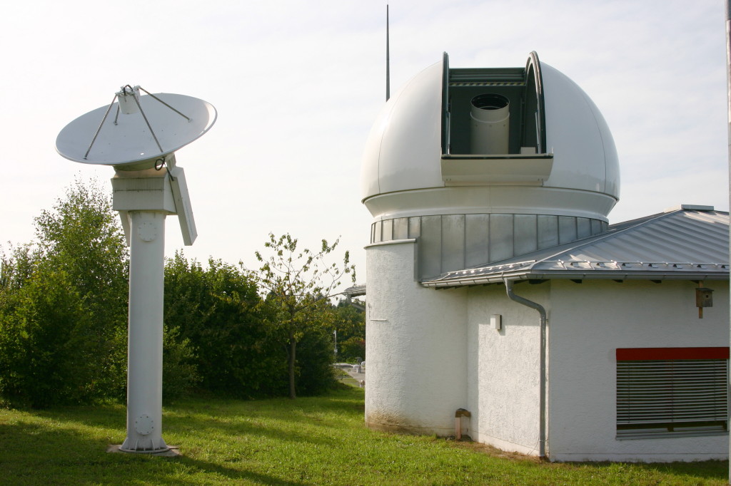
Satellite geodesy
Satellite geodesy is geodesy by means of artificial satellites—the measurement of the form and dimensions of Earth, the location of objects on its surface and the figure of the Earth's gravity field by means of artificial satellite techniques. It belongs to the broader field of space geodesy. Traditional astronomical geodesy is not commonly considered a part of satellite geodesy, although there is considerable overlap between the techniques.
The main goals of satellite geodesy are:
Satellite geodetic data and methods can be applied to diverse fields such as navigation, hydrography, oceanography and geophysics. Satellite geodesy relies heavily on orbital mechanics.
Satellite geodesy began shortly after the launch of Sputnik in 1957. Observations of Explorer 1 and Sputnik 2 in 1958 allowed for an accurate determination of Earth's flattening. The 1960s saw the launch of the Doppler satellite Transit-1B and the balloon satellites Echo 1, Echo 2, and PAGEOS. The first dedicated geodetic satellite was ANNA-1B, a collaborative effort between NASA, the DoD, and other civilian agencies. ANNA-1B carried the first of the US Army's SECOR (Sequential Collation of Range) instruments. These missions led to the accurate determination of the leading spherical harmonic coefficients of the geopotential, the general shape of the geoid, and linked the world's geodetic datums.
Soviet military satellites undertook geodesic missions to assist in ICBM targeting in the late 1960s and early 1970s.
The Transit satellite system was used extensively for Doppler surveying, navigation, and positioning. Observations of satellites in the 1970s by worldwide triangulation networks allowed for the establishment of the World Geodetic System. The development of GPS by the United States in the 1980s allowed for precise navigation and positioning and soon became a standard tool in surveying. In the 1980s and 1990s satellite geodesy began to be used for monitoring of geodynamic phenomena, such as crustal motion, Earth rotation, and polar motion.
The 1990s were focused on the development of permanent geodetic networks and reference frames. Dedicated satellites were launched to measure Earth's gravity field in the 2000s, such as CHAMP, GRACE, and GOCE.
Techniques of satellite geodesy may be classified by instrument platform: A satellite may
Hub AI
Satellite geodesy AI simulator
(@Satellite geodesy_simulator)
Satellite geodesy
Satellite geodesy is geodesy by means of artificial satellites—the measurement of the form and dimensions of Earth, the location of objects on its surface and the figure of the Earth's gravity field by means of artificial satellite techniques. It belongs to the broader field of space geodesy. Traditional astronomical geodesy is not commonly considered a part of satellite geodesy, although there is considerable overlap between the techniques.
The main goals of satellite geodesy are:
Satellite geodetic data and methods can be applied to diverse fields such as navigation, hydrography, oceanography and geophysics. Satellite geodesy relies heavily on orbital mechanics.
Satellite geodesy began shortly after the launch of Sputnik in 1957. Observations of Explorer 1 and Sputnik 2 in 1958 allowed for an accurate determination of Earth's flattening. The 1960s saw the launch of the Doppler satellite Transit-1B and the balloon satellites Echo 1, Echo 2, and PAGEOS. The first dedicated geodetic satellite was ANNA-1B, a collaborative effort between NASA, the DoD, and other civilian agencies. ANNA-1B carried the first of the US Army's SECOR (Sequential Collation of Range) instruments. These missions led to the accurate determination of the leading spherical harmonic coefficients of the geopotential, the general shape of the geoid, and linked the world's geodetic datums.
Soviet military satellites undertook geodesic missions to assist in ICBM targeting in the late 1960s and early 1970s.
The Transit satellite system was used extensively for Doppler surveying, navigation, and positioning. Observations of satellites in the 1970s by worldwide triangulation networks allowed for the establishment of the World Geodetic System. The development of GPS by the United States in the 1980s allowed for precise navigation and positioning and soon became a standard tool in surveying. In the 1980s and 1990s satellite geodesy began to be used for monitoring of geodynamic phenomena, such as crustal motion, Earth rotation, and polar motion.
The 1990s were focused on the development of permanent geodetic networks and reference frames. Dedicated satellites were launched to measure Earth's gravity field in the 2000s, such as CHAMP, GRACE, and GOCE.
Techniques of satellite geodesy may be classified by instrument platform: A satellite may