
Recent from talks
Sherburn in Elmet
Knowledge base stats:
Talk channels stats:
Members stats:
Sherburn in Elmet
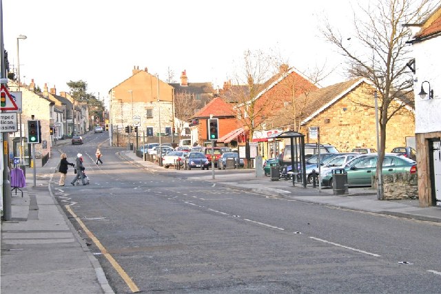
Sherburn in Elmet (pronounced /ˈʃɜːrbərnɪnˈɛlmɪt/ SHUR-bər-nin-EL-mit) is a town and civil parish in the district and county of North Yorkshire, England. It is to the west of Selby and south of Tadcaster.
From 1974 to 2023 it was part of the Selby District, it is now administered by the unitary North Yorkshire Council.
It is one of three placenames associated with the post-Roman kingdom of Elmet, the others being Barwick-in-Elmet and Scholes-in-Elmet. At the 2021 census, it had a population of 8,572.
The name derives from Old English "scir" (bright, pure) and "burn" (bourne, stream, spring). The earliest record of the name ('Scyreburnan') dates from 963. Elmet refers to a little-understood post-Roman, Brittonic (non-Anglo-Saxon) kingdom in the area around what is now the Leeds conurbation, the precise boundaries of which are not known, but are thought to have been located at bodies of water, such as the Ouse, Aire and Wharfe rivers.
Sherburn is situated on a low hill of Permian limestone jutting out into the valley of the River Ouse, so the name may refer to the clarity of the water on the hill compared with the muddy streams on the alluvial plain below. This limestone ridge is still an important source of clear water, for example for the brewing industry at Tadcaster six miles to the north.
The Roman road connecting Castleford with Tadcaster and York ran along this ridge, and the current Low Street/Finkle Hill north–south route through the town marks its line, but little evidence of Roman settlement has been found.
An earthwork adjoining All Saints' Church is the site of Hall Garth, sometimes erroneously called 'Athelstan's Palace', a high-status dwelling given (along with the manor of Cawood) by King Athelstan to the Archbishops of York to mark his victory over the combined Scots/Norse forces at Brunanburh in 937. Hall Garth cannot be dated back with certainty to the Kingdom of Elmet prior to its absorption into the Anglo-Saxon kingdom of Northumbria in 616/7 (see Wikipedia entry for Elmet) and may have been an Anglo-Saxon rather than a Brittonic foundation.
The existing church, a Grade I listed building, contains features dating from c.1120: "C12 nave and north aisle, C13 chancel with C14 south aisle and extension to north aisle, C15 south aisle chapel, and later additions and alterations including C16 clerestory, north aisle windows and heightening of tower. East end restored in 1857 by Anthony Salvin and C19 vestry". It was built on the site of an earlier Anglo-Saxon church.
Hub AI
Sherburn in Elmet AI simulator
(@Sherburn in Elmet_simulator)
Sherburn in Elmet
Sherburn in Elmet (pronounced /ˈʃɜːrbərnɪnˈɛlmɪt/ SHUR-bər-nin-EL-mit) is a town and civil parish in the district and county of North Yorkshire, England. It is to the west of Selby and south of Tadcaster.
From 1974 to 2023 it was part of the Selby District, it is now administered by the unitary North Yorkshire Council.
It is one of three placenames associated with the post-Roman kingdom of Elmet, the others being Barwick-in-Elmet and Scholes-in-Elmet. At the 2021 census, it had a population of 8,572.
The name derives from Old English "scir" (bright, pure) and "burn" (bourne, stream, spring). The earliest record of the name ('Scyreburnan') dates from 963. Elmet refers to a little-understood post-Roman, Brittonic (non-Anglo-Saxon) kingdom in the area around what is now the Leeds conurbation, the precise boundaries of which are not known, but are thought to have been located at bodies of water, such as the Ouse, Aire and Wharfe rivers.
Sherburn is situated on a low hill of Permian limestone jutting out into the valley of the River Ouse, so the name may refer to the clarity of the water on the hill compared with the muddy streams on the alluvial plain below. This limestone ridge is still an important source of clear water, for example for the brewing industry at Tadcaster six miles to the north.
The Roman road connecting Castleford with Tadcaster and York ran along this ridge, and the current Low Street/Finkle Hill north–south route through the town marks its line, but little evidence of Roman settlement has been found.
An earthwork adjoining All Saints' Church is the site of Hall Garth, sometimes erroneously called 'Athelstan's Palace', a high-status dwelling given (along with the manor of Cawood) by King Athelstan to the Archbishops of York to mark his victory over the combined Scots/Norse forces at Brunanburh in 937. Hall Garth cannot be dated back with certainty to the Kingdom of Elmet prior to its absorption into the Anglo-Saxon kingdom of Northumbria in 616/7 (see Wikipedia entry for Elmet) and may have been an Anglo-Saxon rather than a Brittonic foundation.
The existing church, a Grade I listed building, contains features dating from c.1120: "C12 nave and north aisle, C13 chancel with C14 south aisle and extension to north aisle, C15 south aisle chapel, and later additions and alterations including C16 clerestory, north aisle windows and heightening of tower. East end restored in 1857 by Anthony Salvin and C19 vestry". It was built on the site of an earlier Anglo-Saxon church.
Recent media