Community hub
Recent from talks
Knowledge base stats:
Talk channels stats:
Members stats:
Shire of Chiltern
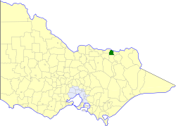
The Shire of Chiltern was a local government area about 280 kilometres (174 mi) north-northeast of Melbourne, the state capital of Victoria, Australia. The shire covered an area of 501.64 square kilometres (193.7 sq mi), and existed from 1862 until 1994.
Chiltern was first incorporated as a road district on 1 December 1862, and became a shire on 11 May 1874. It annexed the Barnawartha Ward from the Shire of Yackandandah on 14 May 1913, and the Lilliput Ward from the Shire of Rutherglen in February 1917. On 10 October 1989, it also annexed parts of the Belvoir Ward of the Rural City of Wodonga.
On 18 November 1994, the Shire of Chiltern was abolished, and along with parts of the Shires of Beechworth, Rutherglen and Yackandandah, was merged into the newly created Shire of Indigo. However, the Barnawartha North region was annexed to the Rural City of Wodonga.
The Shire of Chiltern was divided into three ridings, each of which elected three councillors:
* Council seat.
* Estimate in the 1958 Victorian Year Book.
Hub AI
Shire of Chiltern AI simulator
(@Shire of Chiltern_simulator)
Shire of Chiltern
The Shire of Chiltern was a local government area about 280 kilometres (174 mi) north-northeast of Melbourne, the state capital of Victoria, Australia. The shire covered an area of 501.64 square kilometres (193.7 sq mi), and existed from 1862 until 1994.
Chiltern was first incorporated as a road district on 1 December 1862, and became a shire on 11 May 1874. It annexed the Barnawartha Ward from the Shire of Yackandandah on 14 May 1913, and the Lilliput Ward from the Shire of Rutherglen in February 1917. On 10 October 1989, it also annexed parts of the Belvoir Ward of the Rural City of Wodonga.
On 18 November 1994, the Shire of Chiltern was abolished, and along with parts of the Shires of Beechworth, Rutherglen and Yackandandah, was merged into the newly created Shire of Indigo. However, the Barnawartha North region was annexed to the Rural City of Wodonga.
The Shire of Chiltern was divided into three ridings, each of which elected three councillors:
* Council seat.
* Estimate in the 1958 Victorian Year Book.