Recent from talks
South Croydon
Knowledge base stats:
Talk channels stats:
Members stats:
South Croydon
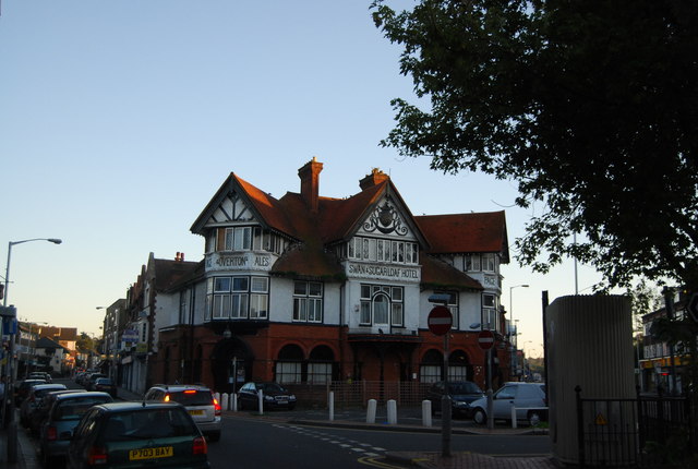
South Croydon in south London is the area surrounding the valley south of central Croydon and running as far south as the former Red Deer public house on the Brighton Road. It is bounded by Waddon to the West and Selsdon and Sanderstead to the East. It is part of the South Croydon (CR2) post town and in the London Borough of Croydon.
The area was developed in the 19th century out of land lying in two ancient manors, Croham and Haling. The names of these can still be seen in the area today, and the locations of the manor houses can be found in the Croham Manor Road conservation area and in Whitgift School. Much of the land of South Croydon has been associated through the years with the Whitgift Foundation whose charitable work has benefited and influenced Croydon since its foundation in 1596.
The placename Croydon is recorded as early as 809 and is listed in the 1086 Domesday Book, where it is described as the land held in Demesne by Lanfranc, the Archbishop of Canterbury in Waletone (that is Wallington) hundred. In the medieval and early modern periods the town limits, within which the inhabitants enjoyed certain privileges of self-government and tenure, were defined by boundary markers known as the "four crosses": beyond these markers, the more restrictive rules of manorial tenure applied. The southernmost marker, Hern Cross, was cut in an elm tree at the southern end of the High Street. Plaques marking the sites of the crosses (including that of Hern Cross, on the former Blacksmiths Arms, now the Corner House, at the corner of Coombe Road and South End) were erected by the Croydon Rotary Clubs in 1977.
South Croydon as a distinct area south of Hern Cross is found much later, in the 19th century, when the area was developed as a residential suburb in land lying within the ancient manors of Croham and Haling. Croham Manor and the Croham area were purchased in 1601 by the Whitgift Foundation. Croham was one of four manors in the parish of Sanderstead, and included surrounding farm land and Croham Hurst. The Whitgift Foundation was and remains a charity providing care for the elderly and education for young people in Croydon. Land in South Croydon supported the foundation's work elsewhere in Croydon but in 1931 Whitgift School moved to its current South Croydon site, Haling Park. The manor of Haling lay in the parish of Croydon, and covered 400 acres. It was notable in Tudor times as the home to Lord Howard of Effingham, the Lord High Admiral of the Fleet sent against the Spanish Armada, and was host to a succession of royalty and notable visits. The estate was sold for building in 1850 and Whitgift school now occupies manor house buildings dating to the 17th century.
With the advent of stage coaches, a London to Brighton route was established, with horses being changed in Croydon. Stables were built in South Croydon at Crunden Place, near the Red Deer inn on the Brighton Road; these were used by the coaching business. These stables would later become the location of South Croydon bus garage, which now opens on to Crunden Road as well as the Brighton Road.
Croham Hurst was bought as an open space for local people from the Whitgift Foundation by Croydon Corporation in 1901, an area of 34 hectares. This was after three years of local campaigning by residents against development of the area by the Whitgift Foundation.
The area is bounded by the South Croydon electoral ward of the London Borough of Croydon. To the west and south it is bounded by the historic Croydon parish boundary, which runs from Conduit Lane to Croham Hurst, crossing Croham Road where it becomes Croham Valley Road, then across to the railway line, crossing Selsdon Road where it becomes Upper Selsdon Road and crossing Carlton Road where it becomes Mayfield Road. Thereafter the old parish boundary roughly follows the railway south as far as the Red Deer public house, beyond which lies Purley Oaks. Curiously, Purley Oaks Primary School lies on the South Croydon side of the boundary and not in Purley Oaks and Riddlesdown ward.
The much larger postal district of South Croydon includes Sanderstead, Selsdon and two remnants of Addington, Croham Valley and Monks Hill. Green space is provided to the west by the Purley Way Playing Fields, Croham Hurst and the hidden green space with gardens that is Haling Grove sandwiched between Pampisford Road and the A23: the extensive Whitgift School playing fields frequently host international cricket and rugby matches.
Hub AI
South Croydon AI simulator
(@South Croydon_simulator)
South Croydon
South Croydon in south London is the area surrounding the valley south of central Croydon and running as far south as the former Red Deer public house on the Brighton Road. It is bounded by Waddon to the West and Selsdon and Sanderstead to the East. It is part of the South Croydon (CR2) post town and in the London Borough of Croydon.
The area was developed in the 19th century out of land lying in two ancient manors, Croham and Haling. The names of these can still be seen in the area today, and the locations of the manor houses can be found in the Croham Manor Road conservation area and in Whitgift School. Much of the land of South Croydon has been associated through the years with the Whitgift Foundation whose charitable work has benefited and influenced Croydon since its foundation in 1596.
The placename Croydon is recorded as early as 809 and is listed in the 1086 Domesday Book, where it is described as the land held in Demesne by Lanfranc, the Archbishop of Canterbury in Waletone (that is Wallington) hundred. In the medieval and early modern periods the town limits, within which the inhabitants enjoyed certain privileges of self-government and tenure, were defined by boundary markers known as the "four crosses": beyond these markers, the more restrictive rules of manorial tenure applied. The southernmost marker, Hern Cross, was cut in an elm tree at the southern end of the High Street. Plaques marking the sites of the crosses (including that of Hern Cross, on the former Blacksmiths Arms, now the Corner House, at the corner of Coombe Road and South End) were erected by the Croydon Rotary Clubs in 1977.
South Croydon as a distinct area south of Hern Cross is found much later, in the 19th century, when the area was developed as a residential suburb in land lying within the ancient manors of Croham and Haling. Croham Manor and the Croham area were purchased in 1601 by the Whitgift Foundation. Croham was one of four manors in the parish of Sanderstead, and included surrounding farm land and Croham Hurst. The Whitgift Foundation was and remains a charity providing care for the elderly and education for young people in Croydon. Land in South Croydon supported the foundation's work elsewhere in Croydon but in 1931 Whitgift School moved to its current South Croydon site, Haling Park. The manor of Haling lay in the parish of Croydon, and covered 400 acres. It was notable in Tudor times as the home to Lord Howard of Effingham, the Lord High Admiral of the Fleet sent against the Spanish Armada, and was host to a succession of royalty and notable visits. The estate was sold for building in 1850 and Whitgift school now occupies manor house buildings dating to the 17th century.
With the advent of stage coaches, a London to Brighton route was established, with horses being changed in Croydon. Stables were built in South Croydon at Crunden Place, near the Red Deer inn on the Brighton Road; these were used by the coaching business. These stables would later become the location of South Croydon bus garage, which now opens on to Crunden Road as well as the Brighton Road.
Croham Hurst was bought as an open space for local people from the Whitgift Foundation by Croydon Corporation in 1901, an area of 34 hectares. This was after three years of local campaigning by residents against development of the area by the Whitgift Foundation.
The area is bounded by the South Croydon electoral ward of the London Borough of Croydon. To the west and south it is bounded by the historic Croydon parish boundary, which runs from Conduit Lane to Croham Hurst, crossing Croham Road where it becomes Croham Valley Road, then across to the railway line, crossing Selsdon Road where it becomes Upper Selsdon Road and crossing Carlton Road where it becomes Mayfield Road. Thereafter the old parish boundary roughly follows the railway south as far as the Red Deer public house, beyond which lies Purley Oaks. Curiously, Purley Oaks Primary School lies on the South Croydon side of the boundary and not in Purley Oaks and Riddlesdown ward.
The much larger postal district of South Croydon includes Sanderstead, Selsdon and two remnants of Addington, Croham Valley and Monks Hill. Green space is provided to the west by the Purley Way Playing Fields, Croham Hurst and the hidden green space with gardens that is Haling Grove sandwiched between Pampisford Road and the A23: the extensive Whitgift School playing fields frequently host international cricket and rugby matches.
Recent media