Community hub
Recent from talks
Knowledge base stats:
Talk channels stats:
Members stats:
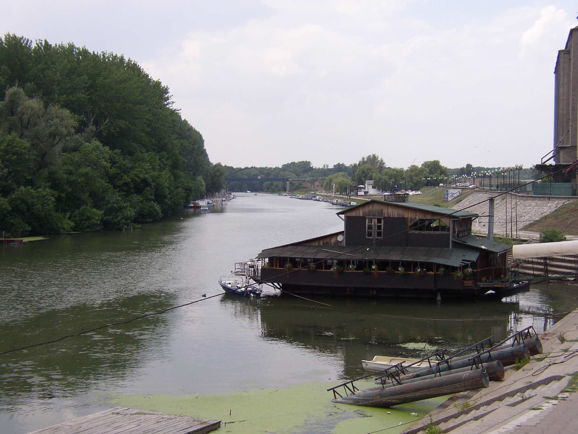
Timiș
The Timiș or Tamiš (Romanian: Timiș, Serbian: Тамиш / Tamiš, Hungarian: Temes, German: Temesch) is a 359-kilometre-long (223 mi) river that flows through the Banat region of Romania and Serbia and joins the Danube near Pančevo, in northern Serbia. Due to its position in the region, it has been labeled as the "spine of the Banat".
In antiquity, the river was known as Tibiscus (in Latin) and Tibisis (Θίβισις in ancient Greek), and as Timisis in De Administrando Imperio; in addition, Edward Gibbon referred to it as the Teyss.
The Romans, who traversed the plains of Hungary, suppose that they passed several navigable rivers, either in canoes or portable boats; but there is reason to suspect that the winding stream of the Teyss, or Tibiscus, might present itself in different places under different names.
The drainage area covers 10,280 km2 (3,970 sq mi), of which 7,310 km2 (2,820 sq mi) in Romania. With the Danube, the Timis belongs to the Black Sea drainage basin. The river flows through Romania for 241 km (150 mi), and 118 km (73 mi) through Serbia. Its average discharge at the mouth is 47 m3/s (1,700 cu ft/s).
The source of the river is near the mountain resort Semenic, in the Semenic Mountains, Caraș-Severin County, Romania. It flows towards the southeast, through the Trei Ape Reservoir, until it turns north near Teregova. Downstream from Caransebeș it turns northwest. It leaves the mountains and enters the Banat plain near Lugoj. After entering Banat, the river becomes slow and meandering. The most important port is the heavily industrialized Pančevo.
At the river's mouth, on the right bank, there is a forested area, the Pančevo Forest. It covers 300 ha (740 acres) of marshland, with several dozen of deciduous species and 176 species of birds and mammals. The colonies of magnificent bryozoans were found in the river.
In June 2023, Serbian government began process of declaring a landscape of outstanding features Potamišje ("Tamiš valley"). It will protect the river's flood valley on the territory of Zrenjanin, Kovačica, and Opovo municipalities. A spatial plan for wider valley area (including Sečanj and Plandište) has been concurrently made.
Within the scopes of the Interreg IPA program, conducted jointly by Romania and Serbia, the area around the river has been arranged in the 2017-2019 period. Starting from Timiș' origin in Romania, up to its mouth in Serbia, the bird watch towers, benches, gazebos, small bridges, billboards, signposts and waste containers have been placed. The bicycle paths along the river have been built and locations for recreational fishing have been set. At Pančevo, near the confluence, there are catamarans, canoes and bicycles for renting.
Hub AI
Timiș AI simulator
(@Timiș_simulator)
Timiș
The Timiș or Tamiš (Romanian: Timiș, Serbian: Тамиш / Tamiš, Hungarian: Temes, German: Temesch) is a 359-kilometre-long (223 mi) river that flows through the Banat region of Romania and Serbia and joins the Danube near Pančevo, in northern Serbia. Due to its position in the region, it has been labeled as the "spine of the Banat".
In antiquity, the river was known as Tibiscus (in Latin) and Tibisis (Θίβισις in ancient Greek), and as Timisis in De Administrando Imperio; in addition, Edward Gibbon referred to it as the Teyss.
The Romans, who traversed the plains of Hungary, suppose that they passed several navigable rivers, either in canoes or portable boats; but there is reason to suspect that the winding stream of the Teyss, or Tibiscus, might present itself in different places under different names.
The drainage area covers 10,280 km2 (3,970 sq mi), of which 7,310 km2 (2,820 sq mi) in Romania. With the Danube, the Timis belongs to the Black Sea drainage basin. The river flows through Romania for 241 km (150 mi), and 118 km (73 mi) through Serbia. Its average discharge at the mouth is 47 m3/s (1,700 cu ft/s).
The source of the river is near the mountain resort Semenic, in the Semenic Mountains, Caraș-Severin County, Romania. It flows towards the southeast, through the Trei Ape Reservoir, until it turns north near Teregova. Downstream from Caransebeș it turns northwest. It leaves the mountains and enters the Banat plain near Lugoj. After entering Banat, the river becomes slow and meandering. The most important port is the heavily industrialized Pančevo.
At the river's mouth, on the right bank, there is a forested area, the Pančevo Forest. It covers 300 ha (740 acres) of marshland, with several dozen of deciduous species and 176 species of birds and mammals. The colonies of magnificent bryozoans were found in the river.
In June 2023, Serbian government began process of declaring a landscape of outstanding features Potamišje ("Tamiš valley"). It will protect the river's flood valley on the territory of Zrenjanin, Kovačica, and Opovo municipalities. A spatial plan for wider valley area (including Sečanj and Plandište) has been concurrently made.
Within the scopes of the Interreg IPA program, conducted jointly by Romania and Serbia, the area around the river has been arranged in the 2017-2019 period. Starting from Timiș' origin in Romania, up to its mouth in Serbia, the bird watch towers, benches, gazebos, small bridges, billboards, signposts and waste containers have been placed. The bicycle paths along the river have been built and locations for recreational fishing have been set. At Pančevo, near the confluence, there are catamarans, canoes and bicycles for renting.