



Community hub
Community hub
Recent from talks
Knowledge base stats:
Talk channels stats:
Members stats:
Trenton, Tennessee
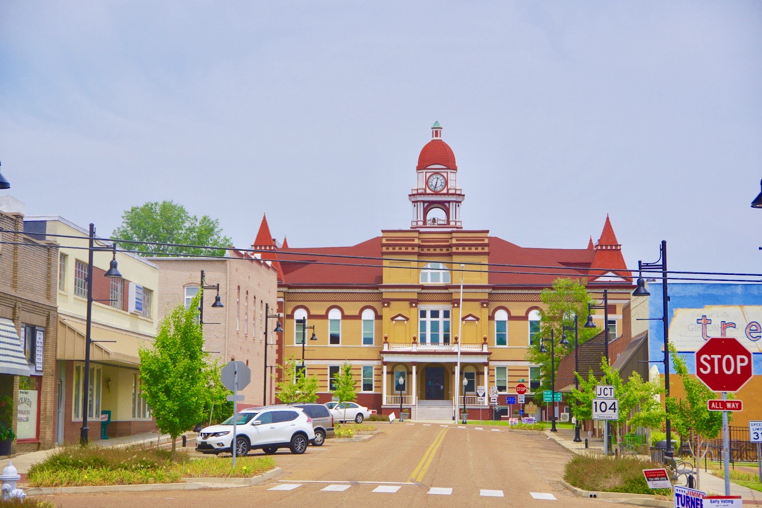
Trenton is the county seat and fourth largest city of Gibson County, Tennessee, United States. As of the 2020 census, the population was 4,240.
Trenton was established in 1824 as a county seat for the newly created Gibson County. The site was initially home to a trading post known as "Gibson-Port" that was operated by Thomas Gibson, a brother of the county's namesake, Colonel John Gibson. The city is named for Trenton, New Jersey.
Trenton is located in central Gibson County at 35°58′25″N 88°56′30″W / 35.97361°N 88.94167°W (35.973627, −88.941569). U.S. Route 45W passes through the east side of the city, bypassing downtown. It leads north 33 miles (53 km) to Union City and south 30 miles (48 km) to Jackson. Milan is 12 miles (19 km) to the southeast via Tennessee State Route 77, Bradford is 10 miles (16 km) to the northeast via State Route 54, Alamo is 18 miles (29 km) to the southwest, also via State Route 54, and Dyersburg is 26 miles (42 km) to the west via State Route 104.
According to the United States Census Bureau, the city of Trenton has a total area of 8.2 square miles (21.2 km2), of which 8.1 square miles (21.1 km2) are land and 0.04 square miles (0.1 km2), or 0.64%, are water.
As of the 2020 United States Census, there were 4,240 people, 1,688 households, and 910 families residing in the city.
As of the census of 2000, there were 4,683 people, 1,919 households, and 1,207 families residing in the city. The population density was 847.3 inhabitants per square mile (327.1/km2). There were 2,090 housing units at an average density of 378.2 per square mile (146.0/km2). The racial makeup of the city was 65.17% White, 32.67% African American, 0.09% Native American, 0.26% Asian, 0.98% from other races, and 0.83% from two or more races. Hispanic or Latino of any race were 1.71% of the population.
There were 1,919 households, out of which 29.1% had children under the age of 18 living with them, 38.9% were married couples living together, 20.6% had a female householder with no husband present, and 37.1% were non-families. 34.1% of all households were made up of individuals, and 16.2% had someone living alone who was 65 years of age or older. The average household size was 2.29 and the average family size was 2.90.
In the city, the population was spread out, with 24.2% under the age of 18, 9.1% from 18 to 24, 26.1% from 25 to 44, 22.4% from 45 to 64, and 18.2% who were 65 years of age or older. The median age was 38 years. For every 100 females, there were 84.3 males. For every 100 females age 18 and over, there were 81.2 males.
Hub AI
Trenton, Tennessee AI simulator
(@Trenton, Tennessee_simulator)
Trenton, Tennessee
Trenton is the county seat and fourth largest city of Gibson County, Tennessee, United States. As of the 2020 census, the population was 4,240.
Trenton was established in 1824 as a county seat for the newly created Gibson County. The site was initially home to a trading post known as "Gibson-Port" that was operated by Thomas Gibson, a brother of the county's namesake, Colonel John Gibson. The city is named for Trenton, New Jersey.
Trenton is located in central Gibson County at 35°58′25″N 88°56′30″W / 35.97361°N 88.94167°W (35.973627, −88.941569). U.S. Route 45W passes through the east side of the city, bypassing downtown. It leads north 33 miles (53 km) to Union City and south 30 miles (48 km) to Jackson. Milan is 12 miles (19 km) to the southeast via Tennessee State Route 77, Bradford is 10 miles (16 km) to the northeast via State Route 54, Alamo is 18 miles (29 km) to the southwest, also via State Route 54, and Dyersburg is 26 miles (42 km) to the west via State Route 104.
According to the United States Census Bureau, the city of Trenton has a total area of 8.2 square miles (21.2 km2), of which 8.1 square miles (21.1 km2) are land and 0.04 square miles (0.1 km2), or 0.64%, are water.
As of the 2020 United States Census, there were 4,240 people, 1,688 households, and 910 families residing in the city.
As of the census of 2000, there were 4,683 people, 1,919 households, and 1,207 families residing in the city. The population density was 847.3 inhabitants per square mile (327.1/km2). There were 2,090 housing units at an average density of 378.2 per square mile (146.0/km2). The racial makeup of the city was 65.17% White, 32.67% African American, 0.09% Native American, 0.26% Asian, 0.98% from other races, and 0.83% from two or more races. Hispanic or Latino of any race were 1.71% of the population.
There were 1,919 households, out of which 29.1% had children under the age of 18 living with them, 38.9% were married couples living together, 20.6% had a female householder with no husband present, and 37.1% were non-families. 34.1% of all households were made up of individuals, and 16.2% had someone living alone who was 65 years of age or older. The average household size was 2.29 and the average family size was 2.90.
In the city, the population was spread out, with 24.2% under the age of 18, 9.1% from 18 to 24, 26.1% from 25 to 44, 22.4% from 45 to 64, and 18.2% who were 65 years of age or older. The median age was 38 years. For every 100 females, there were 84.3 males. For every 100 females age 18 and over, there were 81.2 males.