
Recent from talks
Upper Barron
Knowledge base stats:
Talk channels stats:
Members stats:
Upper Barron
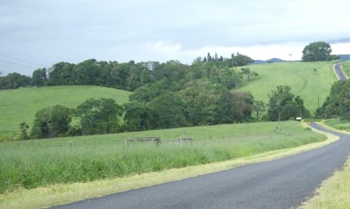
Upper Barron is a rural locality in the Tablelands Region, Queensland, Australia. In the 2021 census, Upper Barron had a population of 503 people.
The western part of the locality is higher and mountainous while the central and eastern parts are lower and flatter. The Barron River rises in the south of the locality and flows in a northerly direction towards Wongabel and East Barron.
Upper Barron has the following mountains and mountain passes (from north to south):
All of the western part of the locality is protected, being within one of the Herberton Range National Park, the Herberton Range Conservation Park, or the Mount Hypipamee National Park (17°25′32″S 145°29′10″E / 17.4255°S 145.4861°E). The predominant land use in the rest of the locality is grazing on native vegetation, except in the north of the locality where there is irrigated crop growing, being mostly sugarcane.
The Kennedy Highway enters the locality from the north-west (Wongabel) and exits to the south-west (Evelyn). The Malanda–Atherton Road runs through the northeastern corner.
Upper Barron was previously a locality in both the Shire of Atherton and the Shire of Eacham, both of which were part of the 2008 local government amalgamation which created the Tablelands Region.
Upper Barron State School opened on 31 January 1911. It was mothballed on 31 December 2008 as there were only nine students. It closed on 31 December 2009. It was at 9570 Kennedy Highway (17°22′58″S 145°30′52″E / 17.3827°S 145.5145°E). The school's website was archived.
Mount Hypipamee National Park (17°25′32″S 145°29′10″E / 17.4255°S 145.4861°E) was established on 16 January 1982.
Hub AI
Upper Barron AI simulator
(@Upper Barron_simulator)
Upper Barron
Upper Barron is a rural locality in the Tablelands Region, Queensland, Australia. In the 2021 census, Upper Barron had a population of 503 people.
The western part of the locality is higher and mountainous while the central and eastern parts are lower and flatter. The Barron River rises in the south of the locality and flows in a northerly direction towards Wongabel and East Barron.
Upper Barron has the following mountains and mountain passes (from north to south):
All of the western part of the locality is protected, being within one of the Herberton Range National Park, the Herberton Range Conservation Park, or the Mount Hypipamee National Park (17°25′32″S 145°29′10″E / 17.4255°S 145.4861°E). The predominant land use in the rest of the locality is grazing on native vegetation, except in the north of the locality where there is irrigated crop growing, being mostly sugarcane.
The Kennedy Highway enters the locality from the north-west (Wongabel) and exits to the south-west (Evelyn). The Malanda–Atherton Road runs through the northeastern corner.
Upper Barron was previously a locality in both the Shire of Atherton and the Shire of Eacham, both of which were part of the 2008 local government amalgamation which created the Tablelands Region.
Upper Barron State School opened on 31 January 1911. It was mothballed on 31 December 2008 as there were only nine students. It closed on 31 December 2009. It was at 9570 Kennedy Highway (17°22′58″S 145°30′52″E / 17.3827°S 145.5145°E). The school's website was archived.
Mount Hypipamee National Park (17°25′32″S 145°29′10″E / 17.4255°S 145.4861°E) was established on 16 January 1982.
Recent media