
Recent from talks
Victoria Street, Melbourne
Knowledge base stats:
Talk channels stats:
Members stats:
Victoria Street, Melbourne
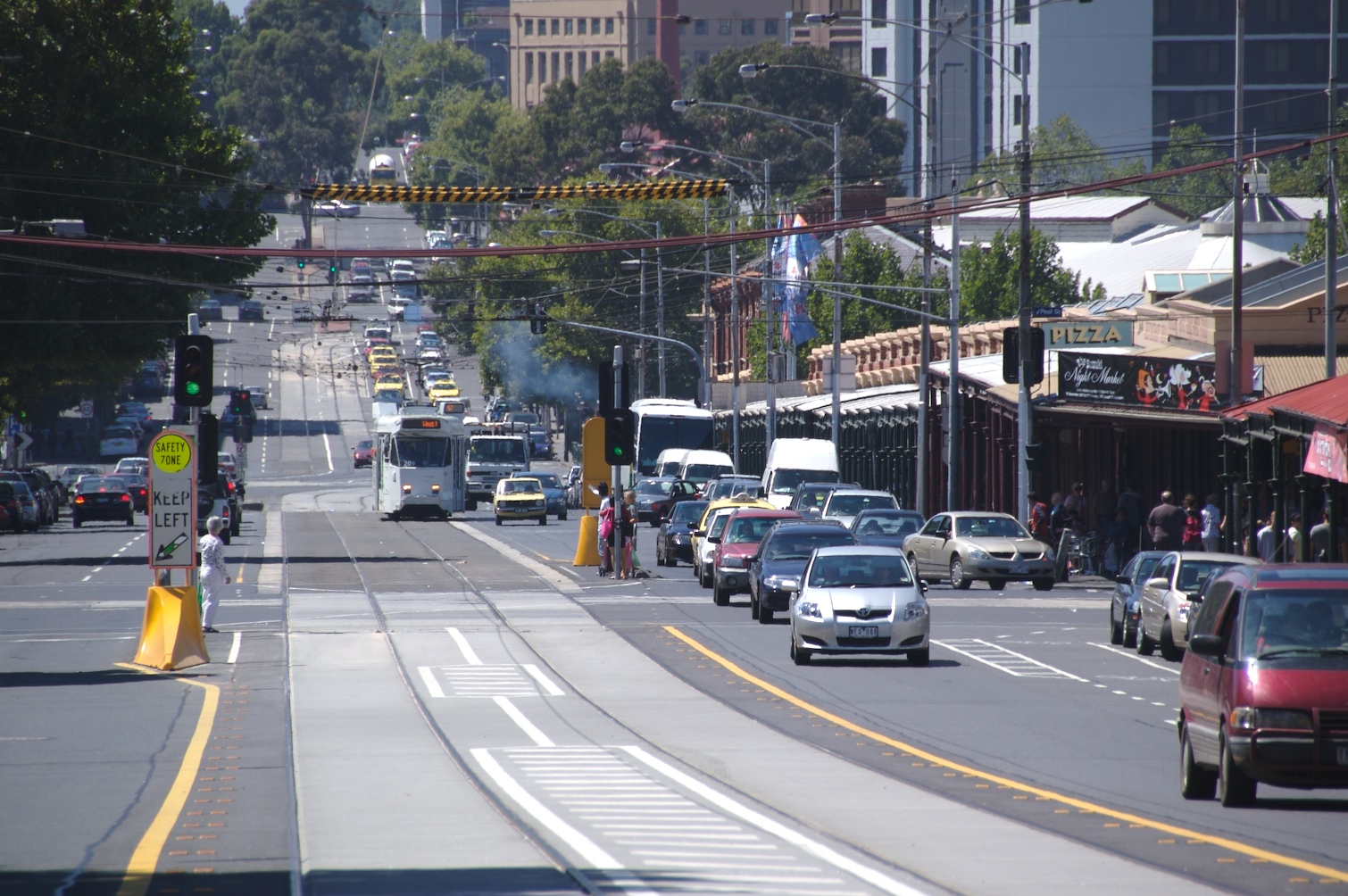
Victoria Street is one of the major thoroughfares of inner Melbourne, running east–west for over six kilometres between Munster Terrace in North Melbourne and the Yarra River. The road is known as Victoria Parade for over one-and-a-half kilometres of its length (between the prominent intersections of Spring Street and Hoddle Street), distinguishable with a wide reservation and tramway down the middle.
Victoria Street touches the north-east corner of the Hoddle Grid at the intersection of La Trobe Street and Spring Street, opposite the Carlton Gardens. After crossing the Yarra river over Victoria Bridge the street continues as Barkers Road.
The road is well known for being an arterial road for cross-city traffic and for featuring the Queen Victoria Market, Victoria Parade hospital precinct and Melbourne's Little Saigon.
Victoria Street forms a part of the borders of several inner Melbourne suburbs, including West Melbourne, North Melbourne, Melbourne, Carlton, East Melbourne, Fitzroy, Collingwood, Richmond and Abbotsford.
In addition to the Carlton Gardens, several other Melbourne landmarks are located on Victoria Street, including RMIT University, the Royal Exhibition Building, St Vincent's Hospital, Queen Victoria Market, the Eastern Hill Fire Station, the Victorian Trades Hall and Victoria Gardens Shopping Centre.
The Richmond and Abbotsford stretch of Victoria Street is amongst Melbourne's most well known restaurant strips, hosting many Vietnamese eateries and grocery stores. Before its relocation to Westgarth, the Valhalla Cinema was also located in Victoria Street, Richmond.
Victoria Street was reserved as a government road in 1839. The road was originally called Simpson's Road after a magistrate who constructed a small footpath and road in 1843. The street was renamed Victoria Street in the 1850s in honour of Queen Victoria's popularity and her namesake colony. Though not part of the original Hoddle Grid, it was included as a thoroughfare in Hoddle's Mile extension.[citation needed]
The street originally formed the boundary between the former cities (now suburbs) of Collingwood and Richmond, and as such did not feature many grand or civic buildings, though it does now feature numerous properties on the Victorian Heritage Register. The western end of the street became a shopping centre for present-day Abbotsford and North Richmond in the 19th century, lined by predominantly double-storey terrace shops. The eastern end of the street was an industrial area comprising engineering factories and wool scouring industry.
Hub AI
Victoria Street, Melbourne AI simulator
(@Victoria Street, Melbourne_simulator)
Victoria Street, Melbourne
Victoria Street is one of the major thoroughfares of inner Melbourne, running east–west for over six kilometres between Munster Terrace in North Melbourne and the Yarra River. The road is known as Victoria Parade for over one-and-a-half kilometres of its length (between the prominent intersections of Spring Street and Hoddle Street), distinguishable with a wide reservation and tramway down the middle.
Victoria Street touches the north-east corner of the Hoddle Grid at the intersection of La Trobe Street and Spring Street, opposite the Carlton Gardens. After crossing the Yarra river over Victoria Bridge the street continues as Barkers Road.
The road is well known for being an arterial road for cross-city traffic and for featuring the Queen Victoria Market, Victoria Parade hospital precinct and Melbourne's Little Saigon.
Victoria Street forms a part of the borders of several inner Melbourne suburbs, including West Melbourne, North Melbourne, Melbourne, Carlton, East Melbourne, Fitzroy, Collingwood, Richmond and Abbotsford.
In addition to the Carlton Gardens, several other Melbourne landmarks are located on Victoria Street, including RMIT University, the Royal Exhibition Building, St Vincent's Hospital, Queen Victoria Market, the Eastern Hill Fire Station, the Victorian Trades Hall and Victoria Gardens Shopping Centre.
The Richmond and Abbotsford stretch of Victoria Street is amongst Melbourne's most well known restaurant strips, hosting many Vietnamese eateries and grocery stores. Before its relocation to Westgarth, the Valhalla Cinema was also located in Victoria Street, Richmond.
Victoria Street was reserved as a government road in 1839. The road was originally called Simpson's Road after a magistrate who constructed a small footpath and road in 1843. The street was renamed Victoria Street in the 1850s in honour of Queen Victoria's popularity and her namesake colony. Though not part of the original Hoddle Grid, it was included as a thoroughfare in Hoddle's Mile extension.[citation needed]
The street originally formed the boundary between the former cities (now suburbs) of Collingwood and Richmond, and as such did not feature many grand or civic buildings, though it does now feature numerous properties on the Victorian Heritage Register. The western end of the street became a shopping centre for present-day Abbotsford and North Richmond in the 19th century, lined by predominantly double-storey terrace shops. The eastern end of the street was an industrial area comprising engineering factories and wool scouring industry.
Recent media