
Recent from talks
Virginia Creeper Trail
Knowledge base stats:
Talk channels stats:
Members stats:
Virginia Creeper Trail
The Virginia Creeper Trail is a 35-mile (56 km) multi-purpose rail trail. Located in southwestern Virginia, the trail runs from Abingdon to Whitetop, Virginia, near Mount Rogers National Recreation Area and the North Carolina state line.
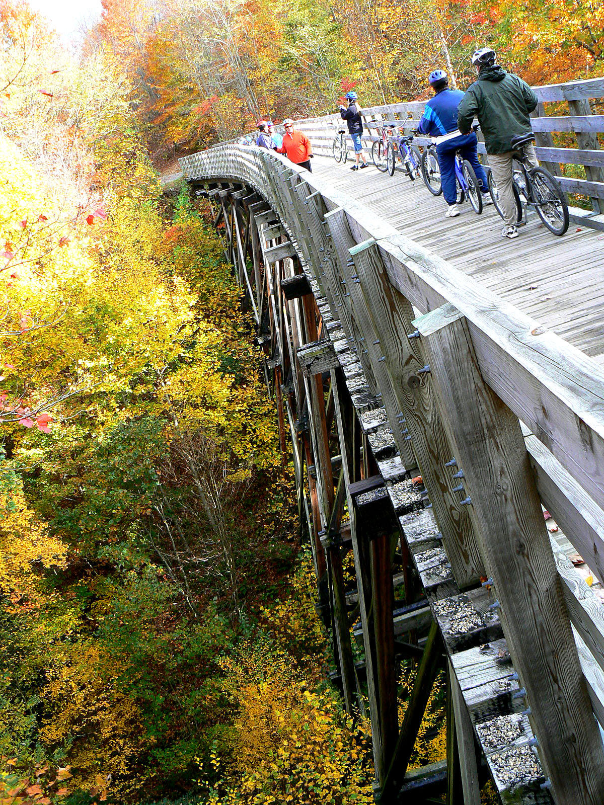
The trail accommodates hikers, cyclists and equestrians on its descent from Abingdon to Damascus, near the North Carolina state line – passing through National Forest, crossing a number of restored trestles and the Appalachian Trail.
Following Laurel Creek and traversing rolling farm countryside as well as a number of privately owned sections, the route necessitates cyclists open and close private gates. The trail features numerous intermediate access points, and between Abingdon and Watauga, five emergency call boxes can access emergency services.[citation needed]
Travelling from Abingdon, the trail goes through Watauga, Alvarado, Damascus, Straight Branch, Taylors Valley, Creek Junction, Green Cove and Whitetop. Elevation drops approximately 300 feet (90 m) from Abingdon to the South Holston River (near Damascus) and then climbs nearly 2,000 feet (610 m) to Whitetop. From Damascus, numerous private services are available to shuttle cyclist to Whitetop for the 17-mile (27 km) return descent.
The trail is for recreational use, but it is also used to host numerous local events and races such as the Run Damascus events, Down the Mountain Marathon, Iron Mountain Trail Races, Dam Yeti 50, Yeti 100, and Bridges & Trestles.
The Virginia Creeper Trail sustained severe damage from Hurricane Helene in September 2024 which led to its partial closure. Eighteen trestles have been destroyed, and seventeen miles of the trail were washed away by flooding. The federal government has allocated $660 million to the Forest Service for the trail's repair.
The trail runs on a railroad right-of-way dating to the 1880s — first belonging to the Abingdon Coal and Iron Railroad. After investing sizable capital without actually opening, that company went out of business. In the early 1890s, the company's assets were purchased by the Virginia–Carolina and Southern Railway. It too had financial trouble and its assets were purchased by the Virginia–Carolina Railway.
In February 1900, the Virginia–Carolina Railway began operating in Damascus, Virginia. By 1912, the railroad extended to Whitetop and by the end of the decade to Elkland, North Carolina (now Todd). In 1919, the Norfolk & Western railroad, which had partially funded the building of the line, took control of it and dubbed it its Abingdon Branch. In 1933, service to Todd ended when the terminus moved to West Jefferson.
Hub AI
Virginia Creeper Trail AI simulator
(@Virginia Creeper Trail_simulator)
Virginia Creeper Trail
The Virginia Creeper Trail is a 35-mile (56 km) multi-purpose rail trail. Located in southwestern Virginia, the trail runs from Abingdon to Whitetop, Virginia, near Mount Rogers National Recreation Area and the North Carolina state line.
The trail accommodates hikers, cyclists and equestrians on its descent from Abingdon to Damascus, near the North Carolina state line – passing through National Forest, crossing a number of restored trestles and the Appalachian Trail.
Following Laurel Creek and traversing rolling farm countryside as well as a number of privately owned sections, the route necessitates cyclists open and close private gates. The trail features numerous intermediate access points, and between Abingdon and Watauga, five emergency call boxes can access emergency services.[citation needed]
Travelling from Abingdon, the trail goes through Watauga, Alvarado, Damascus, Straight Branch, Taylors Valley, Creek Junction, Green Cove and Whitetop. Elevation drops approximately 300 feet (90 m) from Abingdon to the South Holston River (near Damascus) and then climbs nearly 2,000 feet (610 m) to Whitetop. From Damascus, numerous private services are available to shuttle cyclist to Whitetop for the 17-mile (27 km) return descent.
The trail is for recreational use, but it is also used to host numerous local events and races such as the Run Damascus events, Down the Mountain Marathon, Iron Mountain Trail Races, Dam Yeti 50, Yeti 100, and Bridges & Trestles.
The Virginia Creeper Trail sustained severe damage from Hurricane Helene in September 2024 which led to its partial closure. Eighteen trestles have been destroyed, and seventeen miles of the trail were washed away by flooding. The federal government has allocated $660 million to the Forest Service for the trail's repair.
The trail runs on a railroad right-of-way dating to the 1880s — first belonging to the Abingdon Coal and Iron Railroad. After investing sizable capital without actually opening, that company went out of business. In the early 1890s, the company's assets were purchased by the Virginia–Carolina and Southern Railway. It too had financial trouble and its assets were purchased by the Virginia–Carolina Railway.
In February 1900, the Virginia–Carolina Railway began operating in Damascus, Virginia. By 1912, the railroad extended to Whitetop and by the end of the decade to Elkland, North Carolina (now Todd). In 1919, the Norfolk & Western railroad, which had partially funded the building of the line, took control of it and dubbed it its Abingdon Branch. In 1933, service to Todd ended when the terminus moved to West Jefferson.
Recent media