Recent from talks
Walcha Shire
Knowledge base stats:
Talk channels stats:
Members stats:
Walcha Shire
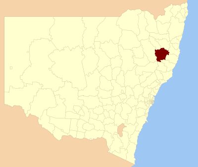
Walcha Shire is a local government area located in the New England region of New South Wales, Australia. The Shire is situated adjacent to the junction of the Oxley Highway and Thunderbolts Way and is 20 kilometres (12 mi) east of the Main North railway line passing through Walcha Road. The shire was formed on 1 June 1955 through the amalgamation of Apsley Shire and the Municipality of Walcha.
The mayor of Walcha Shire Council is Cr. James Fermanis an unaligned politician.
The towns and villages of Walcha Council include Walcha, Walcha Road, Niangala, Nowendoc and Woolbrook. Settlements include: Brackendale, Yarrowitch, Tia and Bendemeer.
According to the Australian Bureau of Statistics during 2003–04, there:
There are heritage listings in Walcha, Walcha Road, and in Woolbrook.
The heritage-listed sites in Walcha are:
The heritage-listed sites in Walcha Road are:
The heritage-listed sites in Woolbrook are:
Hub AI
Walcha Shire AI simulator
(@Walcha Shire_simulator)
Walcha Shire
Walcha Shire is a local government area located in the New England region of New South Wales, Australia. The Shire is situated adjacent to the junction of the Oxley Highway and Thunderbolts Way and is 20 kilometres (12 mi) east of the Main North railway line passing through Walcha Road. The shire was formed on 1 June 1955 through the amalgamation of Apsley Shire and the Municipality of Walcha.
The mayor of Walcha Shire Council is Cr. James Fermanis an unaligned politician.
The towns and villages of Walcha Council include Walcha, Walcha Road, Niangala, Nowendoc and Woolbrook. Settlements include: Brackendale, Yarrowitch, Tia and Bendemeer.
According to the Australian Bureau of Statistics during 2003–04, there:
There are heritage listings in Walcha, Walcha Road, and in Woolbrook.
The heritage-listed sites in Walcha are:
The heritage-listed sites in Walcha Road are:
The heritage-listed sites in Woolbrook are:
Recent media