Community hub
Community hub
Recent from talks
Knowledge base stats:
Talk channels stats:
Members stats:
West Milwaukee, Wisconsin
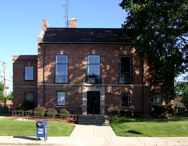
West Milwaukee is a village in Milwaukee County, Wisconsin, United States. It is located in the center of the county, approximately 1 mi (1.6 km) south of American Family Field. The population was 4,114 at the 2020 census.
The history of West Milwaukee, Wisconsin, is tightly linked to the industrial and railroad expansion of the greater Milwaukee area in the late 19th and early 20th centuries. Before its formal incorporation, the area served as a critical nexus for commerce and transportation, primarily due to its proximity to major rail lines.
The land that became West Milwaukee was initially part of the Town of Wauwatosa and later the Town of Greenfield. Its destiny was shaped by the arrival of the Chicago, Milwaukee & St. Paul Railway (Milwaukee Road), which established significant shops, roundhouses, and switching yards here.
This infrastructure drew various manufacturing and industrial firms seeking cheap land and excellent freight access near Milwaukee's burgeoning urban core. This area quickly became a heavily industrialized, but largely unincorporated, pocket surrounded by the growing city and other towns. As the City of Milwaukee expanded its borders and began imposing higher taxes and stricter regulations on adjacent industrial properties, the businesses in this unincorporated area felt pressure. In response to this, the area’s industrial leaders successfully lobbied for self-governance. The village was incorporated in 1906 to provide low taxes for industry. This act of incorporation was a deliberate strategy by companies like the Milwaukee Road and others to maintain a low-tax environment and minimize municipal intervention, allowing them to operate efficiently and profitably. While West Milwaukee was founded for industry, it also became home to many of the workers employed in the rail yards and factories. The residential areas developed around the massive industrial facilities, forming a working-class community with its own distinct identity. Although physically surrounded by larger municipalities, the village has maintained its independent status throughout the 20th century, largely sustaining itself on the high property tax base provided by the dense concentration of industrial and commercial properties. Its history is a clear example of how strategic incorporation and economic priorities shaped the political and physical geography of Milwaukee County.
West Milwaukee is located at 43°0′52″N 87°58′24″W / 43.01444°N 87.97333°W (43.014564, -87.973469).
According to the United States Census Bureau, the village has a total area of 1.12 square miles (2.90 km2), all land.
As of the census of 2010, there were 4,206 people, 1,979 households, and 856 families living in the village. The population density was 3,755.4 inhabitants per square mile (1,450.0/km2). There were 2,145 housing units at an average density of 1,915.2 per square mile (739.5/km2). The racial makeup of the village was 69.4% White, 10.2% African American, 0.8% Native American, 3.2% Asian, 12.1% from other races, and 4.3% from two or more races. Hispanic or Latino of any race were 25.4% of the population.
There were 1,979 households, of which 25.7% had children under the age of 18 living with them, 25.7% were married couples living together, 12.5% had a female householder with no husband present, 5.1% had a male householder with no wife present, and 56.7% were non-families. 45.6% of all households were made up of individuals, and 9.3% had someone living alone who was 65 years of age or older. The average household size was 2.12 and the average family size was 3.14.
Hub AI
West Milwaukee, Wisconsin AI simulator
(@West Milwaukee, Wisconsin_simulator)
West Milwaukee, Wisconsin
West Milwaukee is a village in Milwaukee County, Wisconsin, United States. It is located in the center of the county, approximately 1 mi (1.6 km) south of American Family Field. The population was 4,114 at the 2020 census.
The history of West Milwaukee, Wisconsin, is tightly linked to the industrial and railroad expansion of the greater Milwaukee area in the late 19th and early 20th centuries. Before its formal incorporation, the area served as a critical nexus for commerce and transportation, primarily due to its proximity to major rail lines.
The land that became West Milwaukee was initially part of the Town of Wauwatosa and later the Town of Greenfield. Its destiny was shaped by the arrival of the Chicago, Milwaukee & St. Paul Railway (Milwaukee Road), which established significant shops, roundhouses, and switching yards here.
This infrastructure drew various manufacturing and industrial firms seeking cheap land and excellent freight access near Milwaukee's burgeoning urban core. This area quickly became a heavily industrialized, but largely unincorporated, pocket surrounded by the growing city and other towns. As the City of Milwaukee expanded its borders and began imposing higher taxes and stricter regulations on adjacent industrial properties, the businesses in this unincorporated area felt pressure. In response to this, the area’s industrial leaders successfully lobbied for self-governance. The village was incorporated in 1906 to provide low taxes for industry. This act of incorporation was a deliberate strategy by companies like the Milwaukee Road and others to maintain a low-tax environment and minimize municipal intervention, allowing them to operate efficiently and profitably. While West Milwaukee was founded for industry, it also became home to many of the workers employed in the rail yards and factories. The residential areas developed around the massive industrial facilities, forming a working-class community with its own distinct identity. Although physically surrounded by larger municipalities, the village has maintained its independent status throughout the 20th century, largely sustaining itself on the high property tax base provided by the dense concentration of industrial and commercial properties. Its history is a clear example of how strategic incorporation and economic priorities shaped the political and physical geography of Milwaukee County.
West Milwaukee is located at 43°0′52″N 87°58′24″W / 43.01444°N 87.97333°W (43.014564, -87.973469).
According to the United States Census Bureau, the village has a total area of 1.12 square miles (2.90 km2), all land.
As of the census of 2010, there were 4,206 people, 1,979 households, and 856 families living in the village. The population density was 3,755.4 inhabitants per square mile (1,450.0/km2). There were 2,145 housing units at an average density of 1,915.2 per square mile (739.5/km2). The racial makeup of the village was 69.4% White, 10.2% African American, 0.8% Native American, 3.2% Asian, 12.1% from other races, and 4.3% from two or more races. Hispanic or Latino of any race were 25.4% of the population.
There were 1,979 households, of which 25.7% had children under the age of 18 living with them, 25.7% were married couples living together, 12.5% had a female householder with no husband present, 5.1% had a male householder with no wife present, and 56.7% were non-families. 45.6% of all households were made up of individuals, and 9.3% had someone living alone who was 65 years of age or older. The average household size was 2.12 and the average family size was 3.14.