Recent from talks
Nothing was collected or created yet.
White Nile
View on Wikipedia
| White Nile Victoria Nile, Albert Nile, Mountain Nile | |
|---|---|
A steel Bailey bridge spans the White Nile at Juba, South Sudan | |
![]() | |
| Location | |
| Country | Sudan, South Sudan, Rwanda, Tanzania, Uganda, Democratic Republic of the Congo, Ethiopia, Burundi |
| Cities | Jinja, Uganda, Juba, South Sudan, Khartoum, Sudan |
| Physical characteristics | |
| Source | White Nile |
| • location | Burundi[2] or Rwanda[3] |
| • coordinates | 2°16′56″S 29°19′52″E / 2.28222°S 29.33111°E |
| Length | 3,700 km (2,300 mi)[1] |
| Basin size | 1,800,000 km2 (690,000 sq mi) |
| Discharge | |
| • average | 878 m3/s (31,000 cu ft/s) |
| Basin features | |
| Tributaries | |
| • left | Albert Nile, Bahr el Ghazal |
| • right | Aswa, Sobat |
The White Nile (Arabic: النيل الأبيض an-nīl al-'abyaḍ) is a river in North and East Africa, the minor of the two main tributaries of the Nile, the larger being the Blue Nile.[4] The name "White" comes from the clay sediment carried in the water that changes the water to a pale color.[5]
In the strict meaning, "White Nile" refers to the river formed at Lake No, at the confluence of the Bahr al Jabal and Bahr el Ghazal Rivers. In the wider sense, "White Nile" refers to all the stretches of river draining from Lake Victoria through to the merger with the Blue Nile: the "Victoria Nile" from Lake Victoria via Lake Kyoga to Lake Albert, then the "Albert Nile" to the South Sudan border, and then the "Mountain Nile" or "Bahr-al-Jabal" down to Lake No.[6] "White Nile" may sometimes include the headwaters of Lake Victoria, the most remote of which being 3,700 km (2,300 mi) from the Blue Nile.[1]

Course
[edit]Headwaters
[edit]
The Kagera River, which flows into Lake Victoria near the Tanzanian town of Bukoba, is the longest feeder river for Lake Victoria, although sources do not agree on which is the longest tributary of the Kagera, and hence the most distant source of the Nile.[7] The source of the Nile can be considered to be either the Ruvyironza, which emerges in Bururi Province, Burundi[8] (near Bukirasaz), or the Nyabarongo, which flows from Nyungwe Forest in Rwanda.[9]
These two feeder rivers meet near Rusumo Falls on the border between Rwanda and Tanzania. These waterfalls are known for an event on 28–29 April 1994, when 250,000 Rwandans crossed the bridge at Rusumo Falls into Ngara, Tanzania, in 24 hours, in what the United Nations High Commissioner for Refugees called "the largest and fastest refugee exodus in modern times". The Kagera forms part of the Rwanda–Tanzania and Tanzania–Uganda borders before flowing into Lake Victoria.
In Uganda
[edit]
The White Nile in Uganda goes under the name of "Victoria Nile" from Lake Victoria via Lake Kyoga to Lake Albert, and then as the "Albert Nile" from there to the border with South Sudan.
Victoria Nile
[edit]
The Victoria Nile starts at the outlet of Lake Victoria, at Jinja, Uganda, on the northern shore of the lake.[10] Downstream from the Nalubaale Power Station and the Kiira Power Station at the outlet of the lake, the river goes over Bujagali Falls (the location of the Bujagali Power Station) about 15 km (9.3 mi) downstream from Jinja. The river then flows northwest through Uganda to Lake Kyoga in the centre of the country, thence west to Lake Albert.
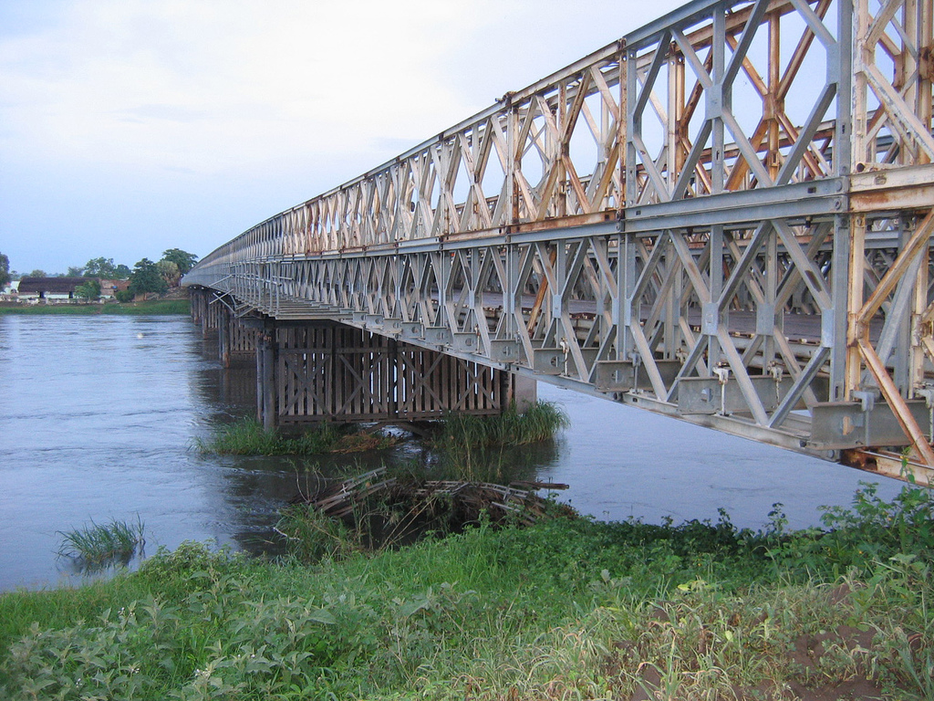
At Karuma Falls, the river flows under Karuma Bridge (2°14′45.40″N 32°15′9.05″E / 2.2459444°N 32.2525139°E) at the southeastern corner of Murchison Falls National Park. During much of the insurgency of the Lord's Resistance Army, Karuma Bridge, built in 1963 to help the cotton industry, was the key stop on the way to Gulu, where vehicles gathered in convoys before being provided with a military escort for the final run north. In 2009, the government of Uganda announced plans to construct a 750-megawatt hydropower project several kilometres north of the bridge, which was scheduled for completion in 2016.[11] The World Bank had approved funding a smaller 200-megawatt power plant, but Uganda opted for a larger project, which the Ugandans will fund internally if necessary.[12]
Just before entering Lake Albert, the river is compressed into a passage just seven meters wide at Murchison Falls, marking its entry into the western branch of the East African Rift. The river then flows into Lake Albert opposite the Blue Mountains in the Democratic Republic of the Congo.
The stretch of river from Lake Kyoga to Lake Albert is sometimes called the "Kyoga Nile".[13]
Albert Nile
[edit]
The river draining from Lake Albert to the north is called the "Albert Nile". It separates the West Nile sub-region of Uganda from the rest of the country. A bridge passes over the Albert Nile near its inlet in Nebbi District, but no other bridge over this section has been built. A ferry connects the roads between Adjumani and Moyo, and navigation of the river is otherwise done by small boat or canoe.
In South Sudan and Sudan
[edit]From the point at which the river enters South Sudan from Uganda, the river goes under the name of "Mountain Nile". From Lake No in South Sudan the river becomes the "White Nile" in its strictest sense, and so continues northwards into Sudan where it ends at its confluence with the Blue Nile.
Mountain Nile
[edit]
From Nimule in South Sudan, close to the border with Uganda, the river becomes known as the "Mountain Nile" or "Baḥr al-Jabal" (also "Baḥr el-Jebel", بحر الجبل), literally "Mountain River" or "River of the Mountain".[14][15] The Southern Sudanese state of Central Equatoria through which the river flows was known as Bahr al-Jabal until 2006.[16]
The southern stretch of the river encounters several rapids before reaching the Sudan plain and the vast swamp of the Sudd. It makes its way to Lake No, where it merges with the Bahr el Ghazal and there forms the White Nile.[17][18] An anabranch river called Bahr el Zeraf flows out of the Bahr al-Jabal at and flows through the Sudd, to eventually join the White Nile. The Mountain Nile cascades through narrow gorges and over a series of rapids that includes the Fula (Fola) Rapids.[18][19]

White Nile proper
[edit]To some people, the White Nile starts at the confluence of the Mountain Nile with the Bahr el Ghazal at Lake No.[17]
The 120 kilometers of White Nile that flow east from Lake No to the mouth of the Sobat are very gently sloping and hold many swamps and lagoons.[20] When in flood, the Sobat River tributary carries a large amount of sediment, adding greatly to the White Nile's pale color.[21] From South Sudan's second city Malakal, the river runs slowly but swamp-free into Sudan and north to Khartoum. Downstream from Malakal lies Kodok, the site of the 1898 Fashoda Incident that marked an end to the Scramble for Africa.
In Sudan the river lends its name to the Sudanese state of White Nile, before merging with the larger Blue Nile at Khartoum and forming the River Nile.
Inland waterways
[edit]The White Nile is a navigable waterway from the Lake Albert to Khartoum through Jebel Aulia Dam, only between Juba and Uganda requires the river upgrade or channel to make it navigable.
During part of the year the rivers are navigable up to Gambela, Ethiopia, and Wau, South Sudan.
See also
[edit]References
[edit]- ^ a b Penn, James R. (2001). Rivers of the World: A Social, Geographical, and Environmental Sourcebook. ABC-CLIO. p. 299. ISBN 9781576070420. Archived from the original on 30 March 2023. Retrieved 30 March 2023.
- ^ "Nile Africa | Africa Nile | Nile Valley | Mystery Nile | Nile White | Egypt Nile | Ancient Capital Nile". 10 January 2007. Archived from the original on 10 January 2007.
- ^ "Team reaches Nile's 'true source'". 31 March 2006. Archived from the original on 10 November 2013. Retrieved 22 April 2020 – via news.bbc.co.uk.
- ^ Elsanabary, Mohamed Helmy Mahmoud Moustafa (2012), Teleconnection, Modeling, Climate Anomalies Impact and Forecasting of Rainfall and Streamflow of the Upper Blue Nile River Basin, Canada: University of Alberta, doi:10.7939/R3377641M, hdl:10402/era.28151
- ^ The New American Cyclopaedia: A Popular Dictionary of General Knowledge, Volume 12. 1867. p. 362. Archived from the original on 30 March 2023. Retrieved 30 March 2023.
- ^ Dumont, Henri J. (2009). The Nile: Origin, Environments, Limnology and Human Use. Springer Science & Business Media. pp. 344–345. ISBN 9781402097263. Archived from the original on 30 March 2023. Retrieved 30 March 2023.
- ^ McLeay, cam (2 July 2006). "The truth about the source of R. Nile". New Vision. Archived from the original on 9 April 2011. Retrieved 4 April 2011.
- ^ "Nile River". Archived from the original on 10 January 2007. Retrieved 5 February 2011.
- ^ "Team reaches Nile's 'true source'". BBC News. 31 March 2006. Archived from the original on 1 June 2013. Retrieved 4 April 2011.
- ^ vanden Bossche, J.-P.; Bernacsek, G. M. (1990). Source Book for the Inland Fishery Resources of Africa, Issue 18, Volume 1. Food and Agriculture Organization, United Nations. p. 291. ISBN 92-5-102983-0. Retrieved 4 January 2016.
- ^ Holland, Hereward (8 May 2009). "Uganda To Increase Capacity of Electricity Project". Reuters. Archived from the original on 19 April 2014. Retrieved 18 April 2014.
- ^ Wacha, Joe (29 October 2011). "Uganda Oil Money to Finance Karuma Power Project". Uganda Radio Network Online. Archived from the original on 19 April 2014. Retrieved 18 April 2014.
- ^ The Indian Journal of International Law: Official Organ of the Indian Society of International Law. M.K. Nawaz. 1980. p. 398. Archived from the original on 5 October 2017. Retrieved 5 October 2017.
- ^ The Arabic word baḥr (بحر) can refer to either a sea or a large river
- ^ Garstin, William Edmund; Cana, Frank Richardson (1911). . Encyclopædia Britannica. Vol. 19 (11th ed.). pp. 692–699.
- ^ "Southern Sudan Bahr al-Jabal State changes name". Sudan Tribune. 16 April 2006. Archived from the original on 4 October 2017. Retrieved 4 October 2017.
- ^ a b Parsons, Ellen C. (1905). Christus Liberator: An Outline Study of Africa. Macmillan Company. p. 7. Retrieved 5 October 2017.
- ^ a b The Source of the Nile: Rwenzori Mountains National Park, 16 June 2010, archived from the original on 3 August 2020, retrieved 20 August 2020
- ^ "Nile River (Mountain) | Waterbodies.org". www.waterbodies.org. Archived from the original on 21 October 2020. Retrieved 20 August 2020.
- ^ Shahin, Mamdouh (1985). Hydrology of the Nile Basin. Elsevier. p. 40. ISBN 9780444424334. Archived from the original on 5 October 2017. Retrieved 5 October 2017.
- ^ "Sobat River". Encyclopædia Britannica (Online Library ed.). Retrieved 21 January 2008.
External links
[edit]- Nile inland Waterways
- South Sudan Waterway Assessment Archived 9 June 2022 at the Wayback Machine
- Feasibility study river barge system (Cranes on trucks/loader cranes and pallets can increase efficiency)
White Nile
View on GrokipediaGeography
Headwaters and Source
The headwaters of the White Nile lie in the East African highlands, primarily within the Kagera River basin spanning Rwanda, Burundi, and Tanzania. The Kagera River, the longest and largest tributary feeding Lake Victoria, forms from the confluence of the Nyabarongo River (originating in Rwanda's Nyungwe Forest) and the Ruvubu River (from Burundi's highlands), then flows approximately 597 km eastward to enter Lake Victoria near Bukoba, Tanzania. This system supplies the bulk of the lake's inflow, which regulates the White Nile's upper course.[6] The remotest headwater, determined by distance rather than southernmost latitude, emerges as a small perennial stream in Rwanda's Nyungwe National Park near Lake Kivu at coordinates 2.32° S, 29.33° E, at an elevation of about 2,480 meters. This rivulet, traced via the Rukarara, Mwogo, Nyabarongo, and Kagera rivers, extends the Nile's total length to roughly 6,719 km to the Mediterranean Delta, as measured by GPS during the 2006 Ascend the Nile Expedition led by explorers Neil McGrigor, Cam McLeay, and Garth McIntyre. Although some accounts highlight Burundi's Ruvyironza River (a Ruvubu tributary near Mount Gikizi) as a competing southern source, modern hydrological mapping prioritizes the Rwandan stream for maximum path length.[7][8][9] The White Nile emerges conventionally from Lake Victoria's northeastern outlet at Jinja, Uganda (historically Ripon Falls, now submerged by the Owen Falls Dam constructed in 1954), transitioning into the Victoria Nile. However, the upstream Kagera catchment—covering about 65,000 km² and characterized by equatorial rainfall exceeding 1,500 mm annually—defines the hydrological origins, with seasonal flows moderated by the lake's vast 68,800 km² surface area.[7][8]Course Through Uganda
The White Nile enters Uganda at the outlet of Lake Victoria near Jinja, where it emerges as the Victoria Nile, flowing northward for approximately 390 kilometers to Lake Albert.[10] This section begins with a descent through the Owen Falls, now submerged under the Nalubaale Dam constructed in 1954, which regulates outflow from the lake.[11] The river then passes Bujagali Falls, a series of rapids historically significant for whitewater rafting, before widening into the shallow, swampy expanse of Lake Kyoga.[12] In the Lake Kyoga system, the Victoria Nile receives inflows from tributaries such as the Kafu River, contributing to its volume before narrowing again and traversing Karuma Falls en route to Lake Albert.[11] Lake Albert, straddling the Uganda-Democratic Republic of the Congo border, receives the Victoria Nile at its southern end and serves as a natural reservoir, with water levels influenced by upstream regulation and seasonal precipitation.[11] The lake's northeastern outlet marks the transition to the Albert Nile, which flows northward for about 215 kilometers through Murchison Falls National Park, characterized by the dramatic Murchison Falls where the river forces through a 7-meter-wide gorge, dropping over 40 meters.[10][13] The Albert Nile continues northwest, passing settlements like Pakwach and featuring a bridge crossing in northern Uganda, before reaching the South Sudan border near Nimule.[14] This Ugandan segment of the White Nile totals over 600 kilometers, with flow modulated by hydroelectric dams including the Bujagali Dam operational since 2012, which harnesses the river's gradient for power generation while altering natural hydrodynamics.[12]Course Through South Sudan
The White Nile enters South Sudan from Uganda near the border town of Nimule, marking the beginning of its traverse through the country as the Bahr al-Jabal, or "River of the Mountain."[15] From Nimule, the river flows northward through Central Equatoria state, passing through relatively narrow valleys before broadening as it approaches Juba, the national capital located approximately 130 kilometers north of the border.[15] In this initial stretch, the waterway supports riparian settlements and serves as a vital transportation artery, with Juba featuring a key bridge crossing essential for regional connectivity.[16] North of Juba, the White Nile enters Jonglei state and transitions into the expansive Sudd wetland complex, a vast floodplain and swamp system formed by seasonal flooding and slow-flowing waters that can expand to over 15,000 square kilometers during high-water periods.[17] Within the Sudd, known locally as part of the Bahr al-Jabal region, the river meanders through papyrus-choked channels, lagoons, and seasonal inundation zones, dissipating much of its volume through evaporation and infiltration rather than maintaining a defined channel.[18] This labyrinthine path complicates navigation, historically limiting exploration and development to sporadic expeditions and local watercraft.[16] Emerging from the Sudd's northern fringes at Lake No, the river regains a more concentrated flow before reaching Malakal in Upper Nile state, where it converges with the Sobat River to formally constitute the White Nile proper.[15] From Malakal, the waterway continues northward toward the international border with Sudan, spanning roughly 1,000 kilometers from Juba to this confluence point through predominantly low-lying, marshy terrain.[16] The Sudd's impedance effect reduces the river's discharge northward, influencing downstream hydrology across the broader Nile basin.[19]Course Through Sudan
The White Nile enters Sudan from South Sudan near Renk, after traversing the extensive Sudd swamps, where it assumes a more defined channel amid flat savanna plains.[20] Within Sudan, the river courses northward approximately 700 kilometers through White Nile State, a region of semi-arid terrain with minimal topographic variation and low gradient, facilitating slow meandering flow.[21] It receives no major tributaries along this stretch, preserving its steady volume derived from upstream sources.[22] The waterway supports navigation for much of its Sudanese segment, enabling cargo transport from northern South Sudan ports like Juba to Sudanese hubs such as Kosti, where river levels influence local flood risks and economic activities.[21] [23] Further north, near the capital, the Jebel Aulia Dam, completed in 1937 and situated 45 kilometers south of Khartoum, impounds the river to form a reservoir for seasonal water storage, primarily aiding irrigation downstream and flow regulation during low-water periods.[24] The structure, with a storage capacity of about 3.5 billion cubic meters, mitigates variability in Nile discharge but has faced maintenance challenges amid regional conflicts.[25] At Khartoum, the White Nile merges with the Blue Nile at their confluence, forming the Nile proper, which continues northward toward Egypt; this junction marks a critical hydrological transition where the combined waters sustain Sudan's agricultural schemes and urban water supply.[26] The White Nile's passage through Sudan underscores its role in regional water management, though invasive species like water hyacinth have periodically obstructed navigation since the mid-20th century.[27]Hydrology
Flow Characteristics and Discharge
The White Nile maintains a relatively constant flow regime throughout the year, with minimal seasonal fluctuations, due to the regulatory effects of equatorial lake storage in Lake Victoria and the expansive Sudd swamps, which attenuate peak discharges and sustain baseflow during dry periods.[28] This stability contrasts with the highly variable Blue Nile, enabling the White Nile to contribute disproportionately to total Nile discharge (70-90% during dry months) despite its lower volume. Long-term average annual discharge at Malakal, South Sudan—just upstream of the Sobat River confluence—is approximately 31 billion cubic meters (BCM), equivalent to about 980 cubic meters per second (m³/s).[28] This value declines to around 26 BCM annually at Mogren, Sudan, owing to evaporative losses and seepage in the Sudd region, which can retain up to 50% of inflow through flooding and transpiration.[28] At Khartoum, the White Nile's discharge further diminishes to an estimated 15-20 BCM annually before merging with the Blue Nile, reflecting cumulative hydrological losses across the Sudd.[29] The river's sediment load is notably low, with fine particles predominantly deposited in upstream lakes and the Sudd marshes, resulting in minimal downstream transport to the main Nile channel.[30] This deposition contributes to the White Nile's clear waters and reduced aggradation compared to sediment-rich tributaries like the Blue Nile.[31] Flow velocities remain subdued across much of the course, influenced by the low gradient (typically under 0.02%) and braided, swampy morphology, though precise measurements vary by reach and are constrained by gauging challenges in remote sections.| Measurement Station | Average Annual Discharge (BCM) | Equivalent Average (m³/s) | Key Notes |
|---|---|---|---|
| Malakal, South Sudan | 31 | ~980 | Pre-Sudd full flow; minimal seasonality.[28] |
| Mogren, Sudan | 26 | ~825 | Post-Sudd attenuation; evaporation dominant loss.[28] |
| Khartoum (White Nile contribution) | ~18 | ~570 | Baseflow stabilization; merges with Blue Nile.[29] |

