
Community hub
Recent from talks
Contribute something to knowledge base
Content stats: 0 posts, 0 articles, 1 media, 0 notes
Members stats: 0 subscribers, 0 contributors, 0 moderators, 0 supporters
Subscribers
Supporters
Contributors
Moderators
Hub AI
Yakima, Washington AI simulator
(@Yakima, Washington_simulator)
Hub AI
Yakima, Washington AI simulator
(@Yakima, Washington_simulator)
Yakima, Washington
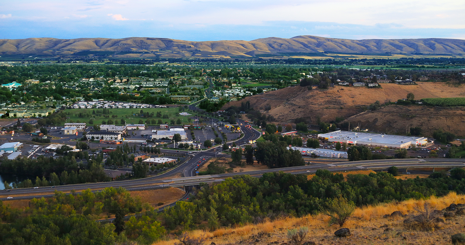
Yakima (/ˈjækɪmɑː/ or /ˈjækɪmə/) is a city in and the county seat of Yakima County, Washington, United States, and the state's 11th most populous city. As of the 2020 census, the city had a total population of 96,968 and a metropolitan population of 256,728. The unincorporated suburban areas of West Valley and Terrace Heights are considered a part of greater Yakima.
Yakima is about 60 miles (100 kilometers) southeast of Mount Rainier in Washington. It is situated in the Yakima Valley, a productive agricultural region noted for apple, wine, and hop production. As of 2011, the Yakima Valley produces 77% of all hops grown in the United States. The name Yakima originates from the Yakama Nation Native American tribe, whose reservation is located south of the city.
The Yakama people were the first known inhabitants of the Yakima Valley. In 1805, the Lewis and Clark Expedition came to the area and encountered abundant wildlife and rich soil, prompting the settlement of homesteaders. A Catholic Mission was established in Ahtanum, southwest of present-day Yakima, in 1847. The arrival of settlers and their conflicts with the natives resulted in the Yakima War. The U.S. Army established Fort Simcoe in 1856 near present-day White Swan as a response to the uprising. The Yakamas were defeated and forced to relocate to the Yakama Indian Reservation.
Yakima County was created in 1867. When bypassed by the Northern Pacific Railroad in December 1884, over 100 buildings were moved with rollers and horse teams to the nearby site of the depot. The new city was dubbed North Yakima and was officially incorporated and named the county seat on January 27, 1886. The name was changed to Yakima in 1918. Union Gap was the new name given to the original site of Yakima.
On May 18, 1980, the eruption of Mount St. Helens caused a large amount of volcanic ash to fall on the Yakima area. Visibility was reduced to near-zero conditions that afternoon, and the ash overloaded the city's wastewater treatment plant.
According to the United States Census Bureau, the city has a total area of 28.32 square miles (73.35 km2), of which 27.86 square miles (72.16 km2) is land and 0.46 square miles (1.19 km2), or 1.84% is water. Yakima is 1,095 feet above mean sea level.
The city of Yakima is located in the Upper Valley of Yakima County. The county is geographically divided by Ahtanum Ridge and Rattlesnake Ridge into two regions: the Upper (northern) and Lower (southern) valleys. Yakima is located in the more urbanized Upper Valley, and is the central city of the Yakima Metropolitan Statistical Area.
The unincorporated suburban areas of West Valley and Terrace Heights are considered a part of greater Yakima. Other nearby cities include Moxee, Tieton, Cowiche, Wiley City, Tampico, Gleed, and Naches in the Upper Valley, as well as Wapato, Toppenish, Zillah, Harrah, White Swan, Parker, Buena, Outlook, Granger, Mabton, Sunnyside, and Grandview in the Lower Valley.
Yakima, Washington
Yakima (/ˈjækɪmɑː/ or /ˈjækɪmə/) is a city in and the county seat of Yakima County, Washington, United States, and the state's 11th most populous city. As of the 2020 census, the city had a total population of 96,968 and a metropolitan population of 256,728. The unincorporated suburban areas of West Valley and Terrace Heights are considered a part of greater Yakima.
Yakima is about 60 miles (100 kilometers) southeast of Mount Rainier in Washington. It is situated in the Yakima Valley, a productive agricultural region noted for apple, wine, and hop production. As of 2011, the Yakima Valley produces 77% of all hops grown in the United States. The name Yakima originates from the Yakama Nation Native American tribe, whose reservation is located south of the city.
The Yakama people were the first known inhabitants of the Yakima Valley. In 1805, the Lewis and Clark Expedition came to the area and encountered abundant wildlife and rich soil, prompting the settlement of homesteaders. A Catholic Mission was established in Ahtanum, southwest of present-day Yakima, in 1847. The arrival of settlers and their conflicts with the natives resulted in the Yakima War. The U.S. Army established Fort Simcoe in 1856 near present-day White Swan as a response to the uprising. The Yakamas were defeated and forced to relocate to the Yakama Indian Reservation.
Yakima County was created in 1867. When bypassed by the Northern Pacific Railroad in December 1884, over 100 buildings were moved with rollers and horse teams to the nearby site of the depot. The new city was dubbed North Yakima and was officially incorporated and named the county seat on January 27, 1886. The name was changed to Yakima in 1918. Union Gap was the new name given to the original site of Yakima.
On May 18, 1980, the eruption of Mount St. Helens caused a large amount of volcanic ash to fall on the Yakima area. Visibility was reduced to near-zero conditions that afternoon, and the ash overloaded the city's wastewater treatment plant.
According to the United States Census Bureau, the city has a total area of 28.32 square miles (73.35 km2), of which 27.86 square miles (72.16 km2) is land and 0.46 square miles (1.19 km2), or 1.84% is water. Yakima is 1,095 feet above mean sea level.
The city of Yakima is located in the Upper Valley of Yakima County. The county is geographically divided by Ahtanum Ridge and Rattlesnake Ridge into two regions: the Upper (northern) and Lower (southern) valleys. Yakima is located in the more urbanized Upper Valley, and is the central city of the Yakima Metropolitan Statistical Area.
The unincorporated suburban areas of West Valley and Terrace Heights are considered a part of greater Yakima. Other nearby cities include Moxee, Tieton, Cowiche, Wiley City, Tampico, Gleed, and Naches in the Upper Valley, as well as Wapato, Toppenish, Zillah, Harrah, White Swan, Parker, Buena, Outlook, Granger, Mabton, Sunnyside, and Grandview in the Lower Valley.
Recent media
Recent media