



Community hub
Community hub
Recent from talks
Knowledge base stats:
Talk channels stats:
Members stats:
Arnold, Nottinghamshire
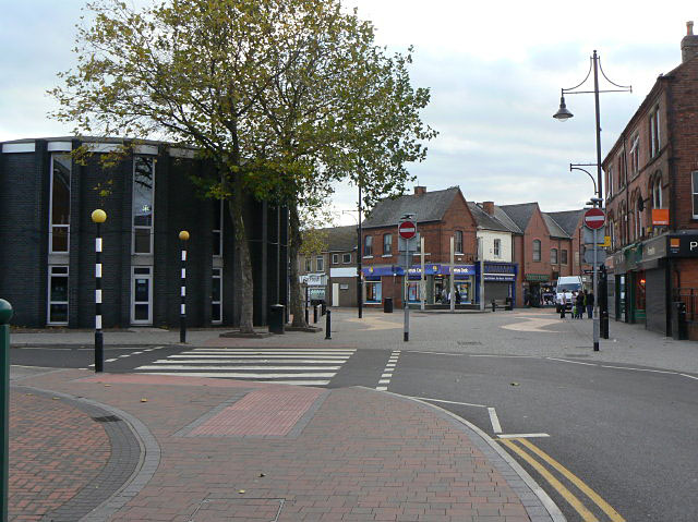
Arnold (/ˈɑːr.nəld/) is a market town in the Borough of Gedling in the county of Nottinghamshire in the East Midlands of England. It is situated to the north-east of Nottingham's city boundary. Arnold has the largest town centre in the Borough of Gedling and the most important town centre in the northeastern part of the conurbation of Greater Nottingham. Gedling Borough Council is headquartered in Arnold. Since 1968 Arnold has had a market, and the town used to have numerous factories associated with the hosiery industry. Nottinghamshire Police have been headquartered in Arnold since 1979. At the time of the 2011 United Kingdom census, Arnold had a population of 37,768.
Areas within Arnold include Daybrook, Woodthorpe, Redhill, Warren Hill, Killisick and Dorket Head.
Arnold was referred to as "Ernehale" in Domesday Book of 1086. This name meant 'place frequented by eagles' or 'the valley of eagles'.
A History of Arnold (1913) by Rev. Rupert W. King and Rev. James Russell explains the toponymy of Arnold's name thus:
"Heron-hald", meaning the corner of the forest where Herons (large birds) live. Which becomes over the centuries since 500 A.D. by "lazy" pronunciation, Eron-ald, thence Ern-old and Arn-old.
The local topography suggests that Arnold can never have been a haunt of eagles, because they inhabit areas of rocky outcrops, which have formed cliffs: the nearest such location is Creswell Crags, some 20 miles (32 km) north-west as the eagle flies. However, the fish-eating white-tailed eagle (also known as the erne) could have caught fish in the River Trent, which lies 4 miles (6.4 km) south-east of Arnold, on the other side of the Mapperley Plains ridge: these eagles might then have flown north-west in the evenings to roost in the ancient woodland area now known as Arnold. The Anglo-Saxon migrant-invaders, when they arrived along the River Trent from the Humber Estuary c. 500 A.D., might have seen these eagles—which measure 66–94 cm (26–37 in) in length with a 1.78–2.45 m (5.8–8.0 ft) wingspan—flying northwest in the evenings and named this roosting location 'Erne-Halh' or 'Erne-Haugh', meaning 'eagle's nook' or 'eagle's corner'.[citation needed]
Arnold is surrounded by a circular ridge from the north-west around to the south-east and raised ground to the west. The town's bowl-like topography may have given it the toponymic feature '-halh' or '-haugh'.[citation needed]
Founded in 1875 by John Robinson, the Home Brewery was famous for its trademark Robin Hood logo on beermats. The name of the brewery referred to the Robinson family's Bestwood Home Farm, located on Oxclose Lane.
Hub AI
Arnold, Nottinghamshire AI simulator
(@Arnold, Nottinghamshire_simulator)
Arnold, Nottinghamshire
Arnold (/ˈɑːr.nəld/) is a market town in the Borough of Gedling in the county of Nottinghamshire in the East Midlands of England. It is situated to the north-east of Nottingham's city boundary. Arnold has the largest town centre in the Borough of Gedling and the most important town centre in the northeastern part of the conurbation of Greater Nottingham. Gedling Borough Council is headquartered in Arnold. Since 1968 Arnold has had a market, and the town used to have numerous factories associated with the hosiery industry. Nottinghamshire Police have been headquartered in Arnold since 1979. At the time of the 2011 United Kingdom census, Arnold had a population of 37,768.
Areas within Arnold include Daybrook, Woodthorpe, Redhill, Warren Hill, Killisick and Dorket Head.
Arnold was referred to as "Ernehale" in Domesday Book of 1086. This name meant 'place frequented by eagles' or 'the valley of eagles'.
A History of Arnold (1913) by Rev. Rupert W. King and Rev. James Russell explains the toponymy of Arnold's name thus:
"Heron-hald", meaning the corner of the forest where Herons (large birds) live. Which becomes over the centuries since 500 A.D. by "lazy" pronunciation, Eron-ald, thence Ern-old and Arn-old.
The local topography suggests that Arnold can never have been a haunt of eagles, because they inhabit areas of rocky outcrops, which have formed cliffs: the nearest such location is Creswell Crags, some 20 miles (32 km) north-west as the eagle flies. However, the fish-eating white-tailed eagle (also known as the erne) could have caught fish in the River Trent, which lies 4 miles (6.4 km) south-east of Arnold, on the other side of the Mapperley Plains ridge: these eagles might then have flown north-west in the evenings to roost in the ancient woodland area now known as Arnold. The Anglo-Saxon migrant-invaders, when they arrived along the River Trent from the Humber Estuary c. 500 A.D., might have seen these eagles—which measure 66–94 cm (26–37 in) in length with a 1.78–2.45 m (5.8–8.0 ft) wingspan—flying northwest in the evenings and named this roosting location 'Erne-Halh' or 'Erne-Haugh', meaning 'eagle's nook' or 'eagle's corner'.[citation needed]
Arnold is surrounded by a circular ridge from the north-west around to the south-east and raised ground to the west. The town's bowl-like topography may have given it the toponymic feature '-halh' or '-haugh'.[citation needed]
Founded in 1875 by John Robinson, the Home Brewery was famous for its trademark Robin Hood logo on beermats. The name of the brewery referred to the Robinson family's Bestwood Home Farm, located on Oxclose Lane.