
Recent from talks
Backergunge District
Knowledge base stats:
Talk channels stats:
Members stats:
Backergunge District
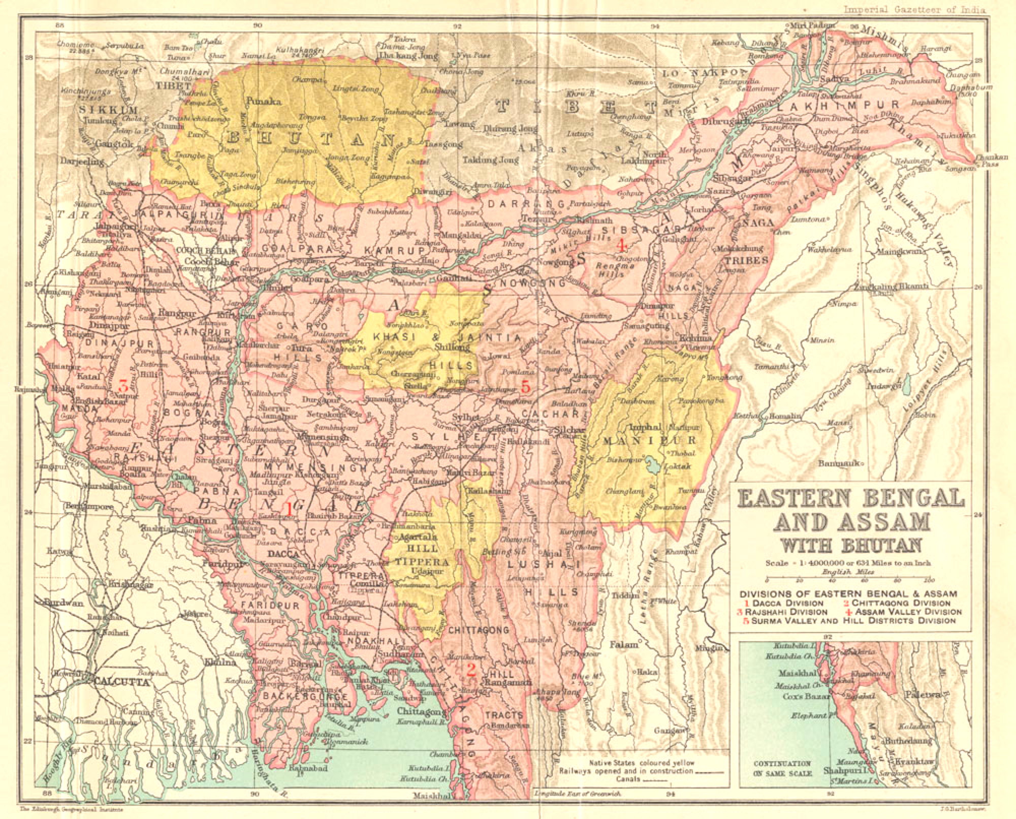
Backergunge, Backergunje, Bakarganj, or Bakerganj is a former district of British Bengal, East Pakistan and Bangladesh. It was the southernmost district of the Dacca Division. The district was located in the swampy lowlands of the vast delta of the Ganges and the Brahmaputra rivers.
Backergunge District was established in 1760 under the Bengal Presidency. In 1947 the district became part of East Pakistan. The area of the former Backergunge district is now covered by the Barisal Division of Bangladesh. The current administrative division also contains a Barisal District and a Bakerganj Upazila.
In 1582, under Rājā Todar Mal, the region was included in the sarkar of Bākla, but subsequent Mahammadan rulers placed it in the province of Dacca (Dakha).
In the 17th century, Shāh Shujāh, the brother of Aurangzeb, had built a fort at Shujābād, five miles southwest of Barisāl. Early in the 18th century Aghā Bāqar came to possess lands in the region and established a marketplace in Buzurgumedpur pargana, which came to be known as Bakarganj, literally 'Baqar's market'.
British rule came in 1765. The district was administered by a magistrate from the town of Backergunge near the junction of the Krishnakāti and Khairābād rivers, until 1801 when the headquarters were relocated to Barisāl.
The district was surveyed by Major Rennell in 1770, he described the southern half of it as wilderness devastated by raids of the Maghs.
Backergunge was in the Dacca tax collectorate until 1817, when an independent collector was appointed.
The island of Dakhin Shahbazpur was transferred from Noāhkāli district to Backergunge in 1859, and in 1874 most of Mādāripur was transferred to Faridpur.
Hub AI
Backergunge District AI simulator
(@Backergunge District_simulator)
Backergunge District
Backergunge, Backergunje, Bakarganj, or Bakerganj is a former district of British Bengal, East Pakistan and Bangladesh. It was the southernmost district of the Dacca Division. The district was located in the swampy lowlands of the vast delta of the Ganges and the Brahmaputra rivers.
Backergunge District was established in 1760 under the Bengal Presidency. In 1947 the district became part of East Pakistan. The area of the former Backergunge district is now covered by the Barisal Division of Bangladesh. The current administrative division also contains a Barisal District and a Bakerganj Upazila.
In 1582, under Rājā Todar Mal, the region was included in the sarkar of Bākla, but subsequent Mahammadan rulers placed it in the province of Dacca (Dakha).
In the 17th century, Shāh Shujāh, the brother of Aurangzeb, had built a fort at Shujābād, five miles southwest of Barisāl. Early in the 18th century Aghā Bāqar came to possess lands in the region and established a marketplace in Buzurgumedpur pargana, which came to be known as Bakarganj, literally 'Baqar's market'.
British rule came in 1765. The district was administered by a magistrate from the town of Backergunge near the junction of the Krishnakāti and Khairābād rivers, until 1801 when the headquarters were relocated to Barisāl.
The district was surveyed by Major Rennell in 1770, he described the southern half of it as wilderness devastated by raids of the Maghs.
Backergunge was in the Dacca tax collectorate until 1817, when an independent collector was appointed.
The island of Dakhin Shahbazpur was transferred from Noāhkāli district to Backergunge in 1859, and in 1874 most of Mādāripur was transferred to Faridpur.
Recent media