
Community hub
Recent from talks
Contribute something
Nothing was collected or created yet.
Barberier
View on Wikipedia
Barberier (French pronunciation: [baʁbəʁje]) is a commune in the Allier department in the Auvergne-Rhône-Alpes region of central France.[3]
Key Information


Geography
[edit]Barberier is located some 17 km (11 mi) north-west of Vichy and some 17 km (11 mi) north by north-east of Gannat. Access to the commune is by the D36 road from Étroussat in the west which passes through the centre of the commune and the village and continues east to join the D2009 east of the commune. The D183 comes from Bayet in the north and also passes through the centre of the commune, intersecting the D36 at the village, continuing south to join the D66 south of the commune. Apart from the village there are the hamlets of Les Varennes in the south, La Grange Neuve in the east, and Bompré in the north.[4][5]
The Sioule river flows north along the south-eastern border of the commune and continues north to join the Allier north-east of Contigny.[4]
Neighbouring communes and villages[4] | |
|---|---|
History
[edit]Barberier appears as Barbrier on the 1750 Cassini Map[6] and the same the 1790 version.[7]
Administration
[edit]Demography
[edit]In 2017 the commune had 143 inhabitants.[11]
|
| ||||||||||||||||||||||||||||||||||||||||||||||||||||||||||||||||||||||||||||||||||||||||||||||||||||||||||||||||||
| Source: EHESS[12] and INSEE[11] | |||||||||||||||||||||||||||||||||||||||||||||||||||||||||||||||||||||||||||||||||||||||||||||||||||||||||||||||||||
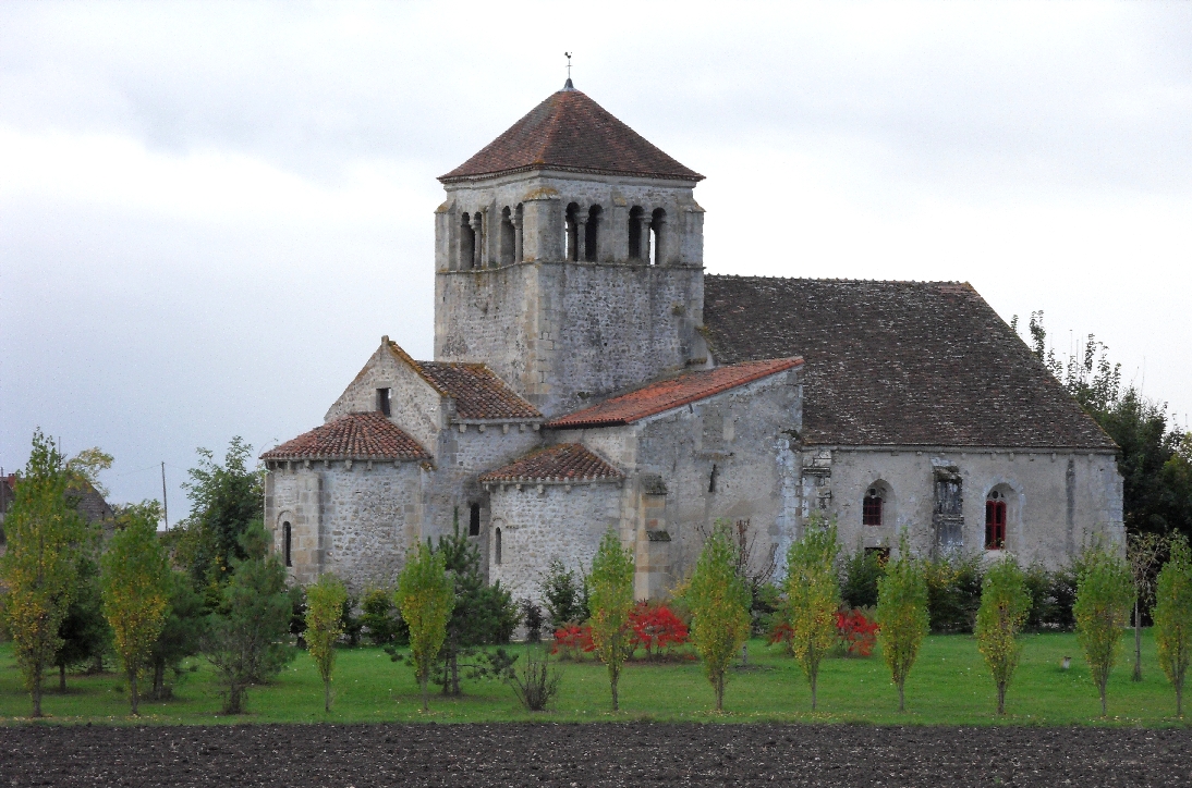
Sites and monuments
[edit]There are two sites in the commune that are registered as historical monuments:
See also
[edit]Bibliography
[edit]- Raymond d'Azémar, Étroussat, Barberier. Municipal Chronicles from the Revolution to today, Montluçon, 1983 (in French)
References
[edit]- ^ "Répertoire national des élus: les maires" (in French). data.gouv.fr, Plateforme ouverte des données publiques françaises. 13 September 2022.
- ^ "Populations de référence 2022" (in French). National Institute of Statistics and Economic Studies. 19 December 2024.
- ^ INSEE commune file
- ^ a b c Barberier on Google Maps
- ^ Barberier on the Géoportail from IGN (in French)
- ^ Barbrier on the 1750 Cassini Map
- ^ Barbrier on the 1790 Cassini Map
- ^ List of Mayors of France (in French)
- ^ "Liste nominative des communes de l'Allier (avec maire, arrondissement et canton)" [Nominative list of communes of Allier (with mayor, arrondissement and canton)] (PDF). Association of Mayors and Presidents of Communities of Allier. 1 April 2015. Archived from the original (PDF) on 18 May 2015.
- ^ "Liste nominative des communes de l'Allier" [Nominative list of communes of Allier] (PDF). maires-allier.fr (in French). Association of Mayors and Presidents of Communities of Allier. 8 July 2020. p. 1. Archived from the original (PDF) on 4 October 2020. Retrieved 31 July 2020.
- ^ a b Population en historique depuis 1968, INSEE
- ^ Des villages de Cassini aux communes d'aujourd'hui: Commune data sheet Barberier, EHESS (in French).
- ^ Ministry of Culture, Mérimée PA00093381 Château of Bompré (in French)
- ^ Ministry of Culture, Mérimée PA00092982 Church of Saint André (in French)
