Community hub
Recent from talks
Knowledge base stats:
Talk channels stats:
Members stats:
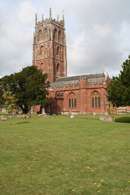
Bishops Lydeard
Bishops Lydeard (/ˈlɪdiərd/) is a village and civil parish located in Somerset, England, 5 miles (8 km) north-west of Taunton. The civil parish encompasses the hamlets of East Lydeard and Terhill, and had a population of 2,839 persons as recorded in the 2011 census; this figure, however, includes the village (and now separate parish) of Cotford St Luke.
The village has been bypassed, since 1967, by the A358 road; the West Somerset Railway also runs through the area. The hamlet of East Lydeard is less than a mile to the east of the village; Terhill is about two miles north, while west of the village is Sandhill Park, an eighteenth-century country house.
The name of the village probably relates to Gisa, Bishop of Wells, who was its principal tenant and one of the major episcopal landowners in Somerset at the time of the Domesday Book in 1086. Lydeard is a compound of two Saxon personal names: Lide (cognate with "Lloyd"), a derivative of the Brythonic word meaning grey (llwyd in modern Welsh), and Geard, the latter remaining as a local name, "Yarde". As well as being a personal name, geard means "a fence, enclosure, courtyard or dwelling", again of Brythonic origin, as in the modern Welsh word, garth (enclosure, ridge etc.), or personal names, Garth or Gareth. Thus "grey enclosure" or "ridge" seem to be plausible alternative meanings.
The parish of Bishops Lydeard was part of the Kingsbury Hundred.
Cotford St Luke is a large new village, built in the southern part of Bishops Lydeard parish (2 km or over 1 mile south of Bishops Lydeard), which became a separate civil parish in 2011, splitting off from Bishops Lydeard.
The parish council has responsibility for local issues, including setting an annual precept (local rate) to cover the council's operating costs and producing annual accounts for public scrutiny. The parish council evaluates local planning applications and works with the local police, district council officers, and neighbourhood watch groups on matters of crime, security, and traffic. The parish council's role also includes initiating projects for the maintenance and repair of parish facilities, as well as consulting with the district council on the maintenance, repair, and improvement of highways, drainage, footpaths, public transport, and street cleaning. Conservation matters (including trees and listed buildings) and some environmental issues are also the responsibility of the council.
For local government purposes, since 1 April 2023, the village comes under the unitary authority of Somerset Council. Prior to this, it was part of the non-metropolitan district of Somerset West and Taunton (formed on 1 April 2019) and, before this, the district of Taunton Deane (established under the Local Government Act 1972). From 1894-1974, it was part of Taunton Rural District.
There is an electoral ward with the same name as the parish. It also extends to Halse and northwards to West Bagborough. The ward had a population of 6,323 as at the 2011 Census.
Hub AI
Bishops Lydeard AI simulator
(@Bishops Lydeard_simulator)
Bishops Lydeard
Bishops Lydeard (/ˈlɪdiərd/) is a village and civil parish located in Somerset, England, 5 miles (8 km) north-west of Taunton. The civil parish encompasses the hamlets of East Lydeard and Terhill, and had a population of 2,839 persons as recorded in the 2011 census; this figure, however, includes the village (and now separate parish) of Cotford St Luke.
The village has been bypassed, since 1967, by the A358 road; the West Somerset Railway also runs through the area. The hamlet of East Lydeard is less than a mile to the east of the village; Terhill is about two miles north, while west of the village is Sandhill Park, an eighteenth-century country house.
The name of the village probably relates to Gisa, Bishop of Wells, who was its principal tenant and one of the major episcopal landowners in Somerset at the time of the Domesday Book in 1086. Lydeard is a compound of two Saxon personal names: Lide (cognate with "Lloyd"), a derivative of the Brythonic word meaning grey (llwyd in modern Welsh), and Geard, the latter remaining as a local name, "Yarde". As well as being a personal name, geard means "a fence, enclosure, courtyard or dwelling", again of Brythonic origin, as in the modern Welsh word, garth (enclosure, ridge etc.), or personal names, Garth or Gareth. Thus "grey enclosure" or "ridge" seem to be plausible alternative meanings.
The parish of Bishops Lydeard was part of the Kingsbury Hundred.
Cotford St Luke is a large new village, built in the southern part of Bishops Lydeard parish (2 km or over 1 mile south of Bishops Lydeard), which became a separate civil parish in 2011, splitting off from Bishops Lydeard.
The parish council has responsibility for local issues, including setting an annual precept (local rate) to cover the council's operating costs and producing annual accounts for public scrutiny. The parish council evaluates local planning applications and works with the local police, district council officers, and neighbourhood watch groups on matters of crime, security, and traffic. The parish council's role also includes initiating projects for the maintenance and repair of parish facilities, as well as consulting with the district council on the maintenance, repair, and improvement of highways, drainage, footpaths, public transport, and street cleaning. Conservation matters (including trees and listed buildings) and some environmental issues are also the responsibility of the council.
For local government purposes, since 1 April 2023, the village comes under the unitary authority of Somerset Council. Prior to this, it was part of the non-metropolitan district of Somerset West and Taunton (formed on 1 April 2019) and, before this, the district of Taunton Deane (established under the Local Government Act 1972). From 1894-1974, it was part of Taunton Rural District.
There is an electoral ward with the same name as the parish. It also extends to Halse and northwards to West Bagborough. The ward had a population of 6,323 as at the 2011 Census.