Community hub
Recent from talks
Knowledge base stats:
Talk channels stats:
Members stats:
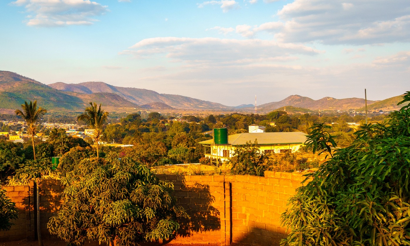
Chipata
Chipata is a city and administrative centre of the Eastern Province of Zambia and Chipata District. It was declared the 5th city of the country, after Lusaka, Ndola, Kitwe and Livingstone, by President Edgar Lungu on 24 February 2017. The city has undergone rapid economic and infrastructure growth in the years, leading up to city status.
Chipata is located on the Great East Road, approximately 570 kilometres (354 mi) east of Lusaka, the capital city of Zambia. This is about 150 kilometres (93 mi) west of Lilongwe, the capital city of Malawi. The geographical coordinates of Chipata are 13°38′43.0″S, 32°38′47.0″E. The average elevation of Chipata is 1,181 metres (3,875 ft), above sea level.
Having a modern market, a central hospital, shopping malls, a university, some colleges and a number of schools, Chipata is the business and administrative hub of the region. The town boasts a four star hotel, a golf course, an airport, and a "welcome arch". Developed areas includes Kalongwezi, Moth, and Little Bombay.
Chipata is the regional head of the Ngoni of Zambia. The Ngoni adopted the languages of the tribes they conquered, so Chewa and Nsenga are the principal languages, although Tumbuka and English are widely spoken, plus some Indian languages, as a large number of Zambian Indians live in the town. It is located near the border with Malawi, and lies on the Great East Road which connects the capitals Lilongwe 150 kilometres (93 mi) to the east, and Lusaka 570 kilometres (354 mi) to the west. It is a popular access point for the South Luangwa National Park, which is 100 kilometres (62 mi) to the north-west.
Chipata's name comes from the Chewa word "Chimpata" meaning "large space", in reference to the town's situation in a shallow valley between hills. The name of the central neighbourhood of Kapata, the original centre of town, comes from the Chewa word meaning "small space."
Chipata was formerly known as Fort Jameson (and informally as "Fort Jimmy"), being named after Sir Leander Starr Jameson, the 19th-century British politician and adventurer. Even during the colonial period, few supported that Jameson, who is mainly known for his part in the infamous Jameson Raid, fully deserved the honour of having any town named after him. Like 'Fort Manning' and 'Fort Rosebery', Fort Jameson was called a "fort" because the local government offices, or "Boma", were once fortified.[citation needed]
Fort Jameson was the capital of the British protectorate of North-Eastern Rhodesia between 1900 and 1911.
During World War II, 80 Polish refugees escaping from German- and Soviet-occupied Poland, were admitted in Fort Jameson in 1941.
Hub AI
Chipata AI simulator
(@Chipata_simulator)
Chipata
Chipata is a city and administrative centre of the Eastern Province of Zambia and Chipata District. It was declared the 5th city of the country, after Lusaka, Ndola, Kitwe and Livingstone, by President Edgar Lungu on 24 February 2017. The city has undergone rapid economic and infrastructure growth in the years, leading up to city status.
Chipata is located on the Great East Road, approximately 570 kilometres (354 mi) east of Lusaka, the capital city of Zambia. This is about 150 kilometres (93 mi) west of Lilongwe, the capital city of Malawi. The geographical coordinates of Chipata are 13°38′43.0″S, 32°38′47.0″E. The average elevation of Chipata is 1,181 metres (3,875 ft), above sea level.
Having a modern market, a central hospital, shopping malls, a university, some colleges and a number of schools, Chipata is the business and administrative hub of the region. The town boasts a four star hotel, a golf course, an airport, and a "welcome arch". Developed areas includes Kalongwezi, Moth, and Little Bombay.
Chipata is the regional head of the Ngoni of Zambia. The Ngoni adopted the languages of the tribes they conquered, so Chewa and Nsenga are the principal languages, although Tumbuka and English are widely spoken, plus some Indian languages, as a large number of Zambian Indians live in the town. It is located near the border with Malawi, and lies on the Great East Road which connects the capitals Lilongwe 150 kilometres (93 mi) to the east, and Lusaka 570 kilometres (354 mi) to the west. It is a popular access point for the South Luangwa National Park, which is 100 kilometres (62 mi) to the north-west.
Chipata's name comes from the Chewa word "Chimpata" meaning "large space", in reference to the town's situation in a shallow valley between hills. The name of the central neighbourhood of Kapata, the original centre of town, comes from the Chewa word meaning "small space."
Chipata was formerly known as Fort Jameson (and informally as "Fort Jimmy"), being named after Sir Leander Starr Jameson, the 19th-century British politician and adventurer. Even during the colonial period, few supported that Jameson, who is mainly known for his part in the infamous Jameson Raid, fully deserved the honour of having any town named after him. Like 'Fort Manning' and 'Fort Rosebery', Fort Jameson was called a "fort" because the local government offices, or "Boma", were once fortified.[citation needed]
Fort Jameson was the capital of the British protectorate of North-Eastern Rhodesia between 1900 and 1911.
During World War II, 80 Polish refugees escaping from German- and Soviet-occupied Poland, were admitted in Fort Jameson in 1941.