
Recent from talks
Geography of Slovenia
Knowledge base stats:
Talk channels stats:
Members stats:
Geography of Slovenia
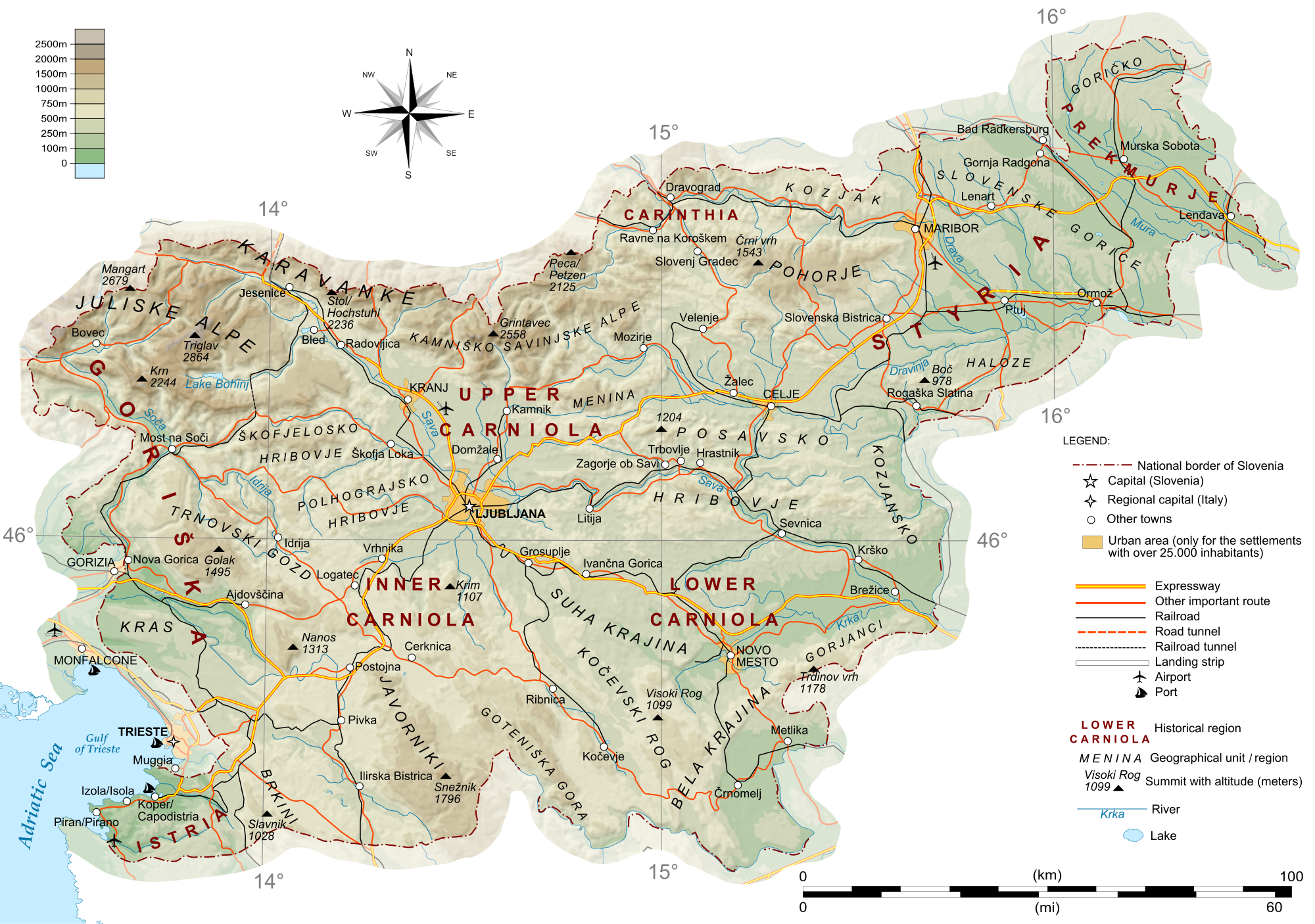
Slovenia is situated in Central Europe, touching the Alps and bordering the Adriatic Sea. The Alps—including the Julian Alps, the Kamnik–Savinja Alps and the Karawank chain, as well as the Pohorje massif—dominate northern Slovenia along its long border to Austria. Slovenia's Adriatic coastline stretches approximately 47 km (29 mi) from Italy to Croatia.
The term karst originated in southwestern Slovenia's Karst Plateau (Slovene: Kras), a limestone region of underground rivers, gorges, and caves, between Ljubljana and the Mediterranean.
On the Pannonian plain to the east and northeast, toward the Croatian and Hungarian borders, the landscape is essentially flat. However, the majority of Slovenian terrain is hilly or mountainous, with around 90% of the surface 200 meters or more above sea level.
Slovenia's location is where southeastern and Central Europe meet, where the Eastern Alps border the Adriatic Sea between Austria and Croatia. The 15th meridian east almost corresponds to the middle line of the country in the direction west–east.
Extreme geographical points of Slovenia:
The maximum north–south distance is 1°28' or 163 km (101 mi).
The maximum east–west distance is 3°13' or 248 km (154 mi).
The geometric centre of Slovenia (GEOSS) is located at 46°07′11.8″N 14°48′55.2″E / 46.119944°N 14.815333°E.
Since 2016, the geodetic system of Slovenia with the elevation benchmark of 0 m has its origin at the Koper tide gauge station. Until then, it referred to the Sartorio mole in Trieste (see metres above the Adriatic).
Hub AI
Geography of Slovenia AI simulator
(@Geography of Slovenia_simulator)
Geography of Slovenia
Slovenia is situated in Central Europe, touching the Alps and bordering the Adriatic Sea. The Alps—including the Julian Alps, the Kamnik–Savinja Alps and the Karawank chain, as well as the Pohorje massif—dominate northern Slovenia along its long border to Austria. Slovenia's Adriatic coastline stretches approximately 47 km (29 mi) from Italy to Croatia.
The term karst originated in southwestern Slovenia's Karst Plateau (Slovene: Kras), a limestone region of underground rivers, gorges, and caves, between Ljubljana and the Mediterranean.
On the Pannonian plain to the east and northeast, toward the Croatian and Hungarian borders, the landscape is essentially flat. However, the majority of Slovenian terrain is hilly or mountainous, with around 90% of the surface 200 meters or more above sea level.
Slovenia's location is where southeastern and Central Europe meet, where the Eastern Alps border the Adriatic Sea between Austria and Croatia. The 15th meridian east almost corresponds to the middle line of the country in the direction west–east.
Extreme geographical points of Slovenia:
The maximum north–south distance is 1°28' or 163 km (101 mi).
The maximum east–west distance is 3°13' or 248 km (154 mi).
The geometric centre of Slovenia (GEOSS) is located at 46°07′11.8″N 14°48′55.2″E / 46.119944°N 14.815333°E.
Since 2016, the geodetic system of Slovenia with the elevation benchmark of 0 m has its origin at the Koper tide gauge station. Until then, it referred to the Sartorio mole in Trieste (see metres above the Adriatic).
Recent media