Recent from talks
Nothing was collected or created yet.
Colton, California
View on Wikipedia
Colton is a city in San Bernardino County, California, United States. Nicknamed "Hub City", Colton is located in the Inland Empire region of the state and is a suburb of San Bernardino, approximately 4 miles (6.4 km) south of the city's downtown. The population of Colton is 53,909 according to the 2020 census, up from 52,154 at the 2010 census.
Key Information
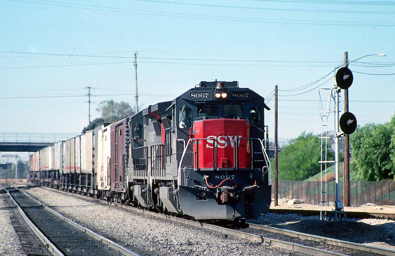
Colton is the site of Colton Crossing, which was one of the busiest at-grade railroad crossings in the United States. The crossing was installed in 1882 by the California Southern Railroad to cross the Southern Pacific Railroad tracks while building northward from San Diego. As a result of railroad acquisitions and mergers, this became the point at which the Burlington Northern Santa Fe's "Southern Transcontinental Route" crossed the Union Pacific's "Sunset Route". As traffic on each line began to soar in the mid-1990s, fueled largely by the vast increase in imports passing through the ports of Los Angeles and Long Beach, the primitive crossing became a serious bottleneck. On August 28, 2013, the at-grade crossing was officially replaced by a fly-over that raises the east–west UP tracks over the north–south BNSF tracks.
Despite its status as a railroad town, Colton does not have passenger rail service. Passenger trains operated by Amtrak and Metrolink pass through Colton but do not stop there.
History
[edit]

Indigenous peoples
[edit]Before Spanish settlement, the area was inhabited by the Tongva, Serrano, and Cahuilla.[4][5] The Tongva village of Homhoangna was located in the area that is now Colton, situated near the base of the foothills of Reche Canyon, historically known as Homhoa Canyon, derived from the Tongva language word homhoabit or "hilly place."[5]
Spanish and Mexican settlement
[edit]During the Mission Era the Mission San Gabriel established a Spanish settlement Politana in 1810, just northeast of what is now Colton.[6] By 1840, Colton was part of two private ranchos, Jurupa and San Bernardino Rancho.[4] From southwest area of modern-day Colton was known as "Agua Mansa" (Gentle Waters). It had been settled by New Mexico pioneers in 1842.[4] What is currently known as Cooley Ranch was known as Indian Knolls for nearly 100 years. This is because the Indians living in what is now the San Bernardino Valley found refuge on the knolls of the property during the flood of 1862.[4]
American settlement
[edit]The original owner of the property was George Cooley of Kent, England who had moved to Colton in 1853 and who purchased 200 acres at $3.50 an acre along the Santa Ana River the next year.[4] Cooley was chairman of the San Bernardino County Board of Supervisors in San Bernardino County.[4] By 1873, the property had mushroomed into a 400-acre property. Eventually, when property taxes had increased, the property was sold to Villelli Enterprises of La Habra.[4] The city was named after David Douty Colton, who had been a brigadier general of the California State Militia in 1855, prior to the Civil War.[7] He was later the vice president of the Southern Pacific Railroad Company.[4]
Colton was created in its modern form when the Southern Pacific Railway was built heading east from Los Angeles in 1875.[4] It was founded in 1875 and incorporated in 1887. Colton was the site of conflict between the Southern Pacific Transportation Company and the Atchison, Topeka and Santa Fe Railway at Colton Crossing when both railroads wanted to cross through the town.
Virgil Earp lived in Colton at 528 West "H" Street[8] where he was the town's first marshal.[9] He resided in Colton from 1883 to 1889. Morgan Earp is buried at Hermosa Cemetery.
1950s to present
[edit]In 1953, a significant portion of the historic downtown of Colton was bulldozed to make room for the Ramona Freeway, which would later be named the San Bernardino Freeway. This included the block on the west side of Eighth Street north of J, including the then 70-year-old Helman's Department Store building, originally housing the First National Bank of Colton, on the corner and the Willet's Department Store building to its north. Both stores moved to locations further north on Eighth.[10]
Geography
[edit]According to the United States Census Bureau, the city has a total area of 16.1 square miles (42 km2). 15.5 square miles (40 km2) of it is land and 0.5 square miles (1.3 km2) of it (3.18%) is water.[2]
Slover Mountain, once the highest point in San Bernardino Valley and the site of the Colton Liberty Flag, is located in the city.[11]
Climate
[edit]According to the Köppen Climate Classification system, Colton has a warm-summer Mediterranean climate, abbreviated "Csa" on climate maps.[12]
Demographics
[edit]| Census | Pop. | Note | %± |
|---|---|---|---|
| 1890 | 1,315 | — | |
| 1900 | 1,285 | −2.3% | |
| 1910 | 3,980 | 209.7% | |
| 1920 | 4,282 | 7.6% | |
| 1930 | 8,014 | 87.2% | |
| 1940 | 9,686 | 20.9% | |
| 1950 | 14,465 | 49.3% | |
| 1960 | 18,666 | 29.0% | |
| 1970 | 20,016 | 7.2% | |
| 1980 | 21,310 | 6.5% | |
| 1990 | 40,213 | 88.7% | |
| 2000 | 47,662 | 18.5% | |
| 2010 | 52,154 | 9.4% | |
| 2020 | 53,909 | 3.4% | |
| U.S. Decennial Census[13] | |||
2020
[edit]The 2020 United States census reported that Colton had a population of 53,909. The population density was 3,466.8 inhabitants per square mile (1,338.5/km2). The racial makeup of Colton was 24.7% White, 8.8% African American, 2.4% Native American, 4.8% Asian, 0.3% Pacific Islander, 42.2% from other races, and 16.9% from two or more races. Hispanic or Latino of any race were 73.8% of the population.[14]
The census reported that 99.0% of the population lived in households, 0.6% lived in non-institutionalized group quarters, and 0.4% were institutionalized.[14]
There were 16,018 households, out of which 44.2% included children under the age of 18, 44.7% were married-couple households, 8.6% were cohabiting couple households, 28.4% had a female householder with no partner present, and 18.2% had a male householder with no partner present. 17.0% of households were one person, and 5.2% were one person aged 65 or older. The average household size was 3.33.[14] There were 12,298 families (76.8% of all households).[15]
The age distribution was 26.6% under the age of 18, 10.8% aged 18 to 24, 29.6% aged 25 to 44, 22.6% aged 45 to 64, and 10.3% who were 65 years of age or older. The median age was 32.2 years. For every 100 females, there were 96.5 males.[14]
There were 16,632 housing units at an average density of 1,069.6 units per square mile (413.0 units/km2), of which 16,018 (96.3%) were occupied. Of these, 50.4% were owner-occupied, and 49.6% were occupied by renters.[14]
In 2023, the US Census Bureau estimated that the median household income was $69,581, and the per capita income was $26,757. About 12.1% of families and 15.3% of the population were below the poverty line.[16]
2010
[edit]At the 2010 census Colton had a population of 52,154. The population density was 3,251.7 inhabitants per square mile (1,255.5/km2). The racial makeup of Colton was 22,613 (43.4%) White (13.0% Non-Hispanic White),[17] 5,055 (9.7%) African American, 661 (1.3%) Native American, 2,590 (5.0%) Asian, 176 (0.3%) Pacific Islander, 18,413 (35.3%) from other races, and 2,646 (5.1%) from two or more races. Hispanic or Latino of any race were 37,039 persons (71.0%).[18]
The census reported that 51,824 people (99.4% of the population) lived in households, 85 (0.2%) lived in non-institutionalized group quarters, and 245 (0.5%) were institutionalized.
There were 14,971 households, 7,826 (52.3%) had children under the age of 18 living in them, 7,167 (47.9%) were opposite-sex married couples living together, 3,233 (21.6%) had a female householder with no husband present, 1,340 (9.0%) had a male householder with no wife present. There were 1,268 (8.5%) unmarried opposite-sex partnerships, and 106 (0.7%) same-sex married couples or partnerships. 2,452 households (16.4%) were one person and 614 (4.1%) had someone living alone who was 65 or older. The average household size was 3.46. There were 11,740 families (78.4% of households); the average family size was 3.86.
The age distribution was 16,671 people (32.0%) under the age of 18, 6,360 people (12.2%) aged 18 to 24, 14,965 people (28.7%) aged 25 to 44, 10,495 people (20.1%) aged 45 to 64, and 3,663 people (7.0%) who were 65 or older. The median age was 28.4 years. For every 100 females, there were 96.0 males. For every 100 females age 18 and over, there were 92.6 males.
There were 16,350 housing units at an average density of 1,019.4 per square mile, of the occupied units 7,766 (51.9%) were owner-occupied and 7,205 (48.1%) were rented. The homeowner vacancy rate was 2.6%; the rental vacancy rate was 9.2%. 28,063 people (53.8% of the population) lived in owner-occupied housing units and 23,761 people (45.6%) lived in rental housing units.
According to the 2010 United States Census, Colton had a median household income of $41,496, with 22.5% of the population living below the federal poverty line.[17]
Economy
[edit]According to the city's 2021 Comprehensive Annual Financial Report,[19] the top employers in the city are:
| # | Employer | # of Employees |
|---|---|---|
| 1 | Arrowhead Regional Medical Center | 3510 |
| 2 | Colton Joint Unified School District | 2320 |
| 3 | Walmart | 1148 |
| 4 | Lineage Logistics | 550 |
| 5 | County of San Bernardino | 427 |
| 6 | Ashley Furniture | 330 |
| 7 | City of Colton | 286 |
| 8 | Brill, Inc | 250 |
| 9 | Reche Canyon rehabilitation & Health Center | 245 |
| 10 | Stater Bros |
Government
[edit]In the California State Senate, Colton is split between the 29th senatorial district, represented by Democrat Eloise Reyes, and the 19th senatorial district, represented by Republican Rosilicie Ochoa Bogh. In the California State Assembly, Colton is in the 50th Assembly district, represented by Democrat Robert Garcia.[20]
In the United States House of Representatives, Colton is in California's 33rd congressional district, represented by Democrat Pete Aguilar.[21]
Education
[edit]Most of Colton is in the Colton Unified School District. A portion is in the Rialto Unified School District.[22]
Notable people
[edit]This section needs additional citations for verification. (October 2016) |
- 40 Glocc (born 1974) – rapper[23]
- Jordan Adebayo-Smith (born 2001) – soccer player[24]
- Tyler Ankrum (born 2001) – NASCAR K&N Pro Series East driver
- Allen Bradford (born 1988) – NFL football player
- Adriana Briscoe – National Academy of Sciences member[25]
- Cam Carreon (1937–1987) – baseball player
- Kit Carson (1912–1983) – baseball player
- George Caster (1907–1955) – baseball player
- Dennis Crane – football player, Detroit Lions
- Jay Dahl (1945–1965) – baseball player
- Rich Dauer (1952–2025) – baseball player, World Series champion
- Nicholas Porter Earp (1813–1907) – father of Wyatt Earp
- Wyatt Earp (1848–1929) – frontier lawman
- Virgil Earp (1843–1905) – frontier lawman, older brother of Wyatt Earp; 1st city marshal of Colton
- Morgan Earp (1851–1882) – lawman
- Gene Evans (1922–1998) – actor
- Jada Hart (born 1998) – tennis player
- Rodolfo Hernandez (born 1931) – Medal of Honor recipient, Korean War
- Kat Von D aka Kathrine Drachenburg (born 1982) – tattoo artist, star of LA Ink
- Ken Hubbs (1941–1964) – Chicago Cubs infielder, 1962 Rookie of the Year
- Jim Messina (born 1947) – musician (Buffalo Springfield, Loggins & Messina)[26]
- George T. Sakato (1921–2015) – Medal of Honor recipient, World War II
- Jimmy Smith (born 1988) – NFL football Player
- Jeremy Suarez (born 1990) – actor, The Bernie Mac Show
- Jimmy Webb (born 1946) – songwriter
- Susan Woodstra (born 1957) – silver medalist, 1984 Summer Olympics, women's volleyball
- Shareece Wright (born 1987) – NFL football player
References
[edit]- ^ a b "Colton". Geographic Names Information System. United States Geological Survey, United States Department of the Interior. Retrieved October 23, 2014.
- ^ a b "2020 U.S. Gazetteer Files". United States Census Bureau. Retrieved October 30, 2021.
- ^ "California Cities by Incorporation Date". California Association of Local Agency Formation Commissions. Archived from the original (Word) on November 3, 2014. Retrieved August 25, 2014.
- ^ a b c d e f g h i "Colton – History". Archived from the original on March 27, 2010. Retrieved December 11, 2011.
- ^ a b Gunther, Jane Davies (1984). Riverside County, California, Place Names: Their Origins and Their Stories. J.D. Gunther. pp. 240–41.
- ^ History of San Bernardino Valley from the padres to the pioneers, 1810–1851 (1902). San Bernardino, Cal., Times-index Press. 1902. pp. 37–41.
- ^ "Finding aid of the Gen. David Douty Colton Papers – C057959". www.oac.cdlib.org. Retrieved March 23, 2018.
- ^ San Bernardino County Register of Deeds Book (entry dated July 7, 1888)
- ^ Colton City News, November 2, 2006
- ^ "Colton News: Pioneer Business Blocks Slated for Demolition: State to Lease Cleared Area for City Parking Lot". San Bernardino Sun-Telegram. February 8, 1953.
- ^ Muckenfuss, Mark (November 17, 2008). "Old Glory Kept Perpetual Shine". Press-enterprise.com. Archived from the original on July 17, 2011. Retrieved September 21, 2013.
- ^ "Colton, California Köppen Climate Classification (Weatherbase)". Weatherbase. Retrieved March 23, 2018.
- ^ "Census of Population and Housing". Census.gov. Retrieved June 4, 2015.
- ^ a b c d e "Colton city, California; DP1: Profile of General Population and Housing Characteristics - 2020 Census of Population and Housing". US Census Bureau. Retrieved June 11, 2025.
- ^ "Colton city, California; P16: Household Type - 2020 Census of Population and Housing". US Census Bureau. Retrieved June 11, 2025.
- ^ "Colton city, California; DP03: Selected Economic Characteristics - 2023 ACS 5-Year Estimates Comparison Profiles". US Census Bureau. Retrieved June 11, 2025.
- ^ a b "Colton (City) QuickFacts from the US Census Bureau". Archived from the original on March 23, 2015. Retrieved December 25, 2013.
- ^ "2010 Census Interactive Population Search: CA – Colton city". U.S. Census Bureau. Archived from the original on July 15, 2014. Retrieved July 12, 2014.
- ^ "ANNUAL COMPREHENSIVE FINANCIAL REPORT(ACFR) | Colton, CA - Official Website". coltonca.gov. Retrieved September 24, 2022.
- ^ "Final Maps | California Citizens Redistricting Commission". Retrieved August 7, 2025.
- ^ "California's 31st Congressional District - Representatives & District Map". Civic Impulse, LLC.
- ^ "2020 CENSUS - SCHOOL DISTRICT REFERENCE MAP: San Bernardino County, CA" (PDF). U.S. Census Bureau. p. 8 (PDF p. 9/12). Retrieved October 4, 2024. - Text list
- ^ Radio, Southern California Public (September 3, 2010). "Well known Colton rapper loses bid to get removed from gang injunction". scpr.org. Retrieved March 23, 2018.
- ^ "New York Red Bulls II Add Forward Jordan Adebayo-Smith on Loan from Tampa Bay Rowdies". New York Red Bulls. February 14, 2022. Retrieved August 15, 2025.
- ^ "National Academy of Sciences Elects Members and International Members". www.nasonline.org. April 30, 2024. Retrieved May 12, 2024.
- ^ Muckenfuss, Mark (April 17, 2009). "Jim Messina recalls getting his musical start in Colton". Press–Enterprise. Retrieved December 4, 2009.
Further reading
[edit]- History of the Colton Fire Department 1889–2011 (2012), Dennis Bickers (retired Colton Fire)
- Images of America, Colton (2004), Larry Sheffield
External links
[edit]- Official website

- History of Colton at the city of San Bernardino website
Colton, California
View on GrokipediaColton is a city in San Bernardino County, California, United States, located in the Inland Empire region approximately 40 miles east of downtown Los Angeles.[1] Incorporated on November 16, 1887, it was named for David Douty Colton, a railroad financier and associate of the Central Pacific Railroad's "Big Four."[2] As of the 2020 United States Census, the city had a population of 53,909 residents across 15.5 square miles, predominantly land area.[3] Historically a vital rail junction since the arrival of the Southern Pacific Railroad in 1875, Colton earned the nickname "Hub City" for its role in connecting transcontinental lines and facilitating freight movement through the San Bernardino Valley.[2] Today, the economy centers on logistics, warehousing, manufacturing, healthcare, and retail trade, bolstered by proximity to two Class I freight railroads and major interstate highways.[4] The city's development reflects the broader growth of the Inland Empire as a distribution hub, with municipal ownership of utilities like electricity and water supporting industrial expansion.[5]
History
Indigenous Peoples
The area encompassing present-day Colton, California, was primarily inhabited by the Serrano people prior to European contact, with their territory extending across the San Bernardino Mountains and adjacent valleys, including sites along the Santa Ana River for seasonal resource exploitation.[6][7] The Serrano, a Shoshonean-speaking group, maintained small, semi-permanent villages near perennial water sources such as streams and seeps, utilizing willow-frame dwellings covered in tule thatching.[8] Adjacent groups like the Cahuilla, who occupied lands east of the Santa Ana River, also frequented the region for hunting and gathering, establishing temporary camps in canyons proximate to food plants and game trails.[8] Local subgroups, including those associated with the Guachama rancheria near the river bluffs, contributed to a mosaic of Serrano-affiliated settlements focused on the valley's fertile lowlands.[9] These indigenous groups sustained themselves through hunter-gatherer economies, relying on acorns processed via bedrock mortars, seeds like buckwheat, berries, deer, rabbits, and waterfowl abundant along the Santa Ana River corridor.[8] Trade networks connected them to coastal Gabrielino communities, exchanging inland goods for marine resources, as evidenced by lithic scatters and rock features in San Bernardino County archaeological records.[8] Ethnographic estimates place the pre-contact Serrano population at approximately 1,500 individuals across their broader territory, implying sparse, kin-based bands of dozens per village in the Colton vicinity rather than large sedentary populations.[7] Archaeological surveys in the San Bernardino Valley reveal over 20 prehistoric sites within a one-mile radius of Colton-area projects, including 13 bedrock milling stations indicative of prolonged plant processing and eight rock enclosures for temporary shelter, attesting to millennia of intermittent occupation for resource procurement.[8] Initial European expeditions in the early 19th century, introducing diseases via mission outposts, precipitated sharp population declines among these groups by mid-century, reducing valley Serrano numbers to remnants through epidemic mortality and displacement pressures antecedent to widespread settlement.[9][7]Spanish and Mexican Settlement
The region of present-day Colton fell within the sphere of influence of Mission San Gabriel Arcángel, founded in 1771 approximately 50 miles to the southwest, which extended its cattle ranching operations into the Inland Empire through estancias established by the late 18th century. Spanish expeditions reached the San Bernardino Valley around 1772, utilizing indigenous labor to develop grazing lands and thereby initiating the displacement of native Serrano and Kitanemuk populations from traditional territories under the mission system.[10][11] Mexican independence from Spain in 1821 marked the shift from ecclesiastical to secular authority, with the Mexican government's secularization laws enacted from 1833 onward redistributing former mission properties as large private grants to encourage ranching and settlement. On September 28, 1838, Governor Juan Bautista Alvarado awarded Rancho Jurupa—a vast tract spanning the Santa Ana River and encompassing territory now partly in Colton—to Juan Bandini, transitioning the area from mission-supervised herds to privately owned cattle estates managed by vaqueros. This grant facilitated extensive livestock operations but supported only sparse habitation, primarily seasonal workers tending hides and tallow production for export.[12][13] In the early 1840s, amid ongoing Mexican rule, Bandini donated sections of Rancho Jurupa along the Santa Ana River to approximately 20-30 families of New Mexican colonists (pobladores nuevomexicanos) from Abiquiú, who founded the settlement of Agua Mansa around 1842-1845 in southern Colton to bolster frontier defense against indigenous raids while pursuing subsistence farming and herding. These settlers, often of mixed Spanish, indigenous, and genízaro heritage, introduced plowed agriculture and adobes to the floodplain, though the population remained limited to a few hundred amid the rancho's emphasis on nomadic vaquero culture and minimal permanent infrastructure.[14][15]American Settlement and Incorporation
Following the Treaty of Guadalupe Hidalgo on February 2, 1848, which ceded Alta California to the United States at the conclusion of the Mexican-American War, the Colton area experienced an influx of Anglo-American settlers seeking agricultural opportunities in the fertile San Bernardino Valley. Many arrived via southern overland routes, including remnants of the Gold Rush migration that bypassed the Sierra Nevada, establishing homesteads on lands previously held under Mexican ranchos such as Jurupa and San Bernardino. These ranchos, granted in the 1830s and 1840s, underwent subdivision into smaller parcels as American property laws supplanted Spanish-Mexican systems, fostering a shift toward intensive farming.[2][16] Land title validation under the U.S. Board of Land Commissioners, established by the 1851 California Land Act, prolonged uncertainties, during which American squatters frequently occupied grant lands pending confirmation, leading to legal disputes and occasional violence in the broader region. In the adjacent Rancho San Bernardino, for instance, early American pioneers clashed with grant holders over boundaries and usage rights, mirroring tensions that delayed full transition to private American ownership until the 1860s and 1870s. Colton-specific settlements emerged amid this flux, with initial farms relying on natural water flows from the Santa Ana River for irrigation.[17][18] The arrival of the Southern Pacific Railroad in 1875 marked a turning point, as crews extended the line from the east, laying out a formal townsite on a rectilinear grid southeast of the river to serve as a junction. Officials named the community after David Douty Colton, the railroad's vice president and a former California militia general, despite his never residing there; the rail link facilitated rapid subdivision of surrounding acreage into lots, attracting merchants, laborers, and farmers. Early infrastructure emphasized water management, with ditches diverting Santa Ana River flows—southeast of the nascent town—to support nascent citrus orchards and row crops, though seasonal floods periodically disrupted these systems until formalized canals emerged in the 1880s.[2][19][16] Colton formally incorporated as a city on July 11, 1887, with a population nearing 1,000, empowered to manage its burgeoning civic needs amid rail-driven urbanization. This status solidified property rights post-grant resolutions and enabled municipal oversight of river diversions, which by decade's end irrigated expanding vineyards and citrus groves that defined local export agriculture.[20][21]Industrial Growth and 20th Century Expansion
In the early 1900s, Colton's economy pivoted toward heavy industry, particularly cement production, leveraging local limestone deposits from Slover Mountain. The California Portland Cement Company established its flagship plant in Colton in 1891, initiating large-scale portland cement manufacturing by 1894, which capitalized on the area's raw materials and rail connectivity to supply growing regional construction demands.[22] This industrial shift complemented agricultural processing, including fruit packing houses that handled citrus and other produce from the Inland Empire's orchards, fostering economic diversification amid California's agricultural boom. By 1930, these developments had driven Colton's population from approximately 1,300 in 1900 to over 8,000, reflecting influxes of workers attracted to manufacturing jobs.[23] During World War II, Colton's strategic rail infrastructure amplified its industrial role, with the Southern Pacific's West Colton Yard serving as a critical classification and maintenance hub for freight, including wartime logistics essential to national supply chains. The yard's expansion, involving nearly 100 miles of new track and repair facilities, supported the movement of materials and troops, underscoring Colton's position as a transportation nexus in Southern California's wartime economy.[24] Post-war suburbanization in the 1950s accelerated growth, as federal interstate construction—specifically Interstates 10 and 215—enhanced accessibility, spurring housing developments and attracting commuters to the area.[2] Flood control measures along the Santa Ana River, including channelization and levee projects initiated after devastating 1937-1938 floods and advanced by the U.S. Army Corps of Engineers in the 1950s, mitigated inundation risks that had previously constrained expansion. These engineering interventions, such as the 1956 levees through nearby Riverside extending influences to Colton, enabled safer land use for residential and industrial sprawl by confining the river's flow and reducing flood-prone areas.[25][26] However, this infrastructure traded natural riparian ecosystems for engineered reliability, prioritizing development over unaltered hydrology.[27]Post-1950 Developments and Modern Challenges
Following World War II, Colton underwent substantial urbanization, with its population expanding through industrial activities centered on manufacturing and warehousing, leveraging the city's rail infrastructure. By the 1990s, the population had reached approximately 36,660 residents, reflecting mid-century growth patterns in the Inland Empire region.[28] In 1993, the U.S. Fish and Wildlife Service listed the Delhi Sands flower-loving fly (Rhaphiomidas terminatus abdominalis) as endangered under the Endangered Species Act, coinciding with and ultimately blocking San Bernardino County's planned hospital construction on the fly's habitat in Colton dunes. This regulatory action protected the species, whose habitat had diminished by over 97% due to prior development, but delayed critical infrastructure, highlighting tensions between federal environmental protections and local needs.[29][30][31] The 2000s saw economic recovery from the recession bolstered by the rise of e-commerce, which spurred development of distribution centers in the Inland Empire, including Colton, due to proximity to ports and rail lines. Warehousing employment grew amid surging online retail demands, transforming the area into a logistics hub.[32][33] Into the 2020s, Colton's population stabilized around 53,000 before a slight decline, estimated at 52,945 for 2025 amid annual decreases of about 0.39%. This shift accompanies criticisms of over-dependence on low-wage logistics jobs, which have intensified traffic congestion from freight movement and strained housing affordability, despite Colton's relatively lower costs compared to broader Southern California trends. Regulatory hurdles, including Endangered Species Act restrictions and state environmental reviews, continue to impede diverse development projects.[34][35][36][37]Geography
Location and Physical Features
Colton is located in San Bernardino County in the Inland Empire region of Southern California, approximately 55 miles east of downtown Los Angeles. The city's geographic center is at coordinates 34°04′N 117°19′W.[38] The terrain consists of a flat alluvial plain formed by sediment deposits from surrounding watercourses, with elevations ranging from about 800 to 1,000 feet above sea level.[39] [40] Colton lies within the Rialto-Colton subbasin of the Upper Santa Ana Valley Groundwater Basin, bounded on the west by the Santa Ana River and influenced by Lytle Creek, which drains southeastward into the river near the city's southern extent.[41] Known as the "Hub City," Colton occupies a strategic position at the intersection of Interstate 10, Interstate 215, State Route 83, and historic rail lines, which has shaped its development amid the expansive plain suitable for transportation infrastructure but constrained by floodplain dynamics.[5]Climate and Environmental Conditions
Colton exhibits a hot-summer Mediterranean climate classified as Köppen Csa, characterized by mild, wet winters and hot, dry summers.[42] The annual average temperature is approximately 65°F, with July average highs reaching 95°F and January average lows around 40°F.[43] Annual precipitation totals about 12 inches, predominantly occurring during winter months from November to March, while summers remain arid with negligible rainfall.[44] Data derived from long-term observations in the Colton area.[42] Santa Ana winds, dry northeasterly gusts originating from high-pressure systems over the Great Basin, periodically affect Colton, exacerbating fire risks by lowering humidity and increasing wind speeds up to 50-60 mph. These winds have fueled incidents such as the January 2025 fire in the adjacent Santa Ana Riverbed, where gusts hindered containment efforts.[45] Urbanization has intensified environmental conditions through the urban heat island effect, where impervious surfaces like concrete and asphalt absorb and radiate heat, elevating local temperatures by 2-5°F above rural baselines. Empirical records from nearby NOAA stations indicate a correlation between post-1950 impervious surface expansion and rising summer highs, with Colton's vulnerability assessments noting exacerbated heat exposure in densely built areas.[46] Concrete channelization of waterways like Lytle Creek and the Santa Ana River, implemented primarily from the 1950s onward for flood control, has reduced riparian habitats and natural percolation but effectively mitigated flood risks from episodic winter storms.Demographics
Population Changes and Projections
The population of Colton experienced significant expansion during the mid-20th century, growing from 7,759 residents in 1930 amid industrial development tied to World War II-era manufacturing and rail activities, reaching peaks in subsequent decades through post-war housing and employment draws. By 2000, the U.S. Census recorded 47,662 inhabitants, reflecting a 20.5% increase from 1990 levels driven primarily by immigration surges in the 1990s. [48] Growth continued into the 21st century, albeit at a decelerating pace, with the 2010 Census tallying 52,154—a 9.4% rise—followed by 53,909 in 2020, a 3.4% increment influenced by sustained foreign inflows offsetting net domestic out-migration. [49]| Census Year | Population | Percent Change from Prior Decade |
|---|---|---|
| 2000 | 47,662 | +20.5% (from 1990) |
| 2010 | 52,154 | +9.4% |
| 2020 | 53,909 | +3.4% |
Ethnic and Racial Breakdown
According to the 2020 United States Census, Colton's population was 74.3% Hispanic or Latino of any race, reflecting a dominant ethnic group with origins primarily from Mexico given regional migration patterns.[55] Non-Hispanic Whites accounted for 10.5%, Black or African Americans 8.1%, Asians 4.6%, and American Indians or Alaska Natives 1.3%, with the remainder comprising Pacific Islanders, other races, or multiracial individuals.[55]| Racial/Ethnic Group | 2010 Percentage | 2020 Percentage |
|---|---|---|
| Hispanic or Latino (any race) | 60.7% | 74.3% |
| White (non-Hispanic) | 13.0% | 10.5% |
| Black or African American | 9.7% | 8.1% |
| Asian | 5.0% | 4.6% |
| Other groups (combined) | 11.6% | 2.5% |
Socioeconomic Metrics Including Income and Poverty
The median household income in Colton was $69,581 according to 2019-2023 American Community Survey estimates, representing about 72% of California's statewide median of $96,334 over the same period. This disparity aligns with Colton's concentration in lower-skill occupations, where limited formal education—evidenced by roughly 20% of adults aged 25 and older holding a bachelor's degree or higher, below state levels—constrains earning potential through reduced human capital accumulation.[56][57] Colton's poverty rate stood at 15.3% in the same ACS period, surpassing California's 12.2%, with regional data indicating child poverty exceeds 17% in San Bernardino County.[58] Labor force participation among civilians aged 16 and older was 62.8%, comparable to state figures but marked by gaps among non-citizens and less-educated cohorts, per Bureau of Labor Statistics and Census analyses of immigrant labor dynamics. These outcomes stem from causal mechanisms beyond institutional bias claims, including family structure breakdowns that elevate welfare reliance; U.S. Census data show single-parent families with children under 18 facing poverty rates of 31.7%, versus 9.5% for two-parent households, a disparity rooted in halved per-capita income support and diluted incentives for skill-building.[59][60] In Colton, where single-parent prevalence mirrors Inland Empire trends around 25-30%, this correlates with persistent fiscal strain, underscoring empirical links between intact families and economic self-sufficiency over narratives emphasizing external barriers alone.[61]Economy
Key Industries and Major Employers
Colton's economy centers on logistics and warehousing, driven by its position in the Inland Empire with access to Interstate 10, rail networks including Colton Junction, and proximity to the Ports of Los Angeles and Long Beach. The city hosts 58 licensed warehouses, supporting distribution operations for firms like UPS, Amazon, FedEx, and Lineage Logistics, which collectively provide thousands of jobs in fulfillment and transportation.[62][4] This sector has supplanted earlier agricultural and heavy manufacturing bases, with post-1950s growth tied to interstate highways and containerized shipping. Manufacturing persists in remnants, notably cement production, though the historic CalPortland plant at Colton ceased major operations in 2018 due to stringent environmental regulations, ending a century-long role in regional construction materials supply.[63][22] Healthcare and education rank as leading employers, with Arrowhead Regional Medical Center, a county-operated facility, sustaining over 4,000 positions in medical services.[64] The City of Colton government employs 458 workers across public services.[65]| Employer | Sector | Employees |
|---|---|---|
| Arrowhead Regional Medical Center | Healthcare | >4,000 |
| City of Colton | Government | 458 |
| Logistics firms (e.g., UPS, Amazon) | Warehousing | Thousands regionally, site-specific varying |
Labor Market Statistics and Trends
As of 2025, the unemployment rate in Colton stood at 5.8 percent, surpassing the national average of 4.3 percent but aligning closely with San Bernardino County's rate of 5.9 percent.[68][69][70] This figure reflects data from the U.S. Bureau of Labor Statistics' Local Area Unemployment Statistics program, which estimates rates for small areas like Colton based on household surveys and census data. Underemployment remains elevated, particularly in service and logistics-related roles, where workers often face involuntary part-time schedules or skills mismatches despite availability.[71][72] Post-2008 recession recovery in the broader Inland Empire region, encompassing Colton, has been marked by substantial job gains, with San Bernardino County adding over 130,000 positions since 2010—a 27 percent increase compared to California's 19 percent statewide growth.[73] E-commerce-driven expansion in warehousing and distribution contributed significantly to this rebound, with the Riverside-San Bernardino-Ontario metropolitan statistical area seeing nonfarm employment rise by more than 140,000 jobs in the post-pandemic period alone, though recent slowdowns in 2023-2024 moderated gains to about 1.2 percent annually.[74][67] These trends indicate a shift toward lower-wage, high-turnover occupations, with average logistics-sector pay lagging coastal counties.[75] Demographic breakdowns reveal persistent challenges for younger workers, mirroring statewide patterns where unemployment for ages 20-24 exceeds 10 percent—higher than the overall rate—and youth disconnection (neither working nor in school) affects a notable share of 16-24-year-olds.[76][77] In Colton, median worker age aligns with the city's 33.9-year population median, but gender disparities show slightly higher rates for young men in seasonal roles, per California Employment Development Department aggregates.[35][78] Analysts debate structural factors, with some citing union density in logistics as contributing to wage rigidity amid automation pressures, while others emphasize market-driven hiring in e-commerce as a net positive for employment volume despite stagnation in real wages.[79][80]Growth Factors and Policy Impacts
Colton's strategic location along Interstate 10 (I-10) and Interstate 215 (I-215) has been a primary enabler of economic expansion, particularly in the logistics and warehousing sectors, by providing direct access to ports, rail lines, and national markets.[81] This infrastructure advantage has supported the growth of distribution centers, with the Inland Empire's logistics industry—encompassing Colton—adding over 316,000 jobs since April 2020 amid post-pandemic e-commerce demand.[72] Local policies, including zoning for industrial parks and tax incentives such as California Competes Tax Credits and sales tax exemptions for manufacturing equipment, have further attracted warehouse developments by reducing upfront costs for qualifying projects.[82] [83] State-level regulations, however, have imposed significant inhibitors on sustained growth. California's minimum wage, rising to $16 per hour statewide in 2024, alongside sector-specific increases like $20 per hour for fast-food workers, has elevated labor costs, contributing to higher operational expenses for logistics firms reliant on entry-level positions.[84] [85] Stringent environmental standards, including Assembly Bill 98's 2026 requirements for warehouse design, truck route mitigation, and emissions reductions, have delayed or restricted expansions, as evidenced by Colton's repeated extensions of a warehouse moratorium from 2021 to 2023 amid community and regulatory concerns.[86] [87] Empirical studies highlight how these policies foster business relocations, with California's high costs—exceeding those in neighboring states by wide margins in labor, regulation, and taxes—driving net outflows of firms and jobs, though the Inland Empire's port proximity has buffered some impacts.[88] [89] Local zoning successes, such as provisions for professional offices and multi-tenant industrial buildings under the I-P zone, contrast with state mandates that critics argue disincentivize investment in labor-intensive sectors, potentially perpetuating socioeconomic challenges by limiting accessible employment opportunities.[90] This tension underscores causal trade-offs: while infrastructure and incentives drive logistics achievements, overregulation elevates barriers, tempering broader prosperity gains.[91]Government and Politics
Municipal Structure and Administration
The City of Colton functions as a general law city under a council-manager form of government, where an elected city council establishes policy and appoints a professional city manager to handle administrative duties and implement council directives.[92] The council comprises five members, including a mayor selected from among them, with responsibilities encompassing ordinance adoption, budget approval, and oversight of municipal services.[93] This structure emphasizes separation between policymaking and operations, with the city manager directing departments such as Development Services—which handles planning, building safety, and business licensing—and Public Works, which manages engineering, streets, parks, and utilities maintenance.[94][95][96] Fiscal operations center on an annual operating budget funded mainly by property taxes, sales taxes, utility fees, and intergovernmental revenues. The fiscal year 2020-21 budget totaled $175.5 million, supporting core functions like public safety, infrastructure, and community services.[97] Recent budgets, archived through fiscal year 2025-26, reflect ongoing adjustments for inflation, service demands, and revenue fluctuations, with council approvals ensuring alignment with priorities like capital improvements.[98] Administrative initiatives in the 2020s include targeted responses to social issues, such as police-led outreach programs that assisted 23 unsheltered individuals with housing or treatment transitions between late 2023 and early 2024.[99] However, financial reports highlight inefficiencies from net pension liabilities under CalPERS, measured as total pension obligations minus plan assets, which contribute to budgetary strains amid rising contribution rates—a challenge amplified statewide where unfunded liabilities exceed $1.5 trillion across public systems.[100][101][102] These obligations necessitate trade-offs in service funding, as evidenced in comprehensive annual financial reports showing persistent net liabilities despite actuarial adjustments.[103]Electoral History and Political Composition
In federal elections, Colton has demonstrated a consistent Democratic lean, aligning with broader trends in California's Inland Empire region. In the 2020 presidential election, precincts within Colton contributed to San Bernardino County's overall results, where Democratic nominee Joe Biden secured approximately 54% of the vote countywide, though urban areas like Colton typically showed stronger support for Biden, exceeding 60% in district-level aggregates reflective of the city's demographics.[104] The city falls within California's 33rd congressional district, represented by Democrat Pete Aguilar since his initial election in 2014, who has won re-election with margins often above 60% in the district, including victories in 2016, 2018, 2020, 2022, and 2024.[105][106] Local elections in Colton are nonpartisan, with the city council consisting of a mayor elected at-large and five district-based council members serving four-year staggered terms. In the November 2022 general election, incumbent Mayor Frank J. Navarro was reelected with 69.81% of the vote against challenger Mark L. Garcia, while new council members altered the body's composition, introducing members focused on fiscal prudence amid rising municipal costs.[107][108] This election reflected subtle shifts toward fiscal conservatism in local governance, contrasting with the city's federal Democratic tilt, as evidenced by voter preferences in the Inland Empire for policies addressing economic pressures over expansive social programs.[109] The political composition of Colton's leadership remains effectively Democratic-leaning despite nonpartisan labels, with council members historically aligning with progressive state policies on issues like housing and labor, though conservative undercurrents persist due to the region's working-class base and dissatisfaction with state-level mandates contributing to higher local taxes and crime rates. Voter turnout in Colton precincts has hovered around county averages of 60-70% in presidential cycles, correlating with outcomes where one-party dominance at higher levels has been critiqued for insufficient checks on spending, as seen in San Bernardino County's budget strains.[110] Proponents of the prevailing governance argue it fosters community-oriented initiatives, such as targeted infrastructure investments, prioritizing resident needs over partisan ideology.[111] Recent Inland Empire trends, including stronger Republican performance in 2024 local and state races, suggest potential erosion of the Democratic monopoly, driven by empirical concerns over inflation and public safety rather than ideological reversals.[109]Education
K-12 Public Education System
The Colton Joint Unified School District operates 25 schools serving 18,912 students from kindergarten through 12th grade.[112] More than 80% of students qualify as low-income, eligible for free or reduced-price meals, reflecting socioeconomic challenges that correlate with academic outcomes.[113] On the 2023 California Assessment of Student Performance and Progress (CAASPP), approximately 33% of district students met or exceeded standards in English language arts, lagging behind the statewide average of around 47%, with similar disparities in mathematics.[114] The district's four-year adjusted cohort graduation rate stood at 86% for the class of 2023, below the state target of 90% but stable over recent years.[115] Implementation of the Local Control Funding Formula (LCFF) since 2013 has boosted per-pupil funding to over $12,000 annually by 2023-24, prioritizing high-need students, yet achievement gaps between low-income, English learner (EL), and other subgroups persist, with EL proficiency rates under 10% in core subjects.[116] [117] ELs comprise about 25% of enrollment, prompting structured English immersion and dual-language immersion programs to accelerate proficiency, including expansions in biliteracy pathways following a 2022 U.S. Department of Justice settlement mandating program overhauls for better access to core content.[118] [119] [120] Career Technical Education (CTE) pathways represent a district strength, offering articulated courses in fields like health science, engineering, and business, with work experience programs enabling up to 40 high school credits through paid employment and pre-employment training for over 350 students annually.[121] [122] However, critics of California public education systems, including those in districts like Colton, attribute ongoing underperformance to teacher union resistance against merit-based pay and evaluation reforms, which empirical studies link to slower improvements in graduation and proficiency rates despite funding gains.[123] [124]Post-Secondary Options and Challenges
Colton residents primarily access post-secondary education through nearby community colleges and vocational programs tailored to local workforce needs. San Bernardino Valley College (SBVC), situated in adjacent San Bernardino approximately 5 miles from central Colton, provides associate degrees, certificates, and pathways for transfer to four-year universities, serving over 20,000 students annually across the Inland Empire.[125] Complementing this, the Center for Employment Training (CET) maintains a campus directly in Colton offering full-time, hands-on vocational training in fields such as automotive technology, heating, ventilation, and air conditioning (HVAC), electrician skills, welding, and green building construction, with programs designed for quick entry into trades.[126] California State University, San Bernardino (CSUSB), about 10 miles away, represents a key four-year option for transfers, though direct enrollment from Colton high schools remains limited.[127] College enrollment and completion rates in Colton lag behind state averages, reflecting broader Inland Empire trends. U.S. Census data indicate that only 16.7% of adults aged 25 and older hold a bachelor's degree or higher, compared to 36.5% statewide, with 27% having some college but no degree.[56] [128] In San Bernardino County, approximately 53.9% of high school graduates enroll in postsecondary institutions post-graduation, predominantly in community colleges (55.3% of enrollees), while direct entry to four-year universities accounts for a smaller share, around 18.6% to California State University campuses.[129] Regional transfer success from community colleges to four-year programs stands at just 31%, the lowest in California, underscoring limited upward mobility through these pathways.[130] Key challenges include systemic transfer barriers within California's community college system, such as inconsistent course articulation agreements, varying unit requirements across campuses, and disjointed financial aid processes, which result in lost credits and extended timelines for degree completion.[131] [132] Compounding this, about 25% of Colton adults lack a high school diploma or equivalent, necessitating remedial adult education; the Colton Joint Unified School District operates programs offering GED preparation, high school diploma courses, and integrated English as a second language training to bridge these foundational gaps.[56] [133] Workforce pipelines face skill mismatches, with California's projected shortages in trades like construction and maintenance—critical to Colton's logistics-heavy economy—exacerbated by historical underemphasis on vocational training relative to liberal arts curricula, contributing to persistent income stagnation despite available local programs.[134] [135]Infrastructure and Transportation
Roadways and Logistics Hubs
Colton functions as a critical logistics node in Southern California's Inland Empire, bolstered by intersecting major highways and rail lines that facilitate freight movement. Interstate 10 (I-10) runs east-west through the region, providing connectivity to ports and distribution centers, while Interstate 215 (I-215) serves as a north-south corridor linking Colton to Riverside and San Bernardino. The interchange at I-10 and Mount Vernon Avenue enables direct access for local traffic and commercial vehicles.[136] Annual average daily traffic on I-215 near Colton reaches 170,000 vehicles, reflecting heavy utilization for both passenger and freight transport.[137] Rail infrastructure centers on the Union Pacific Railroad's West Colton Yard, located adjacent to the city in Bloomington, which operates as a primary freight classification and intermodal facility. This yard processes trains carrying goods across the western United States, supporting Colton's historical designation as "The Hub City" due to its foundational role in regional rail networks established in the late 19th century.[138] [139] The yard's operations handle bulk commodities and containerized cargo, integrating with highway systems for last-mile distribution. Industrial warehouse districts along Mount Vernon Avenue capitalize on this multimodal access, hosting facilities for storage and distribution proximate to highway ramps and rail sidings. Properties such as those at 372 N. Mount Vernon Avenue exemplify the area's concentration of Class C industrial spaces dedicated to warehousing.[140] Similar developments line the corridor, including multi-tenant centers at 1023 S. Mount Vernon Avenue, enhancing efficiency for logistics firms.[141] These assets, however, generate bottlenecks from elevated traffic volumes, with Caltrans monitoring indicating recurrent delays on I-10 and I-215 during peak periods in the Inland Empire.[142] Freight-related emissions exacerbate local air quality challenges, as evidenced by EPA pilot studies documenting elevated motor vehicle pollutants near Colton's freeways, contributing to nonattainment of national standards for particulate matter and ozone.[143]Public Transit and Utilities
Public transit in Colton relies primarily on Omnitrans bus services, which connect the city to surrounding San Bernardino Valley communities including San Bernardino, Fontana, and Redlands. Route 1 provides frequent fixed-route service between Colton and San Bernardino, operating every 15 minutes on weekdays and every 30 minutes on Sundays.[144] Route 19 traverses Colton en route to Grand Terrace, offering additional local and regional access.[145] Commuter rail options via Metrolink are accessible at proximate stations such as San Bernardino Depot and the Tippecanoe station, facilitating travel to greater Los Angeles.[146][147] The City of Colton maintains a municipal electric utility that delivers power to residential and business customers, emphasizing reliable service within city limits.[148] Water supply is sourced entirely from deep groundwater wells drawing from underlying aquifers, one of California's largest potable sources, with infrastructure including 13 wells, booster pumping plants, reservoirs, and distribution systems.[149] In alignment with California state mandates for electrification, the city provides rebates for Level 2 EV charger installations—up to $5,000 for approved units—though programs are currently fully subscribed.[150] Recent developments include the April 2025 opening of Greenlane's commercial EV charging center in Colton, featuring over 40 high-speed chargers for trucks and supporting battery-electric and hydrogen fuel cell vehicles.[151] Utility operations face fiscal pressures, including a projected $24 million deficit, leading to proposed rate hikes for 2025–2029 to generate increased revenue—from $53.9 million in 2025 to $87.4 million in 2029—while addressing maintenance needs and avoiding reserve depletion.[152] These adjustments aim to sustain infrastructure amid rising operational costs, though specific challenges like water loss from aging distribution remain unquantified in local reporting.[46]Public Safety
Crime Statistics and Patterns
In 2023, Colton's violent crime rate stood at 395.6 per 100,000 residents, surpassing the national average of approximately 380 per 100,000.[153] [154] This rate encompassed 216 reported violent incidents, including 3 homicides, 4 rapes, and an elevated number of assaults totaling 265, many classified as aggravated.[155] Property crimes, meanwhile, affected roughly 3,300 per 100,000 residents, driven by 1,083 larcenies, 472 motor vehicle thefts, and 219 burglaries—figures amplified by the city's proximity to logistics corridors, which present opportunistic targets for theft.[155] [156]| Crime Type | 2023 Incidents | Rate per 100,000 (approx., pop. 54,600) |
|---|---|---|
| Homicide | 3 | 5.5 |
| Rape | 4 | 7.3 |
| Assault | 265 | 485.7 |
| Burglary | 219 | 401.1 |
| Larceny | 1,083 | 1,983.2 |
| Auto Theft | 472 | 864.8 |
Policing Strategies and Criticisms
The Colton Police Department maintains a focus on community-oriented policing through programs such as the Police Explorers initiative, which engages youth aged 14-20 in law enforcement activities via the Boy Scouts of America framework, and dedicated school resource officers who collaborate with the Colton Joint Unified School District to address bullying, provide resources, and support on-campus safety.[163][164] Under Chief Anthony Vega, appointed in June 2024, the department has prioritized technology-driven strategies, including deployment of in-car cameras for patrol operations and acquisition of forensic photography equipment funded by a Department of Justice grant, aimed at improving evidence collection and investigative efficiency.[165][166] Criticisms of the department's tactics have highlighted use-of-force incidents, with data from Police Scorecard indicating 4 individuals killed by Colton officers and 43 documented misconduct complaints, contributing to a overall departmental score of 43% on metrics including force application and arrest practices.[167] These concerns have prompted routine reviews by the San Bernardino County District Attorney's office, which investigates all officer-involved shootings in the jurisdiction, as demonstrated in its examination of a fatal shooting on October 22, 2025, involving Officer M. Smith.[168] The Police Scorecard, compiled by advocacy group Campaign Zero, emphasizes accountability but has been critiqued for relying on self-reported and incomplete data that may undercount certain outcomes or overlook contextual factors in high-crime environments like Colton.[167] Reform debates have intersected with state-level changes, such as California's restrictions on no-knock warrants under Penal Code amendments following high-profile incidents elsewhere, which impose requirements for knock-and-announce unless exigent circumstances exist, potentially complicating tactical operations and increasing risks to officers in drug-related or violent suspect apprehensions without evidence of disproportionate impact specific to Colton PD.[169] In response to broader post-2014 national scrutiny on policing, the department publishes its policy manual online, covering use-of-force standards aligned with California POST guidelines, though specific post-Ferguson de-escalation emphases remain integrated into general training without unique Colton-documented outcomes.[170] Achievements in operational effectiveness include proactive community outreach under Vega's leadership targeting homelessness and staffing enhancements, which aim to balance deterrence with resource allocation amid persistent violent crime patterns.[165]Notable Residents
Political Figures
Eloise Gómez Reyes, born January 27, 1956, in Colton, served on the Colton City Council from 2010 to 2016 before her election to the California State Assembly, representing the 47th District from 2017 to 2023 and the 50th District from 2023 to 2025; she was elected to the State Senate for the 29th District in November 2024.[171] [172] As an assemblymember, Reyes chaired the Labor and Employment Committee and advocated for policies expanding paid family leave and protecting agricultural workers, reflecting her background as a labor attorney and daughter of immigrants.[173] Her tenure has emphasized environmental justice measures, including bills to reduce pollution in Inland Empire communities affected by logistics hubs.[174] Abe Beltrán, born in 1932 in Colton to a family of early Mexican-American settlers from the Agua Mansa area, served as mayor from 1976 to 1984 across two terms.[175] [176] Beltrán's leadership focused on community development amid Colton's post-industrial challenges, promoting civic engagement among Hispanic residents and highlighting their historical role in local governance through oral histories preserved by regional archives.[176] He navigated the city's growth as a transportation hub while addressing segregation legacies in South Colton, though his era preceded major federal probes into later municipal corruption unrelated to his administration.[177] Earlier mayoral figures, such as those during Colton's 1887 incorporation, included local advocates like Charles C. Watson (mayor circa 1952), but verifiable native-born politicians remain limited beyond mid-20th-century leaders like Beltrán who bridged demographic shifts toward greater Latino representation.[178] Bipartisan efforts in local politics have been noted in records of council actions, contrasting with state-level partisanship seen in Reyes' Democratic affiliations.[178]Other Prominent Individuals
George T. Sakato (1921–2015), born in Colton to Japanese immigrant parents, earned the Medal of Honor for his heroism as a staff sergeant in the U.S. Army's 442nd Regimental Combat Team during World War II. On October 7, 1944, near Biffontaine, France, Sakato single-handedly assaulted two German machine-gun emplacements, killing or capturing eight enemy soldiers and enabling his unit to rescue a surrounded battalion, despite being wounded himself.[179][180] His award, presented by President Bill Clinton in 2000 alongside other long-overdue recognitions for Japanese American soldiers, highlighted the unit's extraordinary combat record amid wartime internment of their families.[181] Rodolfo P. "Rudy" Hernández (1931–2013), a Colton native from a family of Mexican immigrants, received the Medal of Honor for actions as a corporal in the Korean War. On May 31, 1951, near Wontong-ni, South Korea, Hernández defended his position against a massive Chinese assault, continuing to throw grenades and fire his weapon after sustaining severe head wounds that left him unconscious; his stand allowed reinforcements to arrive and repel the attack.[182] Born to farmworkers, he enlisted at age 17 and later lived modestly, embodying quiet resilience without seeking public acclaim.[183] Ken Hubbs (1941–1964), who grew up in Colton and graduated from Colton High School in 1959 as a multisport standout, played second base for the Chicago Cubs, earning the National League Gold Glove in 1962 at age 20 for his defensive prowess, with a .260 batting average over 218 games.[184] A four-sport letterman in high school, Hubbs exemplified local athletic talent before his death in a small-plane crash near Provo, Utah, on February 13, 1964, prompting the creation of the Ken Hubbs Memorial Little League in Colton to honor his community roots and promote youth baseball.[185] Juan Caldera (c. 1890s–1950s), an early 20th-century self-made entrepreneur in South Colton, founded businesses including a grocery store and pioneered community sports initiatives as an independent promoter, establishing adult baseball leagues, boxing programs, and entertainment events that fostered local recreation amid economic challenges.[186] Immigrating from Mexico as an infant, Caldera built infrastructure like the area's first sports complex through personal enterprise, earning posthumous induction into the Colton Sports Hall of Fame in 2023 for advancing athletics and cultural activities without institutional support.[187] Teresa Scanlan (born 1993), born in Colton before moving to Nebraska, achieved prominence as Miss America 2011 at age 17, the youngest winner since 1937, advocating for mental health awareness based on her experiences with anxiety.[188] She later pursued law, graduating from UC Berkeley School of Law and serving in the Air National Guard, transitioning from pageant success to professional and military service.[189]References
- https://upload.wikimedia.org/wikipedia/[commons](/page/Commons)/f/f5/Final_environmental_statement-Lytle_and_Warm_Creeks%252C_San_Bernardino_County%252C_Calif.-_USACE-p16021coll7-10984.pdf

