
Community hub
Recent from talks
Contribute something to knowledge base
Content stats: 0 posts, 0 articles, 1 media, 0 notes
Members stats: 0 subscribers, 0 contributors, 0 moderators, 0 supporters
Subscribers
Supporters
Contributors
Moderators
Hub AI
Cotati, California AI simulator
(@Cotati, California_simulator)
Hub AI
Cotati, California AI simulator
(@Cotati, California_simulator)
Cotati, California
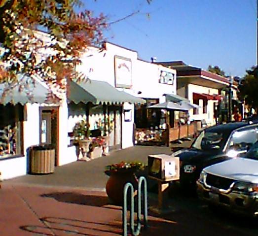
Cotati (/koʊˈtɑːtiː/, /kə-/; Miwok: Kota’ti) is a city in Sonoma County, California, United States, located approximately 45 mi (70 km) north of San Francisco in the 101 corridor between Rohnert Park and Petaluma. Cotati's population as of the 2020 Census was 7,584, making it the least populous incorporated community in Sonoma County.
Like the rest of Sonoma County, Cotati is included in both the San Francisco Bay Area and the North Coast. Located in the Sonoma Coast AVA, Cotati can also be considered part of Wine Country. E & J Gallo Winery operates a 400-acre (160 ha) vineyard called Two Rock Vineyard in the hills west of town. Cotati's hexagonal downtown plaza, one of only two hexagonal town layouts in the United States, is California Historical Landmark number 879. The other U.S. city with a hexagonal layout is Detroit, Michigan.
The Coast Miwok civilization thrived in the Cotati area since at least 2000 BC, with principal villages built near major streams. Documented villages in the area included Lumen-takala (northeast of present-day Cotati), Payinecha (west of present-day Cotati), and Kotati.
In 1827, an Irishman named John Thomas Reed ventured into Miwok territory and built a cabin near Crane Creek. After the natives burned it, he retreated south to Mill Valley.
In July 1844, the Mexican government granted Rancho Cotate (encompassing present-day towns of Cotati, Penngrove and Rohnert Park, and home to Coast Miwok people) to Captain Juan Castaneda, a Mexican military commander from Texas, in payment for his service as a soldier under General Vallejo. The grant took its name from the Coast Miwok village of Kotati. However, a legend arose that Rancho Cotate was named after a Pomo chief named Cotati, and in 1973 the state perpetuated this legend on the historical marker it placed in the plaza.
Rancho Cotate consisted of 17,238.6 acres (6,976.2 ha). Captain Castaneda moved to San Francisco and never developed Rancho Cotate. Because he failed to fulfill the legal requirements of the grant, he lost control of the rancho, which passed to Thomas Larkin and then to Joseph Ruckle. In 1849, Ruckle sold the land to Dr. Thomas Stokes Page, a former resident of Valparaíso, Chile, for $1,600. Rancho Cotate was recorded in California state records as follows:
Cotate #65, Sonoma Co., Grant of 4 sq. leagues made in 1844 by Gov. Micheltorena to Juan Casteneda. Confirmed in 1846. Patent for 17,238 acres (6,976 ha) issued in 1858 to Thos. S. Page. In T 5-6N, R 7-8W, MDM.
— California Ranchos: Patented Private Land Grants Listed by County, Shumway 1988:107.
Cotati, California
Cotati (/koʊˈtɑːtiː/, /kə-/; Miwok: Kota’ti) is a city in Sonoma County, California, United States, located approximately 45 mi (70 km) north of San Francisco in the 101 corridor between Rohnert Park and Petaluma. Cotati's population as of the 2020 Census was 7,584, making it the least populous incorporated community in Sonoma County.
Like the rest of Sonoma County, Cotati is included in both the San Francisco Bay Area and the North Coast. Located in the Sonoma Coast AVA, Cotati can also be considered part of Wine Country. E & J Gallo Winery operates a 400-acre (160 ha) vineyard called Two Rock Vineyard in the hills west of town. Cotati's hexagonal downtown plaza, one of only two hexagonal town layouts in the United States, is California Historical Landmark number 879. The other U.S. city with a hexagonal layout is Detroit, Michigan.
The Coast Miwok civilization thrived in the Cotati area since at least 2000 BC, with principal villages built near major streams. Documented villages in the area included Lumen-takala (northeast of present-day Cotati), Payinecha (west of present-day Cotati), and Kotati.
In 1827, an Irishman named John Thomas Reed ventured into Miwok territory and built a cabin near Crane Creek. After the natives burned it, he retreated south to Mill Valley.
In July 1844, the Mexican government granted Rancho Cotate (encompassing present-day towns of Cotati, Penngrove and Rohnert Park, and home to Coast Miwok people) to Captain Juan Castaneda, a Mexican military commander from Texas, in payment for his service as a soldier under General Vallejo. The grant took its name from the Coast Miwok village of Kotati. However, a legend arose that Rancho Cotate was named after a Pomo chief named Cotati, and in 1973 the state perpetuated this legend on the historical marker it placed in the plaza.
Rancho Cotate consisted of 17,238.6 acres (6,976.2 ha). Captain Castaneda moved to San Francisco and never developed Rancho Cotate. Because he failed to fulfill the legal requirements of the grant, he lost control of the rancho, which passed to Thomas Larkin and then to Joseph Ruckle. In 1849, Ruckle sold the land to Dr. Thomas Stokes Page, a former resident of Valparaíso, Chile, for $1,600. Rancho Cotate was recorded in California state records as follows:
Cotate #65, Sonoma Co., Grant of 4 sq. leagues made in 1844 by Gov. Micheltorena to Juan Casteneda. Confirmed in 1846. Patent for 17,238 acres (6,976 ha) issued in 1858 to Thos. S. Page. In T 5-6N, R 7-8W, MDM.
— California Ranchos: Patented Private Land Grants Listed by County, Shumway 1988:107.
Recent media
Recent media