Recent from talks
Damodar River
Knowledge base stats:
Talk channels stats:
Members stats:
Damodar River
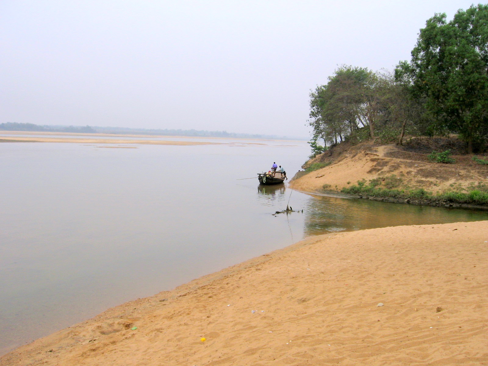
Damodar River (Pron: /ˈdʌmoˌdaː/) is a river flowing across the Indian states of Jharkhand and West Bengal. The valley is rich in mineral resources and is known for large-scale mining and industrial activity. It was also known as the Sorrow of Bengal because of the ravaging floods it caused in the plains of West Bengal. The construction of several dams on the Damodar and its tributaries has helped control some of the flooding.
Damodar means "rope around the belly", derived from Sanskrit दाम (dama) "rope" and उदर (udara) "belly". Damodar is also another name given to the Hindu god Krishna because his foster-mother, Yashoda, had tied him to a large urn.
The Damodar is a rain-fed river. It originates in Khamarpat Hill on Chotanagpur Plateau in Jharkhand. It travels 368 miles (592 km) before joining the Hooghly River in Howrah, in West Bengal.
Damodar River has a number of tributaries and subtributaries, such as Barakar, Konar, Bokaro, Haharo, Jamunia, Ghari, Guaia, Khadia and Bhera. The Damodar and the Barakar trifurcate the Chota Nagpur plateau. The rivers pass through hilly areas with great force, sweeping away whatever lies in their path. Two bridges on the Grand Trunk Road near Barhi in Hazaribagh district were torn down by the Barakar: the great stone bridge in 1913 and the subsequent iron bridge in 1946.
The Chota Nagpur Plateau receives an average annual rainfall of around 1,400 mm (55 in), almost all of it in the monsoon months between June and August. The huge volume of water that flows down the Damodar and its tributaries during the monsoons used to be a fury in the upper reaches of the valley. In the lower valley it used to overflow its banks and flood large areas.
Damodar River was earlier known as the "River of Sorrows" as it used to flood many areas of Bardhaman, Hooghly, Howrah and Medinipur districts.
The floods were virtually an annual ritual. In some years the damage was probably more. Many of the great floods of the Damodar are recorded in history — 1770, 1855, 1866, 1873–74, 1875–76, 1884–85, 1891–92, 1897, 1900, 1907, 1913, 1927, 1930, 1935 and 1943. In four of these floods (1770, 1855, 1913 and 1943) most of Bardhaman town was flooded.
In 1789 an agreement was signed between Maharaja Kirti Chand of Burdwan and the East India Company wherein the Maharaja was asked to pay an additional amount of ₹193,721 (equivalent to ₹110 million, US$1.4 million or £1.0 million in 2023) for the construction and maintenance of embankment to prevent floods. However, these ran into dispute and in 1866 and 1873, The Bengal Embankment Act was passed, transferring the powers to build and maintain embankment to the government.
Hub AI
Damodar River AI simulator
(@Damodar River_simulator)
Damodar River
Damodar River (Pron: /ˈdʌmoˌdaː/) is a river flowing across the Indian states of Jharkhand and West Bengal. The valley is rich in mineral resources and is known for large-scale mining and industrial activity. It was also known as the Sorrow of Bengal because of the ravaging floods it caused in the plains of West Bengal. The construction of several dams on the Damodar and its tributaries has helped control some of the flooding.
Damodar means "rope around the belly", derived from Sanskrit दाम (dama) "rope" and उदर (udara) "belly". Damodar is also another name given to the Hindu god Krishna because his foster-mother, Yashoda, had tied him to a large urn.
The Damodar is a rain-fed river. It originates in Khamarpat Hill on Chotanagpur Plateau in Jharkhand. It travels 368 miles (592 km) before joining the Hooghly River in Howrah, in West Bengal.
Damodar River has a number of tributaries and subtributaries, such as Barakar, Konar, Bokaro, Haharo, Jamunia, Ghari, Guaia, Khadia and Bhera. The Damodar and the Barakar trifurcate the Chota Nagpur plateau. The rivers pass through hilly areas with great force, sweeping away whatever lies in their path. Two bridges on the Grand Trunk Road near Barhi in Hazaribagh district were torn down by the Barakar: the great stone bridge in 1913 and the subsequent iron bridge in 1946.
The Chota Nagpur Plateau receives an average annual rainfall of around 1,400 mm (55 in), almost all of it in the monsoon months between June and August. The huge volume of water that flows down the Damodar and its tributaries during the monsoons used to be a fury in the upper reaches of the valley. In the lower valley it used to overflow its banks and flood large areas.
Damodar River was earlier known as the "River of Sorrows" as it used to flood many areas of Bardhaman, Hooghly, Howrah and Medinipur districts.
The floods were virtually an annual ritual. In some years the damage was probably more. Many of the great floods of the Damodar are recorded in history — 1770, 1855, 1866, 1873–74, 1875–76, 1884–85, 1891–92, 1897, 1900, 1907, 1913, 1927, 1930, 1935 and 1943. In four of these floods (1770, 1855, 1913 and 1943) most of Bardhaman town was flooded.
In 1789 an agreement was signed between Maharaja Kirti Chand of Burdwan and the East India Company wherein the Maharaja was asked to pay an additional amount of ₹193,721 (equivalent to ₹110 million, US$1.4 million or £1.0 million in 2023) for the construction and maintenance of embankment to prevent floods. However, these ran into dispute and in 1866 and 1873, The Bengal Embankment Act was passed, transferring the powers to build and maintain embankment to the government.
Recent media