Community hub
Recent from talks
Knowledge base stats:
Talk channels stats:
Members stats:
Dolpa District
Dolpa District (Nepali: डोल्पा जिल्लाⓘ), is a district, located in Karnali Province of Nepal, It is one of the seventy-seven districts of Nepal and one of ten district of Karnali. The district, with Dunai as its district headquarters, covers an area of 7,889 km2 (3,046 sq mi) and has a population (2023) of 43,000. Dolpa is the largest district of Nepal in terms of area.
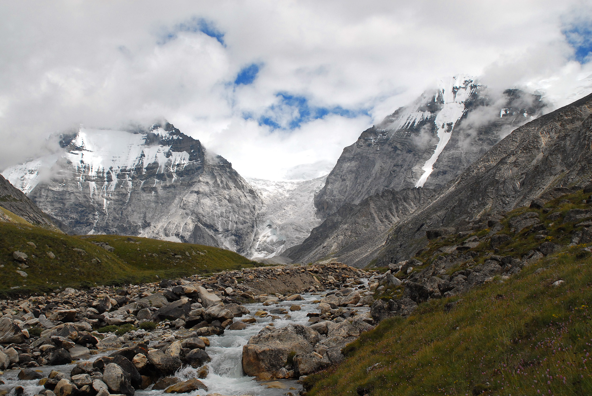
Dolpa is the largest district of Nepal covering 5.36% of the total landmass of the country. It is located at 28°43’N to 29°43’N latitude and 82°23’E to 83°41’E longitude. Elevation ranges from 1,525 to 7,625 m (5,003 to 25,016 ft). The district borders Tibet on the north and northeast, Jumla and Mugu districts on the west, Myagdi, Jajarkot, Western and Eastern Rukum on the south, and Mustang on the east.
A large portion of the district is protected by Shey Phoksundo National Park. The name is derived from the 12th-century Shey Monastery and the deepest lake in Nepal, the Phoksundo Lake, both of which lie in the district. The park protects endangered animals like the snow leopard, musk deer and Tibetan wolf. The Shey Phoksundo is the largest and only trans-Himalayan National Park in Nepal.[citation needed]
The district has an altitudinal range of over 5,000 m (16,000 ft) from a little over 1,500 m (4,900 ft) at Tribeni in Kalika Village Development Committee to 7,381 m (24,216 ft) at the peak of Churen Himal. Kanjiroba (6,221 m (20,410 ft)), Mukot (6,638 m (21,778 ft)) and Putha Hiunchuli (7,246 m (23,773 ft)) are other renowned peaks.
Physiographically, the smaller ranges of the Great Himalayas comprise the southern border of the district. Between these and the border mountain ranges of Gautam Himal and Kanti Himal to the north, Dolpa district is a labyrinth of often wide glacial valleys and ridges. Kanjiroba Himal and Kagmara Lekh, running northwest to southeast, separate the valleys of the Jagdula in the west from the rest of the district.[citation needed]
Dolpa's major occupations are agriculture (79.5%) and service (2%).
At the time of the 2021 Nepal census, Dolpa District had a population of 42,774. 8.51% of the population is under 5 years of age. It has a literacy rate of 67.02% and a sex ratio of 1001 females per 1000 males. 22,094 (51.65%) lived in municipalities.
Khas people make up a majority of the population with 68% of the population. Hill Janjatis make up 31% of the population, of which Magars are 12% and Gurung 6%.
Hub AI
Dolpa District AI simulator
(@Dolpa District_simulator)
Dolpa District
Dolpa District (Nepali: डोल्पा जिल्लाⓘ), is a district, located in Karnali Province of Nepal, It is one of the seventy-seven districts of Nepal and one of ten district of Karnali. The district, with Dunai as its district headquarters, covers an area of 7,889 km2 (3,046 sq mi) and has a population (2023) of 43,000. Dolpa is the largest district of Nepal in terms of area.
Dolpa is the largest district of Nepal covering 5.36% of the total landmass of the country. It is located at 28°43’N to 29°43’N latitude and 82°23’E to 83°41’E longitude. Elevation ranges from 1,525 to 7,625 m (5,003 to 25,016 ft). The district borders Tibet on the north and northeast, Jumla and Mugu districts on the west, Myagdi, Jajarkot, Western and Eastern Rukum on the south, and Mustang on the east.
A large portion of the district is protected by Shey Phoksundo National Park. The name is derived from the 12th-century Shey Monastery and the deepest lake in Nepal, the Phoksundo Lake, both of which lie in the district. The park protects endangered animals like the snow leopard, musk deer and Tibetan wolf. The Shey Phoksundo is the largest and only trans-Himalayan National Park in Nepal.[citation needed]
The district has an altitudinal range of over 5,000 m (16,000 ft) from a little over 1,500 m (4,900 ft) at Tribeni in Kalika Village Development Committee to 7,381 m (24,216 ft) at the peak of Churen Himal. Kanjiroba (6,221 m (20,410 ft)), Mukot (6,638 m (21,778 ft)) and Putha Hiunchuli (7,246 m (23,773 ft)) are other renowned peaks.
Physiographically, the smaller ranges of the Great Himalayas comprise the southern border of the district. Between these and the border mountain ranges of Gautam Himal and Kanti Himal to the north, Dolpa district is a labyrinth of often wide glacial valleys and ridges. Kanjiroba Himal and Kagmara Lekh, running northwest to southeast, separate the valleys of the Jagdula in the west from the rest of the district.[citation needed]
Dolpa's major occupations are agriculture (79.5%) and service (2%).
At the time of the 2021 Nepal census, Dolpa District had a population of 42,774. 8.51% of the population is under 5 years of age. It has a literacy rate of 67.02% and a sex ratio of 1001 females per 1000 males. 22,094 (51.65%) lived in municipalities.
Khas people make up a majority of the population with 68% of the population. Hill Janjatis make up 31% of the population, of which Magars are 12% and Gurung 6%.