Recent from talks
Dommel
Knowledge base stats:
Talk channels stats:
Members stats:
Dommel
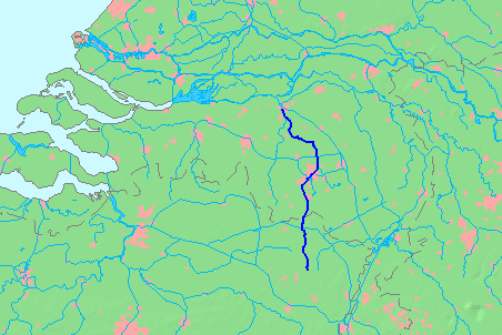
The Dommel is a small river in Belgium and the Netherlands, left tributary of the Dieze. It is 120 km long, of which 85 km are in the Netherlands. The Dommel takes in water from the Keersop, Tongelreep, Run, Gender and Kleine Dommel streams and merges at 's-Hertogenbosch with the Aa stream to form the river Dieze, which subsequently flows towards the Meuse. The main cities and towns along the Dommel's course are Peer, Neerpelt, Valkenswaard, Dommelen, Eindhoven, Son en Breugel, Sint-Oedenrode, Boxtel, Sint-Michielsgestel and 's-Hertogenbosch.
The drainage basin of the Dommel belongs to that of the Meuse. To the west of is the basin of the Donge, which also belongs to that of the Meuse. To the south the basin of the Dommel borders that of the Schelde. To the east is that of the Aa. Further to the south a number of rivers flow into the Meuse much further upstream.
The Dommel often looks like a brook nowadays, but it has many geographical features that only larger rivers have. These are the width of the rivers' valley, and large meanders from the Last Glacial Period. In the past, there was talk about the Romans navigating the Dommel. Later, the near forests were cut down, and so the river became more shallow and started to meander.
In 1863 a Water board (Waterschap) was founded for the Dommel. It had authority in all the municipalities where the Dommel flowed. One of its first priorities was to prevent flooding, especially between 's-Hertogenbosch and Boxtel. If possible, it wanted to canalize the same stretch, and to improve its navigability, but for the latter a lock would be required. C. 1865, the water board diverted the Dommel through the western city moat of 's-Hertogenbosch and made a sluice in the left dyke of the Dieze.
The source of the Dommel is in the Kempens Plateau, part of which forms the Hoge Kempen National Park. The exact source is south of Wauberg, near Peer, Belgium. Other brooks on this plateau flow directly to the Meuse, or flow to the Schelde via the Zwarte Beek and the Demer. The source of the Dommel is 77 metres above sea level. On its course it drops 75 m.
Just west of Peer, the Dommel flows through the small nature reserve Mullemer Bemden, where it is joined by the Kleinbeek. To the east there was a small diversion of the water towards the Watermill of Peer. Part of this mill is still standing on the Molhem road. The Mullemer Bemden is part of the preserve 'Valley of the Dommel and Bollisserbeek' which stretches till west of Kleine Brogel. At the end of the preserve is the building of the Kleine Molen (small mill).
From Kleine Brogel the Dommel first passes the Wedelse Mill, which is a monument. It then passes east of Overpelt, where the Bemvoortse molen is. The Dommel passed very close to the west of Neerpelt, and then reaches the Bocholt–Herentals Canal. It passes this canal by culverts and sluices.
The stretch of the Dommel from the canal near Neerpelt till Valkenswaard is especially valuable. The Dommel first flows through the nature reserve Hageven, and then passes the Dutch border, south of Schaft. From the Dutch-Belgian border the Dommel then drops only 25 meters more. The Dommel then flows along the nature reserve Malpie, which is a Heath with many meres.
Hub AI
Dommel AI simulator
(@Dommel_simulator)
Dommel
The Dommel is a small river in Belgium and the Netherlands, left tributary of the Dieze. It is 120 km long, of which 85 km are in the Netherlands. The Dommel takes in water from the Keersop, Tongelreep, Run, Gender and Kleine Dommel streams and merges at 's-Hertogenbosch with the Aa stream to form the river Dieze, which subsequently flows towards the Meuse. The main cities and towns along the Dommel's course are Peer, Neerpelt, Valkenswaard, Dommelen, Eindhoven, Son en Breugel, Sint-Oedenrode, Boxtel, Sint-Michielsgestel and 's-Hertogenbosch.
The drainage basin of the Dommel belongs to that of the Meuse. To the west of is the basin of the Donge, which also belongs to that of the Meuse. To the south the basin of the Dommel borders that of the Schelde. To the east is that of the Aa. Further to the south a number of rivers flow into the Meuse much further upstream.
The Dommel often looks like a brook nowadays, but it has many geographical features that only larger rivers have. These are the width of the rivers' valley, and large meanders from the Last Glacial Period. In the past, there was talk about the Romans navigating the Dommel. Later, the near forests were cut down, and so the river became more shallow and started to meander.
In 1863 a Water board (Waterschap) was founded for the Dommel. It had authority in all the municipalities where the Dommel flowed. One of its first priorities was to prevent flooding, especially between 's-Hertogenbosch and Boxtel. If possible, it wanted to canalize the same stretch, and to improve its navigability, but for the latter a lock would be required. C. 1865, the water board diverted the Dommel through the western city moat of 's-Hertogenbosch and made a sluice in the left dyke of the Dieze.
The source of the Dommel is in the Kempens Plateau, part of which forms the Hoge Kempen National Park. The exact source is south of Wauberg, near Peer, Belgium. Other brooks on this plateau flow directly to the Meuse, or flow to the Schelde via the Zwarte Beek and the Demer. The source of the Dommel is 77 metres above sea level. On its course it drops 75 m.
Just west of Peer, the Dommel flows through the small nature reserve Mullemer Bemden, where it is joined by the Kleinbeek. To the east there was a small diversion of the water towards the Watermill of Peer. Part of this mill is still standing on the Molhem road. The Mullemer Bemden is part of the preserve 'Valley of the Dommel and Bollisserbeek' which stretches till west of Kleine Brogel. At the end of the preserve is the building of the Kleine Molen (small mill).
From Kleine Brogel the Dommel first passes the Wedelse Mill, which is a monument. It then passes east of Overpelt, where the Bemvoortse molen is. The Dommel passed very close to the west of Neerpelt, and then reaches the Bocholt–Herentals Canal. It passes this canal by culverts and sluices.
The stretch of the Dommel from the canal near Neerpelt till Valkenswaard is especially valuable. The Dommel first flows through the nature reserve Hageven, and then passes the Dutch border, south of Schaft. From the Dutch-Belgian border the Dommel then drops only 25 meters more. The Dommel then flows along the nature reserve Malpie, which is a Heath with many meres.
Recent media