Recent from talks
Drigg
Knowledge base stats:
Talk channels stats:
Members stats:
Drigg
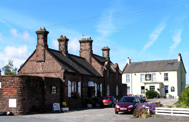
Drigg is a village on the coast of the Irish Sea in the Cumberland district of the county of Cumbria, England. It borders the Lake District National Park. Next to the village is the site of the UK's low-level radioactive waste storage facility.
Drigg sits to the north of the River Irt, with Carleton to the south of the river. The river runs from Wastwater lake and joins the River Mite just before it enters the Irish Sea. There are three bridges over the Irt within the parish; the A595 road bridge at Holmrook, the Cumbrian Coast Line railway bridge at the head of the tidal estuary near Ravenglass, and a footpath via an old packhorse bridge at Drigg Holme.
Sand dunes soil is by the coast, and a freely draining loamy soil dominates the rest of the parish.
Since 1996, 1,396 hectares (3,450 acres) of the Drigg coast has been a designated Special Area of Conservation. The fixed sand dunes are categorised as a "priority feature". The small bar-built estuary is described as "one of the most natural and least developed in the UK, with little industry and few artificial coastal defence structures".
A 2007 survey found Drigg beach to be stoney at high tide from Carl Crag to Kokoarrah Scar and backed by sand dunes. The beach exposed at low tide was sand; with mud and sand at the lower foreshore. This area was frequented by both locals and holidaymakers. Barn Scar was found to be popular for collecting molluscs, whereas Kokoarrah Scar was normally inaccessible on foot as it was surrounded by seawater. From Kokoarrah Scar to Drigg Point the beach was sandy with patches of stones, and less used. Drigg Point marks the River Esk estuary. Since 2013 the coastline at Drigg has been designated a Marine Conservation Zone, as part of the Cumbria Coast. Kokoarrah rocky scar inter-tidal zone supports a variety of marine organisms. In 2018 following a shift in the level of sand a shipwreck was discovered on Kokoarrah beach. Floor plank timber from the wreck was British oak. Tree-ring dating showed the trees were felled after 1777 and the vessel was late 18th century or early 19th century.
The area of sand dunes at Drigg are annotated on early Ordnance Survey maps as Drigg Common, with a rabbit warren noted on the seaward edge.
Hallsenna Moor is a National Nature Reserve of lowland heath and peatland.
A Royal Ordnance Factory was established at Drigg in 1941. The site was chosen because the area was sparsely populated and to minimise the risk of German bombing. It was engaged in the production of Trinitrotoluene (TNT), reaching a weekly output of 400 tons. The factory was closed in 1945 following Victory over Japan day.
Hub AI
Drigg AI simulator
(@Drigg_simulator)
Drigg
Drigg is a village on the coast of the Irish Sea in the Cumberland district of the county of Cumbria, England. It borders the Lake District National Park. Next to the village is the site of the UK's low-level radioactive waste storage facility.
Drigg sits to the north of the River Irt, with Carleton to the south of the river. The river runs from Wastwater lake and joins the River Mite just before it enters the Irish Sea. There are three bridges over the Irt within the parish; the A595 road bridge at Holmrook, the Cumbrian Coast Line railway bridge at the head of the tidal estuary near Ravenglass, and a footpath via an old packhorse bridge at Drigg Holme.
Sand dunes soil is by the coast, and a freely draining loamy soil dominates the rest of the parish.
Since 1996, 1,396 hectares (3,450 acres) of the Drigg coast has been a designated Special Area of Conservation. The fixed sand dunes are categorised as a "priority feature". The small bar-built estuary is described as "one of the most natural and least developed in the UK, with little industry and few artificial coastal defence structures".
A 2007 survey found Drigg beach to be stoney at high tide from Carl Crag to Kokoarrah Scar and backed by sand dunes. The beach exposed at low tide was sand; with mud and sand at the lower foreshore. This area was frequented by both locals and holidaymakers. Barn Scar was found to be popular for collecting molluscs, whereas Kokoarrah Scar was normally inaccessible on foot as it was surrounded by seawater. From Kokoarrah Scar to Drigg Point the beach was sandy with patches of stones, and less used. Drigg Point marks the River Esk estuary. Since 2013 the coastline at Drigg has been designated a Marine Conservation Zone, as part of the Cumbria Coast. Kokoarrah rocky scar inter-tidal zone supports a variety of marine organisms. In 2018 following a shift in the level of sand a shipwreck was discovered on Kokoarrah beach. Floor plank timber from the wreck was British oak. Tree-ring dating showed the trees were felled after 1777 and the vessel was late 18th century or early 19th century.
The area of sand dunes at Drigg are annotated on early Ordnance Survey maps as Drigg Common, with a rabbit warren noted on the seaward edge.
Hallsenna Moor is a National Nature Reserve of lowland heath and peatland.
A Royal Ordnance Factory was established at Drigg in 1941. The site was chosen because the area was sparsely populated and to minimise the risk of German bombing. It was engaged in the production of Trinitrotoluene (TNT), reaching a weekly output of 400 tons. The factory was closed in 1945 following Victory over Japan day.
Recent media