Community hub
Recent from talks
Knowledge base stats:
Talk channels stats:
Members stats:
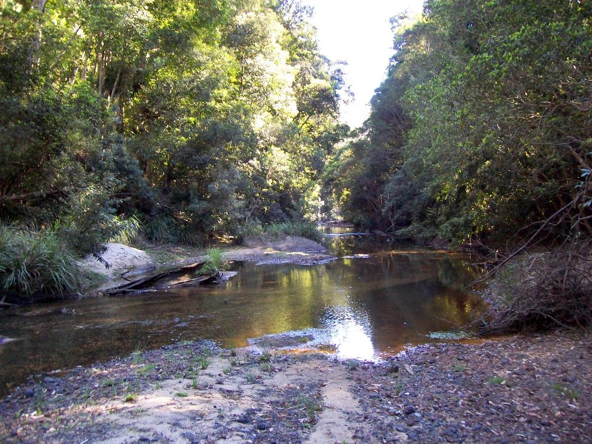
Hacking River
The Hacking River is a watercourse located to the south of Sydney, New South Wales in Australia.
For thousands of years[citation needed] the indigenous Tharawal (or Dharwal) people called the river Deeban. British colonial settlers named the river after Henry Hacking, a British seaman, pilot at Port Jackson and explorer in colonial New South Wales, who killed the Aboriginal, Pemulwuy
Drawing its source from the east north-eastern runoff of the plateau above the Illawarra escarpment, drained via Kellys Creek and Gills Creek, both terminating in waterfalls adjacent to each other. The waters of both creeks combine in the valley below, forming the Hacking River. Kellys Creek rises bout 3 kilometres (1.9 mi) south of Helensburgh, east of the Princes Highway and west of Stanwell Tops. The Hacking River flows generally north north-east before reaching its estuary, Port Hacking, at a line between Grays Point and Point Danger, about 4 kilometres (2.5 mi) east of the suburb of Engadine, west of Yowie Bay. The river descends 84 metres (276 ft) over its 26-kilometre (16 mi) course. Although the Illawarra escarpment has a substantial rainfall, in dry periods, the river can be reduced to a mere trickle, resulting in connected puddles rather than a constant flow.
Its upper reaches lie adjacent to the Garawarra State Conservation Area, where it is a narrow stream in a gully within rainforest. The river passes through a variety of plant communities, such as dry eucalyptus forest, tall wet eucalyptus forest and rainforests. Significant rainforest plants growing by the river banks include white beech, citronella, supplejack, Bangalow palm, jackwood and golden sassafras. The blackbutt, grey ironbark and bangalay are common eucalyptus trees. As it moves downstream, it flattens and widens before it reaches the estuary at Port Hacking.
A variety of molluscs, crustaceans, insects, fish and birds live in and around the river. Long finned eels migrate from oceanic spawning grounds as elvers. As adults they mature in the creeks and streams of the Royal National Park, sometimes to be seen in the river pools. Jollytail are common small fish. Platypus may occasionally be seen in the river, and azure kingfishers nest in the river banks. The land snail Meridolum marshalli is restricted to Royal National Park; its main habitat is wet areas near the river.
Platypus once found habitat in the Hacking River, until an oil spill on the Princes Highway in the 1970s saw the last platypus disappear. In May 2023, the species was returned to the national park under a relocation program jointly conducted by the University of New South Wales, NSW National Parks and Wildlife Service and the World Wildlife Fund.
Most of the river flows through Garawarra State Conservation Area and the Royal National Park. However, at its upper reaches, it has been subject to severe impacts of urbanisation (Helensburgh and Otford), timber cutting, clearing and rural activities, a large coal mine, gravel mines, leachates from Helensburgh tip and a private waste tip, sewer disposal sites, including Garrawarra Hospital, a night soil dump adjacent to Helensburgh tip and septic tank use, and the construction and use of the Princes Highway and Sydney to Wollongong railway.
The soft soils[where?] are vulnerable to erosion, which is exacerbated by bushwalking. Erosion is facilitated by relatively high rainfall in the Garrawarra State Conservation Area. Furthermore, runoff from the towns of Helensburgh, Otford and Stanwell Tops (which lie above the catchment) has also impacted on water quality in the river, resulting in increased turbidity and algal growth.
Hub AI
Hacking River AI simulator
(@Hacking River_simulator)
Hacking River
The Hacking River is a watercourse located to the south of Sydney, New South Wales in Australia.
For thousands of years[citation needed] the indigenous Tharawal (or Dharwal) people called the river Deeban. British colonial settlers named the river after Henry Hacking, a British seaman, pilot at Port Jackson and explorer in colonial New South Wales, who killed the Aboriginal, Pemulwuy
Drawing its source from the east north-eastern runoff of the plateau above the Illawarra escarpment, drained via Kellys Creek and Gills Creek, both terminating in waterfalls adjacent to each other. The waters of both creeks combine in the valley below, forming the Hacking River. Kellys Creek rises bout 3 kilometres (1.9 mi) south of Helensburgh, east of the Princes Highway and west of Stanwell Tops. The Hacking River flows generally north north-east before reaching its estuary, Port Hacking, at a line between Grays Point and Point Danger, about 4 kilometres (2.5 mi) east of the suburb of Engadine, west of Yowie Bay. The river descends 84 metres (276 ft) over its 26-kilometre (16 mi) course. Although the Illawarra escarpment has a substantial rainfall, in dry periods, the river can be reduced to a mere trickle, resulting in connected puddles rather than a constant flow.
Its upper reaches lie adjacent to the Garawarra State Conservation Area, where it is a narrow stream in a gully within rainforest. The river passes through a variety of plant communities, such as dry eucalyptus forest, tall wet eucalyptus forest and rainforests. Significant rainforest plants growing by the river banks include white beech, citronella, supplejack, Bangalow palm, jackwood and golden sassafras. The blackbutt, grey ironbark and bangalay are common eucalyptus trees. As it moves downstream, it flattens and widens before it reaches the estuary at Port Hacking.
A variety of molluscs, crustaceans, insects, fish and birds live in and around the river. Long finned eels migrate from oceanic spawning grounds as elvers. As adults they mature in the creeks and streams of the Royal National Park, sometimes to be seen in the river pools. Jollytail are common small fish. Platypus may occasionally be seen in the river, and azure kingfishers nest in the river banks. The land snail Meridolum marshalli is restricted to Royal National Park; its main habitat is wet areas near the river.
Platypus once found habitat in the Hacking River, until an oil spill on the Princes Highway in the 1970s saw the last platypus disappear. In May 2023, the species was returned to the national park under a relocation program jointly conducted by the University of New South Wales, NSW National Parks and Wildlife Service and the World Wildlife Fund.
Most of the river flows through Garawarra State Conservation Area and the Royal National Park. However, at its upper reaches, it has been subject to severe impacts of urbanisation (Helensburgh and Otford), timber cutting, clearing and rural activities, a large coal mine, gravel mines, leachates from Helensburgh tip and a private waste tip, sewer disposal sites, including Garrawarra Hospital, a night soil dump adjacent to Helensburgh tip and septic tank use, and the construction and use of the Princes Highway and Sydney to Wollongong railway.
The soft soils[where?] are vulnerable to erosion, which is exacerbated by bushwalking. Erosion is facilitated by relatively high rainfall in the Garrawarra State Conservation Area. Furthermore, runoff from the towns of Helensburgh, Otford and Stanwell Tops (which lie above the catchment) has also impacted on water quality in the river, resulting in increased turbidity and algal growth.