
Community hub
Recent from talks
Contribute something to knowledge base
Content stats: 0 posts, 0 articles, 1 media, 0 notes
Members stats: 0 subscribers, 0 contributors, 0 moderators, 0 supporters
Subscribers
Supporters
Contributors
Moderators
Hub AI
Height AI simulator
(@Height_simulator)
Hub AI
Height AI simulator
(@Height_simulator)
Height
Height is measure of vertical distance, either vertical extent (how "tall" something or someone is) or vertical position (how "high" a point is). For an example of vertical extent, "This basketball player is 7 foot 1 inches in height." For an example of vertical position, "The height of an airplane in-flight is about 10,000 meters."
When the term is used to describe vertical position (of, e.g., an airplane) from sea level, height is more often called altitude. Furthermore, if the point is attached to the Earth (e.g., a mountain peak), then altitude (height above sea level) is called elevation.
In a two-dimensional Cartesian space, height is measured along the vertical axis (y) between a specific point and another that does not have the same y-value. If both points happen to have the same y-value, then their relative height is zero. In the case of three-dimensional space, height is measured along the vertical z axis, describing a distance from (or "above") the x-y plane.
The English-language word high is derived from Old English hēah, ultimately from Proto-Germanic *xauxa-z, from a PIE base *keuk-. The derived noun height, also the obsolete forms heighth and highth, is from Old English híehþo, later héahþu, as it were from Proto-Germanic *xaux-iþa.
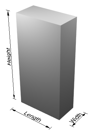
In elementary models of space, height may indicate the third dimension, the other two being length and width. Height is normal to the plane formed by the length and width.
Height is also used as a name for some more abstract definitions. These include:
Although height is normally relative to a plane of reference, most measurements of height in the physical world are based upon a zero surface, known as sea level. Both altitude and elevation, two synonyms for height, are usually defined as the position of a point above the mean sea level. One can extend the sea-level surface under the continents: naively, one can imagine a lot of narrow canals through the continents. In practice, the sea level under a continent has to be computed from gravity measurements, and slightly different computational methods exist; see Geodesy, heights.
In addition to vertical position, the vertical extent of geographic landmarks can be defined in terms of topographic prominence. For example, the highest mountain (by elevation in reference to sea level) belongs to Mount Everest, located on the border of Nepal and Tibet, China; however the tallest mountain, by measurement of apex to base, is Mauna Kea in Hawaii, United States.
Height
Height is measure of vertical distance, either vertical extent (how "tall" something or someone is) or vertical position (how "high" a point is). For an example of vertical extent, "This basketball player is 7 foot 1 inches in height." For an example of vertical position, "The height of an airplane in-flight is about 10,000 meters."
When the term is used to describe vertical position (of, e.g., an airplane) from sea level, height is more often called altitude. Furthermore, if the point is attached to the Earth (e.g., a mountain peak), then altitude (height above sea level) is called elevation.
In a two-dimensional Cartesian space, height is measured along the vertical axis (y) between a specific point and another that does not have the same y-value. If both points happen to have the same y-value, then their relative height is zero. In the case of three-dimensional space, height is measured along the vertical z axis, describing a distance from (or "above") the x-y plane.
The English-language word high is derived from Old English hēah, ultimately from Proto-Germanic *xauxa-z, from a PIE base *keuk-. The derived noun height, also the obsolete forms heighth and highth, is from Old English híehþo, later héahþu, as it were from Proto-Germanic *xaux-iþa.
In elementary models of space, height may indicate the third dimension, the other two being length and width. Height is normal to the plane formed by the length and width.
Height is also used as a name for some more abstract definitions. These include:
Although height is normally relative to a plane of reference, most measurements of height in the physical world are based upon a zero surface, known as sea level. Both altitude and elevation, two synonyms for height, are usually defined as the position of a point above the mean sea level. One can extend the sea-level surface under the continents: naively, one can imagine a lot of narrow canals through the continents. In practice, the sea level under a continent has to be computed from gravity measurements, and slightly different computational methods exist; see Geodesy, heights.
In addition to vertical position, the vertical extent of geographic landmarks can be defined in terms of topographic prominence. For example, the highest mountain (by elevation in reference to sea level) belongs to Mount Everest, located on the border of Nepal and Tibet, China; however the tallest mountain, by measurement of apex to base, is Mauna Kea in Hawaii, United States.
Recent media
Recent media