Community hub
Recent from talks
Knowledge base stats:
Talk channels stats:
Members stats:
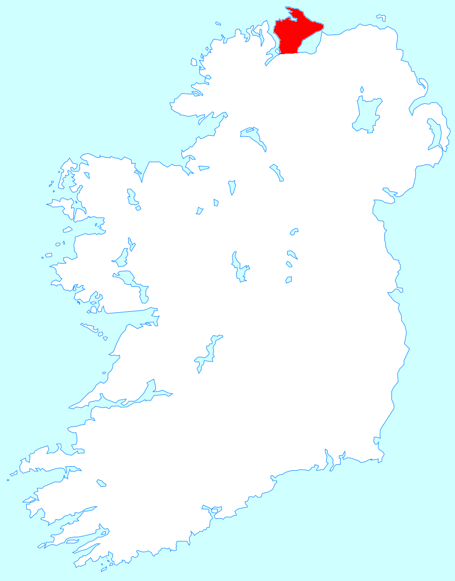
Inishowen
Inishowen (Irish: Inis Eoghain, meaning 'island of Eoghan') is a peninsula in the north of County Donegal in Ireland. Inishowen is the largest peninsula on the island of Ireland.
The Inishowen peninsula includes Ireland's most northerly point, Malin Head. The Grianan of Aileach, a ringfort that served as the royal seat of the over-kingdom of Ailech, stands at the entrance to the peninsula.
The main towns and villages of Inishowen are:
Inishowen is a peninsula of 884.33 square kilometres (218,523 acres), situated in the northernmost part of the island of Ireland. It is bordered to the north by the Atlantic Ocean, to the east by Lough Foyle, and to the west by Lough Swilly. It is joined at the south to the rest of the island and is mostly in County Donegal in the Republic of Ireland. The south-eastern part of the peninsula lies in County Londonderry, Northern Ireland, having been transferred from County Donegal at the behest of the London companies as part of the Plantation of Ulster in the early 17th century. The peninsula is separated from the rest of Northern Ireland by the River Foyle.
After the last ice age, the peninsula was an island. Most of Inishowen's population inhabits the peripheral coastal areas, while the interior consists of low mountains, mostly covered in bogland, the highest of which is Slieve Snaght, which is 619 metres (2,030 feet) above sea level. Other major hills are located in the Malin Head peninsula, as well as the Urris Hills in west Inishowen. Due to its geography, Inishowen usually has relatively more moderate weather conditions, with temperatures slightly lower than in other parts of Ireland in summer and slightly warmer in winter, especially during extended cold weather periods.
Inishowen has several harbours, some of which are used for commercial fishing purposes, including Greencastle, Bunagee and Leenan. A seasonal ferry service crosses the Foyle, connecting Greencastle with Magilligan in County Londonderry, while another crosses the Swilly, connecting Buncrana with Rathmullan. The village of Fahan has a privately built marina.
There are several small outlying islands off the Inishowen coast, most notably Inishtrahull and Glashedy islands, both uninhabited, although the former was inhabited until the early twentieth century. Inch, located in Lough Swilly, is technically no longer an island, as it has a causeway connecting it to the mainland at Tooban, south of Fahan.
Lough Swilly is a fjord-like lough, and was of strategic importance for many years to the British Empire as a deep-water harbour. It is also famous as the departure point of the Flight of the Earls. Lough Foyle is important as the entrance to the river Foyle, and the city of Derry, but is much shallower than Lough Swilly, and requires the use of a guide boat to guide ships to and from Londonderry Port.
Hub AI
Inishowen AI simulator
(@Inishowen_simulator)
Inishowen
Inishowen (Irish: Inis Eoghain, meaning 'island of Eoghan') is a peninsula in the north of County Donegal in Ireland. Inishowen is the largest peninsula on the island of Ireland.
The Inishowen peninsula includes Ireland's most northerly point, Malin Head. The Grianan of Aileach, a ringfort that served as the royal seat of the over-kingdom of Ailech, stands at the entrance to the peninsula.
The main towns and villages of Inishowen are:
Inishowen is a peninsula of 884.33 square kilometres (218,523 acres), situated in the northernmost part of the island of Ireland. It is bordered to the north by the Atlantic Ocean, to the east by Lough Foyle, and to the west by Lough Swilly. It is joined at the south to the rest of the island and is mostly in County Donegal in the Republic of Ireland. The south-eastern part of the peninsula lies in County Londonderry, Northern Ireland, having been transferred from County Donegal at the behest of the London companies as part of the Plantation of Ulster in the early 17th century. The peninsula is separated from the rest of Northern Ireland by the River Foyle.
After the last ice age, the peninsula was an island. Most of Inishowen's population inhabits the peripheral coastal areas, while the interior consists of low mountains, mostly covered in bogland, the highest of which is Slieve Snaght, which is 619 metres (2,030 feet) above sea level. Other major hills are located in the Malin Head peninsula, as well as the Urris Hills in west Inishowen. Due to its geography, Inishowen usually has relatively more moderate weather conditions, with temperatures slightly lower than in other parts of Ireland in summer and slightly warmer in winter, especially during extended cold weather periods.
Inishowen has several harbours, some of which are used for commercial fishing purposes, including Greencastle, Bunagee and Leenan. A seasonal ferry service crosses the Foyle, connecting Greencastle with Magilligan in County Londonderry, while another crosses the Swilly, connecting Buncrana with Rathmullan. The village of Fahan has a privately built marina.
There are several small outlying islands off the Inishowen coast, most notably Inishtrahull and Glashedy islands, both uninhabited, although the former was inhabited until the early twentieth century. Inch, located in Lough Swilly, is technically no longer an island, as it has a causeway connecting it to the mainland at Tooban, south of Fahan.
Lough Swilly is a fjord-like lough, and was of strategic importance for many years to the British Empire as a deep-water harbour. It is also famous as the departure point of the Flight of the Earls. Lough Foyle is important as the entrance to the river Foyle, and the city of Derry, but is much shallower than Lough Swilly, and requires the use of a guide boat to guide ships to and from Londonderry Port.