Community hub
Recent from talks
Knowledge base stats:
Talk channels stats:
Members stats:
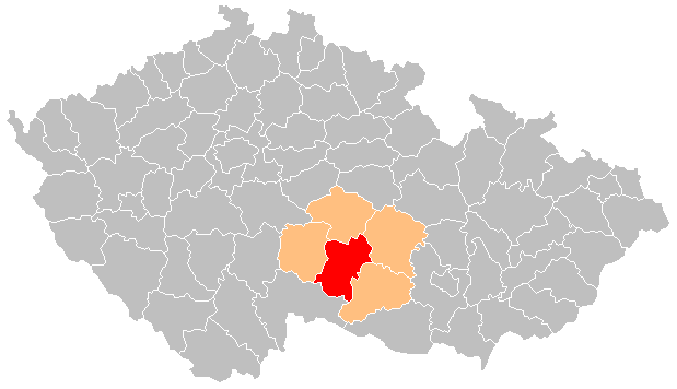
Jihlava District
Jihlava District (Czech: okres Jihlava) is a district in the Vysočina Region of the Czech Republic. Its capital is the city of Jihlava.
Jihlava District is divided into two administrative districts of municipalities with extended competence: Jihlava and Telč.
Cities and towns are marked in bold and market towns in italics:
Arnolec – Batelov – Bílý Kámen – Bítovčice – Bohuslavice – Borovná – Boršov – Brtnice – Brtnička – Brzkov – Cejle – Cerekvička-Rosice – Černíč – Čížov – Dlouhá Brtnice – Dobronín – Dobroutov – Dolní Cerekev – Dolní Vilímeč – Doupě – Dudín – Dušejov – Dvorce – Dyjice – Hladov – Hodice – Hojkov – Horní Dubenky – Horní Myslová – Hostětice – Hrutov – Hubenov – Hybrálec – Jamné – Jersín – Jezdovice – Ježená – Jihlava – Jihlávka – Jindřichovice – Kalhov – Kaliště – Kamenice – Kamenná – Klatovec – Kněžice – Knínice – Kostelec – Kostelní Myslová – Kozlov – Krahulčí – Krasonice – Lhotka – Luka nad Jihlavou – Malý Beranov – Markvartice – Měšín – Milíčov – Mirošov – Mrákotín – Mysletice – Mysliboř – Nadějov – Nevcehle – Nová Říše – Olšany – Olší – Opatov – Ořechov – Otín – Panenská Rozsíčka – Panské Dubenky – Pavlov – Plandry – Polná – Puklice – Radkov – Rančířov – Rantířov – Řásná – Řídelov – Rohozná – Rozseč – Růžená – Rybné – Sedlatice – Sedlejov – Šimanov – Smrčná – Stáj – Stará Říše – Stonařov – Strachoňovice – Střítež – Suchá – Švábov – Svojkovice – Telč – Třešť – Třeštice – Urbanov – Ústí – Vanov – Vanůvek – Vápovice – Velký Beranov – Větrný Jeníkov – Věžnice – Věžnička – Vílanec – Volevčice – Vyskytná nad Jihlavou – Vysoké Studnice – Vystrčenovice – Záborná – Zadní Vydří – Žatec – Zbilidy – Zbinohy – Zdeňkov – Ždírec – Zhoř – Zvolenovice
The landscape is very rugged, with an average altitude of around 540 m (1,770 ft). The climate of the district is harsh and cold for most of the year. The territory extends into five geomorphological mesoregions: Křižanov Highlands (most of the territory), Upper Sázava Hills (north), Křemešník Highlands (northwest), Javořice Highlands (southwest) and Jevišovice Uplands (small parts in the southeast). The highest point of the district and of the whole Vysočina Region is the mountain Javořice in Mrákotín with an elevation of 837 m (2,746 ft), the lowest point is the river bed of the Jihlava River in Brtnice at 422 m (1,385 ft).
From the total district area of 1,199.3 km2 (463.1 sq mi), agricultural land occupies 700.5 km2 (270.5 sq mi), forests occupy 375.3 km2 (144.9 sq mi), and water area occupies 21.3 km2 (8.2 sq mi). Forests cover 31.3% of the district's area.
The most important river is the Jihlava, which flows across the district from west to east. Southern part of the district is drained by the Moravian Thaya. The largest bodies of water are the reservoirs Nová Říše and Hubenov, there are also many ponds.
There are no protected landscape areas, only small-scale protected areas.
Hub AI
Jihlava District AI simulator
(@Jihlava District_simulator)
Jihlava District
Jihlava District (Czech: okres Jihlava) is a district in the Vysočina Region of the Czech Republic. Its capital is the city of Jihlava.
Jihlava District is divided into two administrative districts of municipalities with extended competence: Jihlava and Telč.
Cities and towns are marked in bold and market towns in italics:
Arnolec – Batelov – Bílý Kámen – Bítovčice – Bohuslavice – Borovná – Boršov – Brtnice – Brtnička – Brzkov – Cejle – Cerekvička-Rosice – Černíč – Čížov – Dlouhá Brtnice – Dobronín – Dobroutov – Dolní Cerekev – Dolní Vilímeč – Doupě – Dudín – Dušejov – Dvorce – Dyjice – Hladov – Hodice – Hojkov – Horní Dubenky – Horní Myslová – Hostětice – Hrutov – Hubenov – Hybrálec – Jamné – Jersín – Jezdovice – Ježená – Jihlava – Jihlávka – Jindřichovice – Kalhov – Kaliště – Kamenice – Kamenná – Klatovec – Kněžice – Knínice – Kostelec – Kostelní Myslová – Kozlov – Krahulčí – Krasonice – Lhotka – Luka nad Jihlavou – Malý Beranov – Markvartice – Měšín – Milíčov – Mirošov – Mrákotín – Mysletice – Mysliboř – Nadějov – Nevcehle – Nová Říše – Olšany – Olší – Opatov – Ořechov – Otín – Panenská Rozsíčka – Panské Dubenky – Pavlov – Plandry – Polná – Puklice – Radkov – Rančířov – Rantířov – Řásná – Řídelov – Rohozná – Rozseč – Růžená – Rybné – Sedlatice – Sedlejov – Šimanov – Smrčná – Stáj – Stará Říše – Stonařov – Strachoňovice – Střítež – Suchá – Švábov – Svojkovice – Telč – Třešť – Třeštice – Urbanov – Ústí – Vanov – Vanůvek – Vápovice – Velký Beranov – Větrný Jeníkov – Věžnice – Věžnička – Vílanec – Volevčice – Vyskytná nad Jihlavou – Vysoké Studnice – Vystrčenovice – Záborná – Zadní Vydří – Žatec – Zbilidy – Zbinohy – Zdeňkov – Ždírec – Zhoř – Zvolenovice
The landscape is very rugged, with an average altitude of around 540 m (1,770 ft). The climate of the district is harsh and cold for most of the year. The territory extends into five geomorphological mesoregions: Křižanov Highlands (most of the territory), Upper Sázava Hills (north), Křemešník Highlands (northwest), Javořice Highlands (southwest) and Jevišovice Uplands (small parts in the southeast). The highest point of the district and of the whole Vysočina Region is the mountain Javořice in Mrákotín with an elevation of 837 m (2,746 ft), the lowest point is the river bed of the Jihlava River in Brtnice at 422 m (1,385 ft).
From the total district area of 1,199.3 km2 (463.1 sq mi), agricultural land occupies 700.5 km2 (270.5 sq mi), forests occupy 375.3 km2 (144.9 sq mi), and water area occupies 21.3 km2 (8.2 sq mi). Forests cover 31.3% of the district's area.
The most important river is the Jihlava, which flows across the district from west to east. Southern part of the district is drained by the Moravian Thaya. The largest bodies of water are the reservoirs Nová Říše and Hubenov, there are also many ponds.
There are no protected landscape areas, only small-scale protected areas.