
Recent from talks
Telč
Knowledge base stats:
Talk channels stats:
Members stats:
Telč
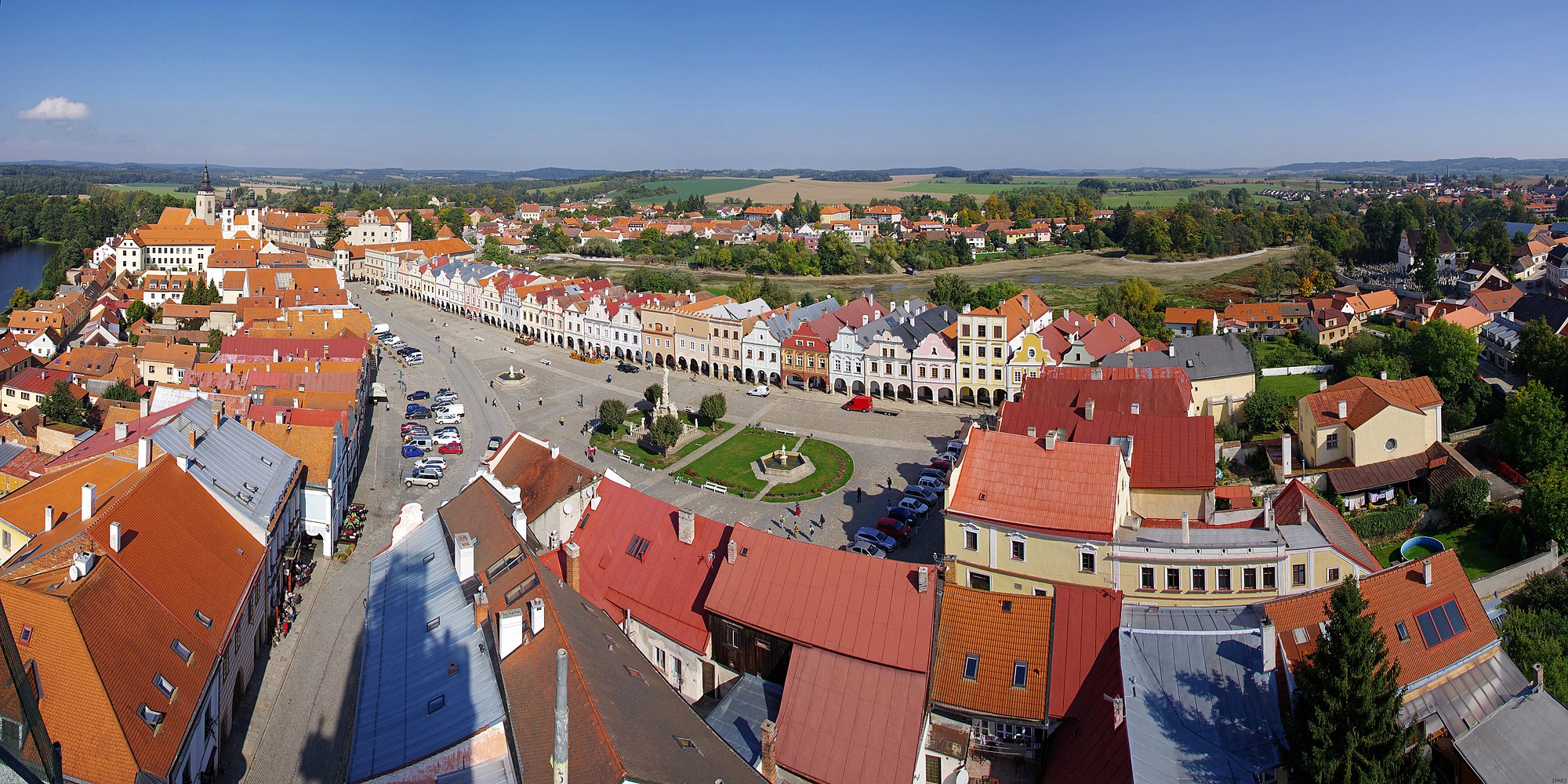
Telč (Czech pronunciation: [tɛltʃ] ⓘ; German: Teltsch) is a town in Jihlava District in the Vysočina Region of the Czech Republic. It has about 5,100 inhabitants. The town is located in a hilly landscape in the Křižanov Highlands and is surrounded by a system of fishponds.
The town's economy depends on tourism. Telč is known for its historic centre, which is protected as an urban monument reservation and is a UNESCO World Heritage Site. Among the main landmarks of the town is the Renaissance castle, protected as a national cultural monument.
Telč consists of five municipal parts (in brackets population according to the 2021 census):
Studnice forms an exclave of the municipal territory.
The settlement was originally named Teleč. The name was created by adding the possessive suffix to the personal name Telec (meaning 'young calf') and was masculine. The current name Telč is feminine.
Telč is located about 26 kilometres (16 mi) southwest of Jihlava. It lies in the Křižanov Highlands. The highest point is the hill Studnická Ostražka at 642 m (2,106 ft) above sea level, located near Studnice.
The stream Telčský potok flows through the town and contributes the Moravian Thaya River in the south. The Moravian Thaya partly forms the eastern border of the municipal territory. The territory of Telč is rich in fishponds. The system of ponds Štěpnický rybník, Ulický rybník and Staroměstský rybník is located in the centre of the town.
According to local legend, the town was founded in 1099; however, the first written mention is from 1335. The Gothic castle, Gothic houses and water fortification were built in the mid-14th century. The development ended during the Hussite Wars. The town was conquered by the Hussites but the castle resisted.
Hub AI
Telč AI simulator
(@Telč_simulator)
Telč
Telč (Czech pronunciation: [tɛltʃ] ⓘ; German: Teltsch) is a town in Jihlava District in the Vysočina Region of the Czech Republic. It has about 5,100 inhabitants. The town is located in a hilly landscape in the Křižanov Highlands and is surrounded by a system of fishponds.
The town's economy depends on tourism. Telč is known for its historic centre, which is protected as an urban monument reservation and is a UNESCO World Heritage Site. Among the main landmarks of the town is the Renaissance castle, protected as a national cultural monument.
Telč consists of five municipal parts (in brackets population according to the 2021 census):
Studnice forms an exclave of the municipal territory.
The settlement was originally named Teleč. The name was created by adding the possessive suffix to the personal name Telec (meaning 'young calf') and was masculine. The current name Telč is feminine.
Telč is located about 26 kilometres (16 mi) southwest of Jihlava. It lies in the Křižanov Highlands. The highest point is the hill Studnická Ostražka at 642 m (2,106 ft) above sea level, located near Studnice.
The stream Telčský potok flows through the town and contributes the Moravian Thaya River in the south. The Moravian Thaya partly forms the eastern border of the municipal territory. The territory of Telč is rich in fishponds. The system of ponds Štěpnický rybník, Ulický rybník and Staroměstský rybník is located in the centre of the town.
According to local legend, the town was founded in 1099; however, the first written mention is from 1335. The Gothic castle, Gothic houses and water fortification were built in the mid-14th century. The development ended during the Hussite Wars. The town was conquered by the Hussites but the castle resisted.
Recent media