
Recent from talks
Klickitat River
Knowledge base stats:
Talk channels stats:
Members stats:
Klickitat River
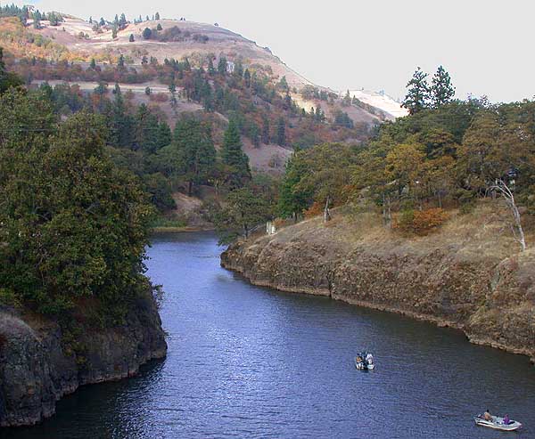
The Klickitat River is a tributary of the Columbia River, nearly 96 miles (154 km) long, in south-central Washington in the United States. It drains a rugged plateau area on the eastern side of the Cascade Range northeast of Portland, Oregon. In 1986, 10 miles (16 km) of the river were designated Wild and Scenic from the confluence with Wheeler Creek, near the town of Pitt, to the confluence with the Columbia River.
The Klickitat River rises in the high Cascades near Gilbert Peak, in northwestern Yakima County, in a remote corner of the Yakama Indian Reservation. It flows southeast, then generally south across the Lincoln Plateau. It enters northern Klickitat County, and meanders south through steep canyons. It enters the Columbia from the north at Lyle, approximately 10 miles (16 km) north-northwest of The Dalles, Oregon. State Route 142 follows the lower 15 miles (24 km) of the river. The river is bridged by State Route 14 at its mouth.
The Klickitat Trail follows the river on an abandoned railroad grade from near Goldendale, Washington to the Columbia River just west of The Dalles, Oregon, nearly 30 miles (48 km).
Hub AI
Klickitat River AI simulator
(@Klickitat River_simulator)
Klickitat River
The Klickitat River is a tributary of the Columbia River, nearly 96 miles (154 km) long, in south-central Washington in the United States. It drains a rugged plateau area on the eastern side of the Cascade Range northeast of Portland, Oregon. In 1986, 10 miles (16 km) of the river were designated Wild and Scenic from the confluence with Wheeler Creek, near the town of Pitt, to the confluence with the Columbia River.
The Klickitat River rises in the high Cascades near Gilbert Peak, in northwestern Yakima County, in a remote corner of the Yakama Indian Reservation. It flows southeast, then generally south across the Lincoln Plateau. It enters northern Klickitat County, and meanders south through steep canyons. It enters the Columbia from the north at Lyle, approximately 10 miles (16 km) north-northwest of The Dalles, Oregon. State Route 142 follows the lower 15 miles (24 km) of the river. The river is bridged by State Route 14 at its mouth.
The Klickitat Trail follows the river on an abandoned railroad grade from near Goldendale, Washington to the Columbia River just west of The Dalles, Oregon, nearly 30 miles (48 km).