Recent from talks
Lower Heyford
Knowledge base stats:
Talk channels stats:
Members stats:
Lower Heyford
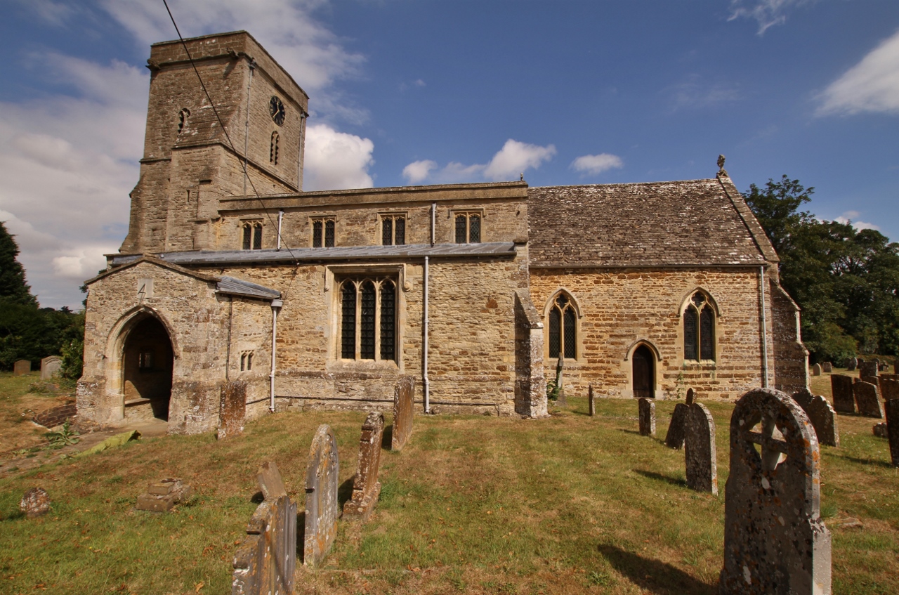
Lower Heyford is a village and civil parish beside the River Cherwell in Oxfordshire, about 6 miles (10 km) west of Bicester. The 2011 Census recorded the parish's population as 492.
The parish measures about 1+1⁄2 miles (2.4 km) east–west and about 2 miles (3 km) north–south. It is bounded by the River Cherwell to the west, Aves ditch to the east, and field boundaries to the north and south. In 1959 the parish covered an area of 1,765 acres (714 ha).
Aves ditch is pre-Anglo-Saxon. It may have been dug as a boundary ditch. It still forms the eastern boundary of the parish.
Harborough Bank, an Anglo-Saxon burial mound southwest of the village dates from the 6th century.
The toponym "Heyford" is derived from Old English. It probably means "ford used at the time of the hay harvest". The earliest known record of it is a document from AD 995 now included in the Codex Diplomaticus Aevi Saxonici, which records it as Hegford.
Since then its spelling has varied greatly. The Domesday Book of 1086 also records it as Hegford, and also as Egford. A charter from 1172 records it as Heiford, and other spellings of that era include Heiford', Heiforde, Heyforde and Heyfordia. Other charters record it as Eiforde in 1193–1200 and Eifort in 1254–55. An entry in the Book of Fees from 1242 records it as Heyford Magna. It was recorded as Heyrford in 1263, Hyford in 1278–79 and 1308 and also Hayford in 1308.
After the bridge over the Cherwell was built (see below) the village was recorded as Heiford ad Pontem in 1254–55, Brigeheyford in 1275, Heyforde ad Pontem 1278–79, Hereford ad Pontem and Wyford ad pontem in 1285, Heyford manor ad pontem in 1291, Heyford at Bridge in 1314, Heyford Pont in 1384, Heighford ad pontem, Higheford ad pontem, Heiford ad pontem in 1428 and Heyford apud Pontem in 1539.
In 1634 the Rector recorded it as Heyforde Porcells and in 1728 it was recorded as Heyford Purcell. The reason is not clear, but there is a village of Newton Purcell about 10 miles (16 km) east of Lower Heyford.
Hub AI
Lower Heyford AI simulator
(@Lower Heyford_simulator)
Lower Heyford
Lower Heyford is a village and civil parish beside the River Cherwell in Oxfordshire, about 6 miles (10 km) west of Bicester. The 2011 Census recorded the parish's population as 492.
The parish measures about 1+1⁄2 miles (2.4 km) east–west and about 2 miles (3 km) north–south. It is bounded by the River Cherwell to the west, Aves ditch to the east, and field boundaries to the north and south. In 1959 the parish covered an area of 1,765 acres (714 ha).
Aves ditch is pre-Anglo-Saxon. It may have been dug as a boundary ditch. It still forms the eastern boundary of the parish.
Harborough Bank, an Anglo-Saxon burial mound southwest of the village dates from the 6th century.
The toponym "Heyford" is derived from Old English. It probably means "ford used at the time of the hay harvest". The earliest known record of it is a document from AD 995 now included in the Codex Diplomaticus Aevi Saxonici, which records it as Hegford.
Since then its spelling has varied greatly. The Domesday Book of 1086 also records it as Hegford, and also as Egford. A charter from 1172 records it as Heiford, and other spellings of that era include Heiford', Heiforde, Heyforde and Heyfordia. Other charters record it as Eiforde in 1193–1200 and Eifort in 1254–55. An entry in the Book of Fees from 1242 records it as Heyford Magna. It was recorded as Heyrford in 1263, Hyford in 1278–79 and 1308 and also Hayford in 1308.
After the bridge over the Cherwell was built (see below) the village was recorded as Heiford ad Pontem in 1254–55, Brigeheyford in 1275, Heyforde ad Pontem 1278–79, Hereford ad Pontem and Wyford ad pontem in 1285, Heyford manor ad pontem in 1291, Heyford at Bridge in 1314, Heyford Pont in 1384, Heighford ad pontem, Higheford ad pontem, Heiford ad pontem in 1428 and Heyford apud Pontem in 1539.
In 1634 the Rector recorded it as Heyforde Porcells and in 1728 it was recorded as Heyford Purcell. The reason is not clear, but there is a village of Newton Purcell about 10 miles (16 km) east of Lower Heyford.
Recent media