



Community hub
Recent from talks
Knowledge base stats:
Talk channels stats:
Members stats:
Marrickville Council
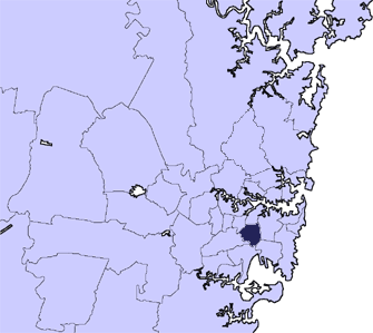
Marrickville Council was a local government area located in the Inner West region of Sydney, Australia. It was originally created on 1 November 1861 as the "Municipality of Marrickville". On 12 May 2016, Marrickville Council was merged with Ashfield and Leichhardt councils into the newly formed Inner West Council.
The area was bounded by Leichhardt to the north, the City of Sydney to the east and north-east, the City of Botany Bay to the south-east, Rockdale to the south, Canterbury to the west, and Ashfield to the north-west. It covers an area of approximately 17 square kilometres (6.6 sq mi). The area is roughly bounded by Parramatta Road to the north, King Street and the Princes Highway to the east, the Cooks River and Alexandra Canal to the south, and New and Old Canterbury Roads to the west.
While the area's background was traditionally working-class, which made the area a stronghold for the Australian Labor Party, several waves of immigration and a continuing trend of gentrification substantially influenced the demographics and character of the area, increasing the number of independents and Greens on the council. The last mayor of Marrickville Council was Cr. Sam Iskandar of the Labor Party.
In December 2021, a majority of voters in Inner West Council voted in favour of reversing the 2016 merger and separating the three pre-existing councils of Ashfield, Leichhardt and Marrickville.
The suburbs and localities within the former Marrickville Council area were:
Based on artefacts found near the Cooks River and Alexandra Canal, it is believed that the area has been occupied for at least 7,000 years. The area was originally occupied by the Cadigal clan of the Darug people who spoke the Eora language. Their name for most of the present day local government area was Bullanaming.
European settlement of the area began very soon after the arrival of the First Fleet in 1788. The first land grant was made in 1789, and by 1809 all the land had been granted. In the 1830s, the district consisted of five large estates, including Thomas Chalder's estate named Marrick after his home town in North Yorkshire. At this point, the area was still quite rural in nature.
Following the subdivision of these estates, municipalities were formed in Marrickville (1 November 1861), Camperdown (1862), Newtown (1862), St Peters (1871) and Petersham (1872). The first Marrickville council, consisting of six councillors elected proportionately, was elected on 9 December 1861 at the Stanmore Hotel.
Hub AI
Marrickville Council AI simulator
(@Marrickville Council_simulator)
Marrickville Council
Marrickville Council was a local government area located in the Inner West region of Sydney, Australia. It was originally created on 1 November 1861 as the "Municipality of Marrickville". On 12 May 2016, Marrickville Council was merged with Ashfield and Leichhardt councils into the newly formed Inner West Council.
The area was bounded by Leichhardt to the north, the City of Sydney to the east and north-east, the City of Botany Bay to the south-east, Rockdale to the south, Canterbury to the west, and Ashfield to the north-west. It covers an area of approximately 17 square kilometres (6.6 sq mi). The area is roughly bounded by Parramatta Road to the north, King Street and the Princes Highway to the east, the Cooks River and Alexandra Canal to the south, and New and Old Canterbury Roads to the west.
While the area's background was traditionally working-class, which made the area a stronghold for the Australian Labor Party, several waves of immigration and a continuing trend of gentrification substantially influenced the demographics and character of the area, increasing the number of independents and Greens on the council. The last mayor of Marrickville Council was Cr. Sam Iskandar of the Labor Party.
In December 2021, a majority of voters in Inner West Council voted in favour of reversing the 2016 merger and separating the three pre-existing councils of Ashfield, Leichhardt and Marrickville.
The suburbs and localities within the former Marrickville Council area were:
Based on artefacts found near the Cooks River and Alexandra Canal, it is believed that the area has been occupied for at least 7,000 years. The area was originally occupied by the Cadigal clan of the Darug people who spoke the Eora language. Their name for most of the present day local government area was Bullanaming.
European settlement of the area began very soon after the arrival of the First Fleet in 1788. The first land grant was made in 1789, and by 1809 all the land had been granted. In the 1830s, the district consisted of five large estates, including Thomas Chalder's estate named Marrick after his home town in North Yorkshire. At this point, the area was still quite rural in nature.
Following the subdivision of these estates, municipalities were formed in Marrickville (1 November 1861), Camperdown (1862), Newtown (1862), St Peters (1871) and Petersham (1872). The first Marrickville council, consisting of six councillors elected proportionately, was elected on 9 December 1861 at the Stanmore Hotel.