
Recent from talks
Cooks River
Knowledge base stats:
Talk channels stats:
Members stats:
Cooks River
The Cooks River, a semi-mature tide-dominated drowned valley estuary, is a tributary of Botany Bay, located in southern Sydney, New South Wales, Australia.
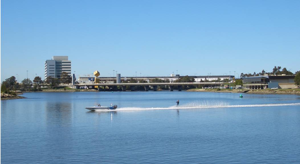
The course of the 23-kilometre-long (14 mi) urban waterway has been altered to accommodate various developments along its shore. It serves as part of a stormwater system for the 100 square kilometres (39 sq mi) of its watershed, and many of the original streams running into it have been turned into concrete lined channels. The tidal sections support significant areas of mangrove ecosystems and are used for recreational activities.
The river begins at Graf Park, Yagoona, then flows in a roughly north-easterly direction to Chullora. It reaches its northernmost point at Strathfield, where it leads into a concrete open canal, no more than one metre wide and thirty centimetres deep. It then heads towards the south-east. Where Cooks River runs through Strathfield Golf Course, the concrete lining has been partly removed. Here the plants have returned and have created an environment where the water is filtered and runs clean, and where wildlife has returned. One section here is called the Chain of Ponds.
At Belfield it joins with the Cox Creek Channel and flows in an easterly direction. The canal widens and deepens as it picks up stormwater from surrounding suburbs, such as Campsie and becomes influenced by tidal action.
At Canterbury, it is joined by Cup and Saucer Creek. Industrial areas line the Cooks River at Canterbury. In the past, factories discharged their waste directly into the water.
The valley becomes more pronounced as the river reaches Tempe, where it is joined by Wolli Creek and the Alexandra Canal. The Princes Highway crosses the Cooks River and links Tempe to the suburb of Wolli Creek. Also here is the low-lying Fatima Island, which is submerged at high tide.
The course of the final south-flowing section of river is entirely artificial. The river formerly flowed, via marshes, on a meandering course across the present site of Sydney Airport to meet Mill Stream and enter Botany Bay from the northern end of the bay. The boundary between the Parish of Botany and the Parish of St George remains at the former mouth of Cooks River. This part of the river course was altered to accommodate the expanding Sydney Airport. Cooks River now connects with Botany Bay at Kyeemagh.
The corridor of land beside the river is a conduit for many services along large parts of its length including electricity, high-voltage lines, a high-pressure oil pipe owned by Shell, and high-volume sewage pipes. Many of the lower-lying areas have been filled and are parks and sports grounds. In spite of this the river and adjacent lands are being recognised for their beauty, history, amenity and environmental value, if not also for potential for improvements. The walkway and cycleway beside much of the river is part of the path connecting Sydney Olympic Park with Botany Bay.
Hub AI
Cooks River AI simulator
(@Cooks River_simulator)
Cooks River
The Cooks River, a semi-mature tide-dominated drowned valley estuary, is a tributary of Botany Bay, located in southern Sydney, New South Wales, Australia.
The course of the 23-kilometre-long (14 mi) urban waterway has been altered to accommodate various developments along its shore. It serves as part of a stormwater system for the 100 square kilometres (39 sq mi) of its watershed, and many of the original streams running into it have been turned into concrete lined channels. The tidal sections support significant areas of mangrove ecosystems and are used for recreational activities.
The river begins at Graf Park, Yagoona, then flows in a roughly north-easterly direction to Chullora. It reaches its northernmost point at Strathfield, where it leads into a concrete open canal, no more than one metre wide and thirty centimetres deep. It then heads towards the south-east. Where Cooks River runs through Strathfield Golf Course, the concrete lining has been partly removed. Here the plants have returned and have created an environment where the water is filtered and runs clean, and where wildlife has returned. One section here is called the Chain of Ponds.
At Belfield it joins with the Cox Creek Channel and flows in an easterly direction. The canal widens and deepens as it picks up stormwater from surrounding suburbs, such as Campsie and becomes influenced by tidal action.
At Canterbury, it is joined by Cup and Saucer Creek. Industrial areas line the Cooks River at Canterbury. In the past, factories discharged their waste directly into the water.
The valley becomes more pronounced as the river reaches Tempe, where it is joined by Wolli Creek and the Alexandra Canal. The Princes Highway crosses the Cooks River and links Tempe to the suburb of Wolli Creek. Also here is the low-lying Fatima Island, which is submerged at high tide.
The course of the final south-flowing section of river is entirely artificial. The river formerly flowed, via marshes, on a meandering course across the present site of Sydney Airport to meet Mill Stream and enter Botany Bay from the northern end of the bay. The boundary between the Parish of Botany and the Parish of St George remains at the former mouth of Cooks River. This part of the river course was altered to accommodate the expanding Sydney Airport. Cooks River now connects with Botany Bay at Kyeemagh.
The corridor of land beside the river is a conduit for many services along large parts of its length including electricity, high-voltage lines, a high-pressure oil pipe owned by Shell, and high-volume sewage pipes. Many of the lower-lying areas have been filled and are parks and sports grounds. In spite of this the river and adjacent lands are being recognised for their beauty, history, amenity and environmental value, if not also for potential for improvements. The walkway and cycleway beside much of the river is part of the path connecting Sydney Olympic Park with Botany Bay.
Recent media