
Community hub
Recent from talks
Contribute something
Nothing was collected or created yet.
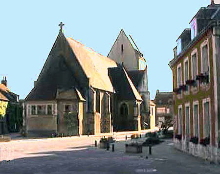
Merlerault-le-Pin
View on Wikipedia
Merlerault-le-Pin (French pronunciation: [mɛʁləʁo lə pɛ̃]) is a commune in the Orne department in north-western France. It was formed on 1 January 2025, with the merger of Les Authieux-du-Puits, La Genevraie, Godisson, Le Merlerault and Nonant-le-Pin.[3]
Key Information


Geography
[edit]The commune is made up of the following collection of villages and hamlets, La Butte, La Reboursière, La Chauvinière, Les Terres Noires,Les Mandrettes, Nonant-le-Pin, Le Merlerault, La Chambre, La Guerrie, Les Carrés, Les Mares, Montmarcé, La Cailletière, La Patte-d'Oie, Les Authieux-du-Puits, Carnettes, Les Foutelées, Les Houx, Le Varo, La Chevallerie, Le Tertre, Les Clos, Le Prieuré, Le Moncel, Le Cerisier, La Bêchetière, Ferme des Herbages, Le Tourniquet, Le Marais, Godisson, La Lamberderie, La Teunebeuverie, La Roussière, Le Mesnil-Hurel and La Dauphinerie.
The Commune is one of 27 communes that make up the Natura 2000 protected area of Bocages et vergers du sud Pays d'Auge.[4]
Merlerault-le-Pin along with another 65 communes is part of a 20,593 hectare, Natura 2000 conservation area, called the Haute vallée de l'Orne et affluents.[5]
Merlerault-le-Pin has 3 rivers that run through it, the Dieuge the Don and the Ure. The commune also has six streams flowing through its borders the Saint-Martin, Monts Damain, la Genevraie, Bois Guimon, Brullemail and the Varo.
Neighbouring communes | |
|---|---|
Climate
[edit]Merlerault-le-Pin benefits from an oceanic climate with mild winters and temperate summers.[6]
| Climate data for Le Merlerault (2007–2020 normals, extremes 2007–2024) | |||||||||||||
|---|---|---|---|---|---|---|---|---|---|---|---|---|---|
| Month | Jan | Feb | Mar | Apr | May | Jun | Jul | Aug | Sep | Oct | Nov | Dec | Year |
| Record high °C (°F) | 14.2 (57.6) |
19.7 (67.5) |
23.2 (73.8) |
27.2 (81.0) |
28.1 (82.6) |
36.3 (97.3) |
39.1 (102.4) |
36.6 (97.9) |
32.7 (90.9) |
27.5 (81.5) |
22 (72) |
15.5 (59.9) |
39.1 (102.4) |
| Mean daily maximum °C (°F) | 6.8 (44.2) |
7.8 (46.0) |
11.1 (52.0) |
15 (59) |
18 (64) |
21.3 (70.3) |
23.8 (74.8) |
23.3 (73.9) |
20.5 (68.9) |
15.4 (59.7) |
10.7 (51.3) |
7.7 (45.9) |
15.1 (59.2) |
| Daily mean °C (°F) | 4.2 (39.6) |
4.7 (40.5) |
7.2 (45.0) |
10.2 (50.4) |
13 (55) |
16.3 (61.3) |
18.3 (64.9) |
18.1 (64.6) |
15.5 (59.9) |
11.8 (53.2) |
7.9 (46.2) |
5 (41) |
11 (52) |
| Mean daily minimum °C (°F) | 1.7 (35.1) |
1.5 (34.7) |
3.3 (37.9) |
5.3 (41.5) |
8.1 (46.6) |
11.2 (52.2) |
12.8 (55.0) |
12.8 (55.0) |
10.5 (50.9) |
8.2 (46.8) |
5.2 (41.4) |
2.3 (36.1) |
6.9 (44.4) |
| Record low °C (°F) | −12.1 (10.2) |
−12.5 (9.5) |
−9.2 (15.4) |
−3.8 (25.2) |
−1.6 (29.1) |
2.7 (36.9) |
5.3 (41.5) |
5.4 (41.7) |
1.1 (34.0) |
−1.8 (28.8) |
−6.5 (20.3) |
−10.1 (13.8) |
−12.5 (9.5) |
| Average precipitation mm (inches) | 71.8 (2.83) |
61.3 (2.41) |
60.9 (2.40) |
52.8 (2.08) |
68.6 (2.70) |
61.7 (2.43) |
49.2 (1.94) |
63.7 (2.51) |
42.6 (1.68) |
70.9 (2.79) |
79 (3.1) |
92.8 (3.65) |
775.3 (30.52) |
| Average precipitation days (≥ 1.0 mm) | 13.9 | 11.8 | 10.6 | 9.5 | 9.5 | 8.9 | 6.8 | 9.8 | 7.8 | 12.5 | 14.5 | 15.2 | 130.6 |
| Source: Meteociel[7] | |||||||||||||
Points of interest
[edit]National heritage sites
[edit]- Ensemble castral remains of a medieval residence with a circular mound located in Le Merlerault, it was registered as a Monument historique in 1989.[8]
Notable people
[edit]- Foulques du Merle - (1239 - 1314) was Seigneur of Gacé and Bellou-en-Houlme, and Baron of Le Merlerault, Briouze and Messei.[9]
- Charles-Paul Landon (1760 - 1826), a French painter and popular writer on art and artists, was born here.[10]
- François Pouqueville - (1770 – 1838) a French diplomat, writer, explorer, physician and historian, and member of the Institut de France was born here.[11]
- Marie Duplessis (1824-1847), a French courtesan and mistress to a number of prominent and wealthy men was born here.[12] She was the inspiration for Marguerite Gautier, the main character of the 1848 novel The Lady of the Camellias.[13]
- Léon Labbé - (1832 – 1916) a French surgeon and politician was born here.[14]
Transport
[edit]Twin towns – sister cities
[edit]Le Merlerault is twinned with:
 Collingbourne Ducis, United Kingdom (since 1992)[17]
See also
[edit]References
[edit]- ^ "Répertoire national des élus: les maires" (in French). data.gouv.fr, Plateforme ouverte des données publiques françaises. 12 March 2025.
- ^ "Populations de référence 2023" (in French). National Institute of Statistics and Economic Studies. 18 December 2025.
- ^ Arrêté du 13 septembre 2024 portant création de la commune nouvelle de Merlerault-le-Pin, Légifrance, retrieved 16 January 2025
- ^ "INPN - FSD Natura 2000 - FR2502014 - Bocages et vergers du sud Pays d'Auge - Description". inpn.mnhn.fr.
- ^ "INPN - FSD Natura 2000 - FR2500099 - Haute vallée de l'Orne et affluents - Description". inpn.mnhn.fr.
- ^ "Mindat.org". www.mindat.org.
- ^ "Meteociel - Normales et records pour Le Merlerault (61)". www.meteociel.fr.
- ^ "Ensemble castral au Merlerault - PA00110977". monumentum.fr.
- ^ Louis de La Roque, Catalog historique des généraux français, connétables, maréchaux de France, lieutenants généraux, maréchaux de camp. Connétables et maréchaux de France depuis les premiers temps de la monarchie jusqu'à la fin du règne de Louis XIV (Paris, A. Desaide, 1896-1902), p.25.
- ^ "Charles-Paul Landon (1760-1826)". data.bnf.fr.
- ^ "Le Merlerault | CDC des Vallées d'Auge et du Merlerault". www.cdcvam.fr.
- ^ "Auberge Restaurant La Tête au Loup : site touristique du Haras du Pin, circuit de la Dame aux Camélias, Orne, Normandie 61". www.lateteauloup.fr.
- ^ "The Real Traviata: The tragic true story that inspired La traviata". www.roh.org.uk.
- ^ "Léon Labbé (1830-1916)". data.bnf.fr.
- ^ Plan du réseau, TER Normandie, accessed 24 September 2023.
- ^ "Transport infrastructure in Le Merlerault from A to Z." MFG.
- ^ "Our village". Collingbourne Ducis Parish Council.