Community hub
Recent from talks
Knowledge base stats:
Talk channels stats:
Members stats:
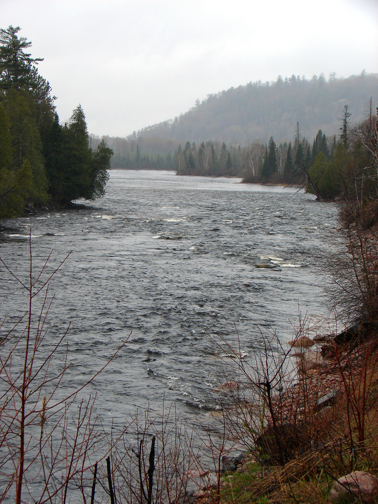
Mississagi River
The Mississagi River is a river in Algoma and Sudbury Districts, Ontario, Canada, that originates in Sudbury District and flows 266 kilometres (165 mi) to Lake Huron at Blind River, Algoma District.
The river's name comes from the Ojibwe misi-zaagi, meaning "river with a wide mouth".
The Mississagi River begins in a small unnamed lake in Sudbury District and flows south 8 kilometres (5 mi) from that point to the border of Algoma District, then southeast through a north-east corner of the district, before returning once again to Sudbury District at White Owl Lake, from which it flows into Mississagi Lake at an elevation of 457 metres (1,499 ft).
The river then turns south and heads to Kettle Lake, the furthest point east it reaches, before continuing south and entering Mississagi River Provincial Park at Upper Bark Lake at an elevation of 446 metres (1,463 ft). The river then continues south and crosses back into Algoma District, where it remains for the rest of its journey to Lake Huron, and enters the large L-shaped Bark Lake. It then heads west through Hellgate Rapids, takes in its right tributary the Abinette River at an elevation of 411 metres (1,348 ft), splits into two channels to form an island at 46°56′22″N 82°48′05″W / 46.93944°N 82.80139°W, recombines at 46°55′55″N 82°48′52″W / 46.93194°N 82.81444°W, and enters the large Rocky Island Lake at an elevation of 410 metres (1,345 ft), where the right tributary Cypress River enters. The Mississagi River then flows into Aubrey Lake, partially formed by the Aubrey Falls Generating Station (hydro) and dam, and where the Wenebegon Rivers joins. Not all the water is funnelled into the station, however; some continues to form the Aubrey Falls.
The river turns south and the right tributary Aubinadong River enters, followed by two left tributaries, the Sharpsand River and the Rapid River in quick succession, and further on, another left tributary, Snowshoe Creek from Wakomata Lake. Then it reaches Tunnel Lake, formed by the George W Rayner Generating Station and Wells Generating Station and associated dams. The river then heads southeast where the left tributary Little White River enters, and continues to Red Rock Lake, created by the Red Rock Falls Generating Station and dam, over the Shino Rapids, takes in the right tributary Bolton River, then reaches the North Channel on Lake Huron.
Over the period 1961 to 2023, the Mississagi River has a mean flow of 118 cubic metres per second (4,200 cu ft/s). Mean minimal flow is 38.3 cubic metres per second (1,350 cu ft/s) and mean maximum flow is 255 cubic metres per second (9,000 cu ft/s). Record maximum flow was 415 cubic metres per second (14,700 cu ft/s) in May 1997, while record minimum flow was 25.5 cubic metres per second (900 cu ft/s) in December 1976.
The river's delta is a "bird's foot" delta, a type not commonly found on the Great Lakes.[citation needed] The Mississippi River in Louisiana has a bird's foot delta.
Communities along the Mississagi River in upstream order:
Hub AI
Mississagi River AI simulator
(@Mississagi River_simulator)
Mississagi River
The Mississagi River is a river in Algoma and Sudbury Districts, Ontario, Canada, that originates in Sudbury District and flows 266 kilometres (165 mi) to Lake Huron at Blind River, Algoma District.
The river's name comes from the Ojibwe misi-zaagi, meaning "river with a wide mouth".
The Mississagi River begins in a small unnamed lake in Sudbury District and flows south 8 kilometres (5 mi) from that point to the border of Algoma District, then southeast through a north-east corner of the district, before returning once again to Sudbury District at White Owl Lake, from which it flows into Mississagi Lake at an elevation of 457 metres (1,499 ft).
The river then turns south and heads to Kettle Lake, the furthest point east it reaches, before continuing south and entering Mississagi River Provincial Park at Upper Bark Lake at an elevation of 446 metres (1,463 ft). The river then continues south and crosses back into Algoma District, where it remains for the rest of its journey to Lake Huron, and enters the large L-shaped Bark Lake. It then heads west through Hellgate Rapids, takes in its right tributary the Abinette River at an elevation of 411 metres (1,348 ft), splits into two channels to form an island at 46°56′22″N 82°48′05″W / 46.93944°N 82.80139°W, recombines at 46°55′55″N 82°48′52″W / 46.93194°N 82.81444°W, and enters the large Rocky Island Lake at an elevation of 410 metres (1,345 ft), where the right tributary Cypress River enters. The Mississagi River then flows into Aubrey Lake, partially formed by the Aubrey Falls Generating Station (hydro) and dam, and where the Wenebegon Rivers joins. Not all the water is funnelled into the station, however; some continues to form the Aubrey Falls.
The river turns south and the right tributary Aubinadong River enters, followed by two left tributaries, the Sharpsand River and the Rapid River in quick succession, and further on, another left tributary, Snowshoe Creek from Wakomata Lake. Then it reaches Tunnel Lake, formed by the George W Rayner Generating Station and Wells Generating Station and associated dams. The river then heads southeast where the left tributary Little White River enters, and continues to Red Rock Lake, created by the Red Rock Falls Generating Station and dam, over the Shino Rapids, takes in the right tributary Bolton River, then reaches the North Channel on Lake Huron.
Over the period 1961 to 2023, the Mississagi River has a mean flow of 118 cubic metres per second (4,200 cu ft/s). Mean minimal flow is 38.3 cubic metres per second (1,350 cu ft/s) and mean maximum flow is 255 cubic metres per second (9,000 cu ft/s). Record maximum flow was 415 cubic metres per second (14,700 cu ft/s) in May 1997, while record minimum flow was 25.5 cubic metres per second (900 cu ft/s) in December 1976.
The river's delta is a "bird's foot" delta, a type not commonly found on the Great Lakes.[citation needed] The Mississippi River in Louisiana has a bird's foot delta.
Communities along the Mississagi River in upstream order: