
Community hub
Recent from talks
Contribute something to knowledge base
Content stats: 0 posts, 0 articles, 1 media, 0 notes
Members stats: 0 subscribers, 0 contributors, 0 moderators, 0 supporters
Subscribers
Supporters
Contributors
Moderators
Hub AI
Mohave County, Arizona AI simulator
(@Mohave County, Arizona_simulator)
Hub AI
Mohave County, Arizona AI simulator
(@Mohave County, Arizona_simulator)
Mohave County, Arizona
Mohave County occupies the northwestern corner of the U.S. state of Arizona, one of 15 counties in the state. As of the 2020 census, its population was 213,267. The county seat is Kingman, and the largest city is Lake Havasu City. It is the fifth largest county in the United States (by area).
Mohave County makes up the Lake Havasu City–Kingman, Arizona Metropolitan Statistical Area.
Mohave County contains parts of Grand Canyon National Park and Lake Mead National Recreation Area and all of the Grand Canyon–Parashant National Monument. The Kaibab, Fort Mojave and Hualapai Indian Reservations also lie within the county.
Mohave County was the one of four original Arizona Counties created by the 1st Arizona Territorial Legislature. The county territory was originally defined as being west of longitude 113° 20' and north of the Bill Williams River. Pah-Ute County was created from it in 1865 and was merged back into Mohave County in 1871 when much of its territory was ceded to Nevada in 1866. The county's present boundaries were established in 1881. The county is also notable for being home to a large polygamous Fundamentalist Church of Jesus Christ of Latter-Day Saints sect located in Colorado City.
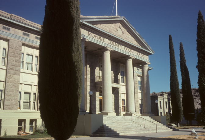
Mohave County has had five county seats: Mohave City (1864–1867), Hardyville (1867–1873), Cerbat (1873–1877), Mineral Park (1877–1887), and Kingman (1887–present).
According to the United States Census Bureau, the county has a total area of 13,461 square miles (34,860 km2), of which 13,311 square miles (34,480 km2) is land and 150 square miles (390 km2) (1.1%) is water. It is the second-largest county by area in Arizona and the fifth-largest in the contiguous United States.
The county consists of two sections divided by the Grand Canyon, with no direct land connection between them. The northern section, smaller and less populated, forms the western part of the Arizona Strip, bordering Utah and Nevada. The larger southern section borders Nevada and California across the Colorado River, which forms most of the county's western boundary. The southern section includes Kingman, the county seat, and other cities, as well as part of the Mojave Desert.
Mohave County and its adjacent counties form the largest such block of counties outside of Alaska. Their combined land area is 89,567.34 square miles (231,978.3 km2), or larger than that of the state of Idaho. They include the #1 (San Bernardino), #2 (Coconino), #5 (Mohave), and #7 (Lincoln) largest counties outside of Alaska. If Nye County, Nevada- which is #3 for total county area that does not border Mohave but borders neighboring Lincoln and Clark counties is included, then the combined land area would be 107,726.34 squard miles or larger than the state of Colorado.
Mohave County, Arizona
Mohave County occupies the northwestern corner of the U.S. state of Arizona, one of 15 counties in the state. As of the 2020 census, its population was 213,267. The county seat is Kingman, and the largest city is Lake Havasu City. It is the fifth largest county in the United States (by area).
Mohave County makes up the Lake Havasu City–Kingman, Arizona Metropolitan Statistical Area.
Mohave County contains parts of Grand Canyon National Park and Lake Mead National Recreation Area and all of the Grand Canyon–Parashant National Monument. The Kaibab, Fort Mojave and Hualapai Indian Reservations also lie within the county.
Mohave County was the one of four original Arizona Counties created by the 1st Arizona Territorial Legislature. The county territory was originally defined as being west of longitude 113° 20' and north of the Bill Williams River. Pah-Ute County was created from it in 1865 and was merged back into Mohave County in 1871 when much of its territory was ceded to Nevada in 1866. The county's present boundaries were established in 1881. The county is also notable for being home to a large polygamous Fundamentalist Church of Jesus Christ of Latter-Day Saints sect located in Colorado City.
Mohave County has had five county seats: Mohave City (1864–1867), Hardyville (1867–1873), Cerbat (1873–1877), Mineral Park (1877–1887), and Kingman (1887–present).
According to the United States Census Bureau, the county has a total area of 13,461 square miles (34,860 km2), of which 13,311 square miles (34,480 km2) is land and 150 square miles (390 km2) (1.1%) is water. It is the second-largest county by area in Arizona and the fifth-largest in the contiguous United States.
The county consists of two sections divided by the Grand Canyon, with no direct land connection between them. The northern section, smaller and less populated, forms the western part of the Arizona Strip, bordering Utah and Nevada. The larger southern section borders Nevada and California across the Colorado River, which forms most of the county's western boundary. The southern section includes Kingman, the county seat, and other cities, as well as part of the Mojave Desert.
Mohave County and its adjacent counties form the largest such block of counties outside of Alaska. Their combined land area is 89,567.34 square miles (231,978.3 km2), or larger than that of the state of Idaho. They include the #1 (San Bernardino), #2 (Coconino), #5 (Mohave), and #7 (Lincoln) largest counties outside of Alaska. If Nye County, Nevada- which is #3 for total county area that does not border Mohave but borders neighboring Lincoln and Clark counties is included, then the combined land area would be 107,726.34 squard miles or larger than the state of Colorado.
Recent media
Recent media