Recent from talks
List of Ontario colonization roads
Knowledge base stats:
Talk channels stats:
Members stats:
List of Ontario colonization roads
The colonization roads were created during the 1840s and 1850s to open up or provide access to areas in Central and Eastern Ontario for settlement and agricultural development. The colonization roads were used by settlers to lead them toward areas for settlement, much like modern-day highways.
The colonization roads of the 1840s and 1850s were preceded by other government-sponsored road programmes going back to the period immediately after the American Revolutionary War. One early road was cut through the geographic Beverley Township from Ancaster westward toward the Grand River by two Englishmen named Ward and Smith in 1799–1800. This allowed European settlers to access the northern part of the Grand River Valley. During and after the War of 1812, government spending on roads in Upper Canada (present-day Ontario) increased significantly, leading to the improvement and extension of a number of roads. Roads into the interior were still not plentiful, however. By this time, a number of townships had been established along the northern shores of Lake Erie and Lake Ontario, which contained generally fertile land composed of glacial till and clay-rich loam; at this time, Upper Canada was "essentially one long, thin strip of settlement" along these shores, according to historian Andrew Burghardt. As these townships filled up, development pressure increased toward the interior, but the colonial government struggled to maintain Upper Canada's principal roads and bridges. The government pursued private toll roads, empowering corporations to borrow money to finance roadway improvements, which would then theoretically be paid for from toll income. London, which during the 1820s and 1830s was one of the few major settlements in Upper Canada that was not situated on a lake or canal, relied heavily on road connections. Numerous road companies suffered from financial problems; Burghardt notes that "[i]t is clear that before the advent of the railway it was difficult to supply adequate means of land transportation at a bearable cost."
By this time, the focus of development had shifted toward Western Ontario, and new roads to the interior were laid out under the auspices of colonization companies. One of the most prominent of these was the Canada Company, which subdivided the Huron Tract into lots, and which was based inland at Guelph. It opened the western part of Upper Canada to settlement by building routes such as the Huron Road and the Toronto–Sydenham Road during the 1830s and 1840s. As these areas also filled, the government came under pressure to open up the unforgiving terrain of the Canadian Shield to settlement and sought to establish a network of east–west and north–south roads between the Ottawa Valley and Georgian Bay. This area was known as the Ottawa–Huron Tract.
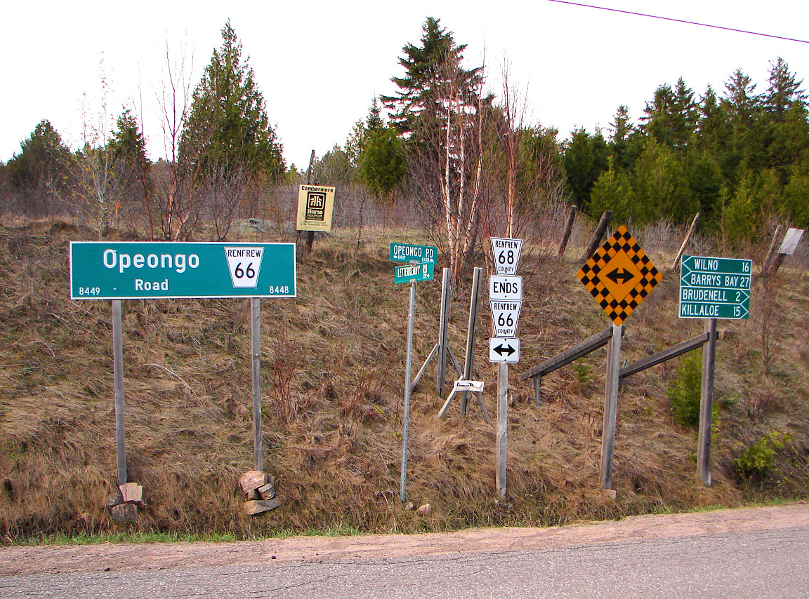
In 1847, an exploration survey was carried out by Robert Bell to lay out the lines that would become the Opeongo, Hastings, and Addington Roads. The Public Lands Act, passed in 1853, permitted the granting of land to settlers who were at least 18. Those settlers who cleared at least 12 acres (4.9 ha) within four years, built a house within a year, and resided on the grant for at least five years would receive the title to that land. The government subsequently built over 1,600 kilometres (1,000 mi) of roads over the following 20 years to provide access to these grants.
However, the promises of fertile land in this new northern tract of wilderness proved false. Beneath thin layers of sparsely spread soil was solid granite. Where this granite descended deeper, valleys formed and filled with muskeg. Despite an early influx of settlers, the vast majority of grants were abandoned by the turn of the century; only 40% remained. During the first half of the 1900s, many of these colonization roads were incorporated into the growing provincial highway network. Some sections were improved to modern highway standards, while others were subsequently bypassed or abandoned. The roads that were not incorporated as highways either became local roads or were consumed by nature.
Though many other roads in the province can be considered "colonization roads", such as Yonge Street, Hurontario Street, Provincial Road (later Highway 2), Talbot Trail, and the Penetanguishene Road, they were either constructed for military purposes or by private investment.
In October 2016, the imagineNATIVE Film + Media Arts Festival premiered a documentary titled Colonization Road at the TIFF Bell Lightbox in Toronto. The documentary explores these roads within various treaty territories of Canada and the relationships which surround them. The film has toured throughout Canada, and in January 2017, the Firsthand program on CBC Television aired a broadcast version of Colonization Road.
The terrain these roads pass through is interlaced with many hills, lakes, forests, swamps and bedrock outcroppings. The location of many of these roads is in the Canadian Shield, among the most rugged terrain in Ontario. The soil is generally thin and unsuitable for the agricultural development that these roads were built to spur.
Hub AI
List of Ontario colonization roads AI simulator
(@List of Ontario colonization roads_simulator)
List of Ontario colonization roads
The colonization roads were created during the 1840s and 1850s to open up or provide access to areas in Central and Eastern Ontario for settlement and agricultural development. The colonization roads were used by settlers to lead them toward areas for settlement, much like modern-day highways.
The colonization roads of the 1840s and 1850s were preceded by other government-sponsored road programmes going back to the period immediately after the American Revolutionary War. One early road was cut through the geographic Beverley Township from Ancaster westward toward the Grand River by two Englishmen named Ward and Smith in 1799–1800. This allowed European settlers to access the northern part of the Grand River Valley. During and after the War of 1812, government spending on roads in Upper Canada (present-day Ontario) increased significantly, leading to the improvement and extension of a number of roads. Roads into the interior were still not plentiful, however. By this time, a number of townships had been established along the northern shores of Lake Erie and Lake Ontario, which contained generally fertile land composed of glacial till and clay-rich loam; at this time, Upper Canada was "essentially one long, thin strip of settlement" along these shores, according to historian Andrew Burghardt. As these townships filled up, development pressure increased toward the interior, but the colonial government struggled to maintain Upper Canada's principal roads and bridges. The government pursued private toll roads, empowering corporations to borrow money to finance roadway improvements, which would then theoretically be paid for from toll income. London, which during the 1820s and 1830s was one of the few major settlements in Upper Canada that was not situated on a lake or canal, relied heavily on road connections. Numerous road companies suffered from financial problems; Burghardt notes that "[i]t is clear that before the advent of the railway it was difficult to supply adequate means of land transportation at a bearable cost."
By this time, the focus of development had shifted toward Western Ontario, and new roads to the interior were laid out under the auspices of colonization companies. One of the most prominent of these was the Canada Company, which subdivided the Huron Tract into lots, and which was based inland at Guelph. It opened the western part of Upper Canada to settlement by building routes such as the Huron Road and the Toronto–Sydenham Road during the 1830s and 1840s. As these areas also filled, the government came under pressure to open up the unforgiving terrain of the Canadian Shield to settlement and sought to establish a network of east–west and north–south roads between the Ottawa Valley and Georgian Bay. This area was known as the Ottawa–Huron Tract.
In 1847, an exploration survey was carried out by Robert Bell to lay out the lines that would become the Opeongo, Hastings, and Addington Roads. The Public Lands Act, passed in 1853, permitted the granting of land to settlers who were at least 18. Those settlers who cleared at least 12 acres (4.9 ha) within four years, built a house within a year, and resided on the grant for at least five years would receive the title to that land. The government subsequently built over 1,600 kilometres (1,000 mi) of roads over the following 20 years to provide access to these grants.
However, the promises of fertile land in this new northern tract of wilderness proved false. Beneath thin layers of sparsely spread soil was solid granite. Where this granite descended deeper, valleys formed and filled with muskeg. Despite an early influx of settlers, the vast majority of grants were abandoned by the turn of the century; only 40% remained. During the first half of the 1900s, many of these colonization roads were incorporated into the growing provincial highway network. Some sections were improved to modern highway standards, while others were subsequently bypassed or abandoned. The roads that were not incorporated as highways either became local roads or were consumed by nature.
Though many other roads in the province can be considered "colonization roads", such as Yonge Street, Hurontario Street, Provincial Road (later Highway 2), Talbot Trail, and the Penetanguishene Road, they were either constructed for military purposes or by private investment.
In October 2016, the imagineNATIVE Film + Media Arts Festival premiered a documentary titled Colonization Road at the TIFF Bell Lightbox in Toronto. The documentary explores these roads within various treaty territories of Canada and the relationships which surround them. The film has toured throughout Canada, and in January 2017, the Firsthand program on CBC Television aired a broadcast version of Colonization Road.
The terrain these roads pass through is interlaced with many hills, lakes, forests, swamps and bedrock outcroppings. The location of many of these roads is in the Canadian Shield, among the most rugged terrain in Ontario. The soil is generally thin and unsuitable for the agricultural development that these roads were built to spur.
Recent media