Recent from talks
Mont Revard
Knowledge base stats:
Talk channels stats:
Members stats:
Mont Revard
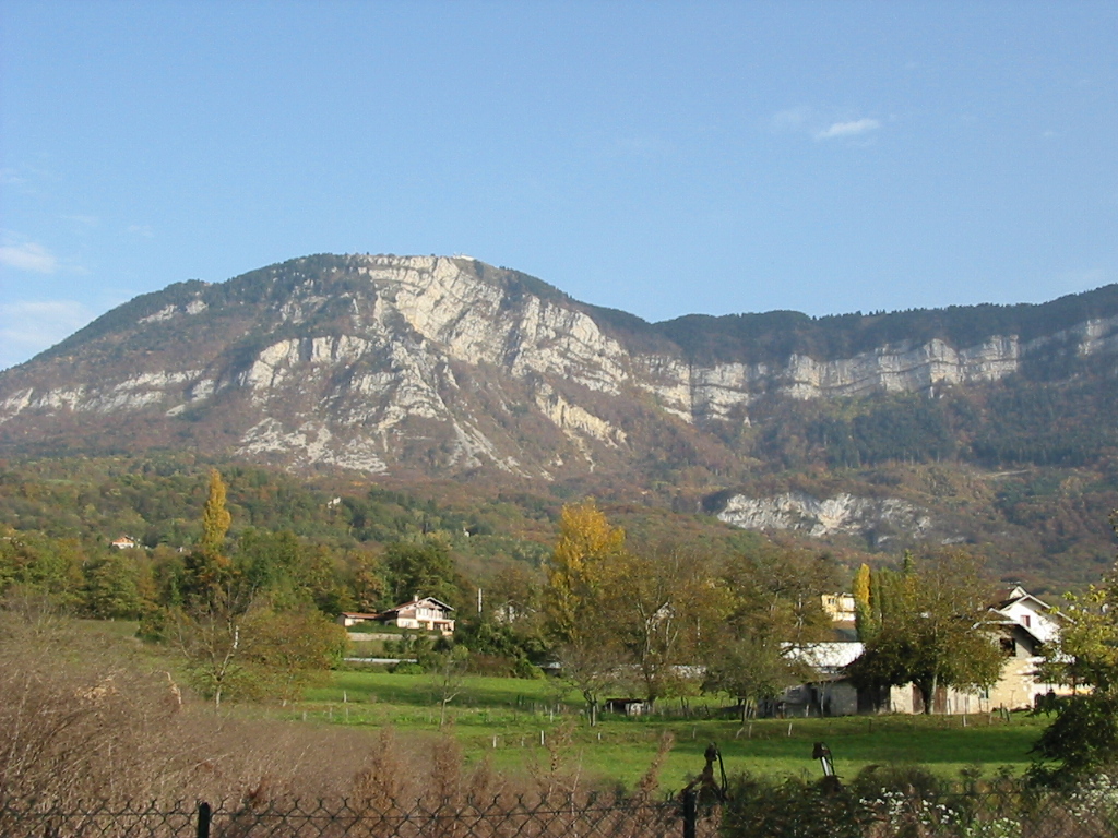
Mont Revard (French pronunciation: [mɔ̃ ʁəvaʁ],) is a mountain in the Bauges Massif near Aix-les-Bains in Savoie, France with an elevation of 1,562 m (5,125 ft). The mountain is crossed by the D913 road between the villages of Saint-Jean-d'Arvey and Pugny-Chatenod near Aix-les-Bains. The ski resort of Le Revard is situated on the northern edge of the mountain at an elevation of 1,537 m (5,043 ft).
The summit of D913 has an elevation of 1,463 m (4,800 ft) and was crossed on the penultimate stage of the 2013 Tour de France (Stage 20). The Tour de France has crossed the pass twice previously and has had a stage finish twice on the summit.
Mont Revard features a warm-summer humid continental climate (Köppen: Dfb) due to its altitude and far inland position.
Located at the western end of the French Alps, Mont Revard receives a lot of precipitation over the year and significant accumulations of snow - up to 8 m (26 ft 3 in) during the winter of 2012–2013. Summers are quite warm and sunny and thunderstorms are not uncommon. Winters are very cold and snowy.
In 2013, the climb used by the Tour de France commenced at Saint-Jean-d'Arvey and climbs 866 m (2,841 ft) in 15.9 km (9.9 mi) at an average gradient of 5.6%, and was ranked a Category 1 climb.
From Aix-les-Bains, the climb to the ski resort at Le Revard via the D913 is 21.4 km (13.3 mi) long, climbing 1,277 m (4,190 ft) at an average gradient of 6%. From Chambery, the climb via the D912/D913 is 25.0 km (15.5 mi) long with 1,267 m (4,157 ft) height gained at an average of 5.1%.
The limestone plateau is conducive to karst formations. Some pit caves (called 'tannes') are connected to underground networks such as the Garde-Cavale network, accessible from the Trou du Garde and the Creux de la Cavale. More than 50 km of this network has been explored. The waters, whose flow varies from 14 to 7,000 litres per second, come out at the Doria cave, which is visible from Chambéry.
The mountain was included in the route of the 1991 Tour de France and again in 1998, however the latter stage was cancelled in the wake of the 1998 Festina affair.
Hub AI
Mont Revard AI simulator
(@Mont Revard_simulator)
Mont Revard
Mont Revard (French pronunciation: [mɔ̃ ʁəvaʁ],) is a mountain in the Bauges Massif near Aix-les-Bains in Savoie, France with an elevation of 1,562 m (5,125 ft). The mountain is crossed by the D913 road between the villages of Saint-Jean-d'Arvey and Pugny-Chatenod near Aix-les-Bains. The ski resort of Le Revard is situated on the northern edge of the mountain at an elevation of 1,537 m (5,043 ft).
The summit of D913 has an elevation of 1,463 m (4,800 ft) and was crossed on the penultimate stage of the 2013 Tour de France (Stage 20). The Tour de France has crossed the pass twice previously and has had a stage finish twice on the summit.
Mont Revard features a warm-summer humid continental climate (Köppen: Dfb) due to its altitude and far inland position.
Located at the western end of the French Alps, Mont Revard receives a lot of precipitation over the year and significant accumulations of snow - up to 8 m (26 ft 3 in) during the winter of 2012–2013. Summers are quite warm and sunny and thunderstorms are not uncommon. Winters are very cold and snowy.
In 2013, the climb used by the Tour de France commenced at Saint-Jean-d'Arvey and climbs 866 m (2,841 ft) in 15.9 km (9.9 mi) at an average gradient of 5.6%, and was ranked a Category 1 climb.
From Aix-les-Bains, the climb to the ski resort at Le Revard via the D913 is 21.4 km (13.3 mi) long, climbing 1,277 m (4,190 ft) at an average gradient of 6%. From Chambery, the climb via the D912/D913 is 25.0 km (15.5 mi) long with 1,267 m (4,157 ft) height gained at an average of 5.1%.
The limestone plateau is conducive to karst formations. Some pit caves (called 'tannes') are connected to underground networks such as the Garde-Cavale network, accessible from the Trou du Garde and the Creux de la Cavale. More than 50 km of this network has been explored. The waters, whose flow varies from 14 to 7,000 litres per second, come out at the Doria cave, which is visible from Chambéry.
The mountain was included in the route of the 1991 Tour de France and again in 1998, however the latter stage was cancelled in the wake of the 1998 Festina affair.
Recent media