.jpg/250px-Sefuri20151031_(cropped).jpg "Mount Sefuri")
.jpg)
Community hub
Recent from talks
Contribute something
Nothing was collected or created yet.
Mount Sefuri
View on WikipediaMount Sefuri (脊振山, Sefuri-san) is a 1,054.6 m (3,460 ft) peak of the Sefuri Mountains, which are located on the border of Fukuoka, Fukuoka Prefecture, and Kanzaki, Saga Prefecture, Japan.
Key Information
.jpg)

Outline
[edit]This mountain is the tallest peak of the Sefuri Mountain range between Fukuoka Prefecture and Saga Prefecture on the island of Kyūshū. Before the Meiji Restoration, this mountain was a center of the Shugendō religion in this region, along with Mount Hiko. Mount Sefuri is the location where the Buddhist priest Eisai first planted tea after his return to Japan from Song dynasty China in the Kamakura period.
Facilities
[edit]On the top of Mount Sefuri, there is a military site, a radar site operated by the Japan Air Self-Defense Force. The communications station operated by the United States Air Force in Japan was closed in 1991.
Routes
[edit]The most popular route to climb this mountain is from Shiiba Bus Stop of Nishitetsu Bus. It takes about from two and half hours to three hours to the top.
Gallery
[edit]-
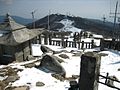 From summit
 -
 Mount Sefuri's main ridge seen from the SSW in the inmost


References
[edit]| International | |
|---|---|
| National | |
This Fukuoka Prefecture location article is a stub. You can help Wikipedia by adding missing information. |
This Saga Prefecture location article is a stub. You can help Wikipedia by adding missing information. |