
Community hub
Recent from talks
Contribute something to knowledge base
Content stats: 0 posts, 0 articles, 1 media, 0 notes
Members stats: 0 subscribers, 0 contributors, 0 moderators, 0 supporters
Subscribers
Supporters
Contributors
Moderators
Hub AI
Noonday Creek AI simulator
(@Noonday Creek_simulator)
Hub AI
Noonday Creek AI simulator
(@Noonday Creek_simulator)
Noonday Creek
Noonday Creek is a 20.2-mile-long (32.5 km) stream in Cobb and Cherokee counties in the U.S. state of Georgia. The stream begins near Kennesaw Mountain and ends at Lake Allatoona.
Noonday is a translation of the native Cherokee language name, referring to the solar noon.
Noonday Creek is a tributary of the Little River, joining it within Lake Allatoona just to the north of the Towne Lake development. The confluence of Little River and Noonday Creek now lies beneath the water of the lake.
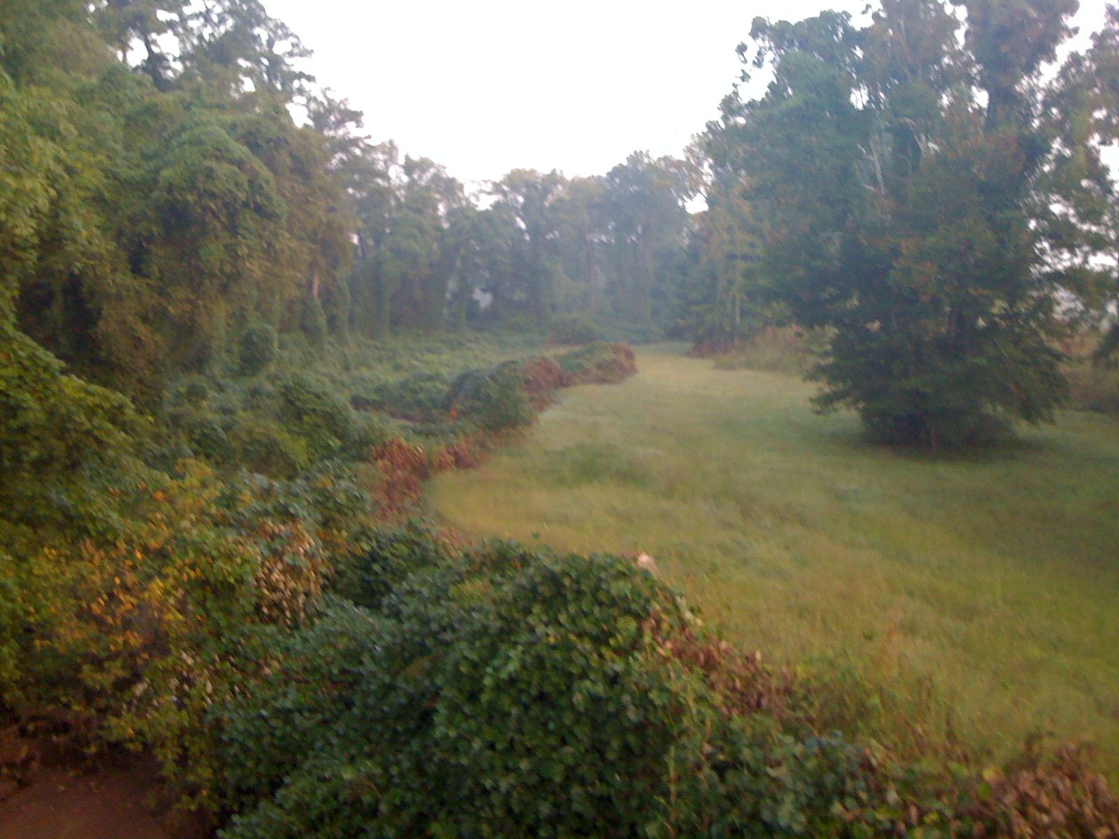
At the northern end of Cobb County, Noonday Creek picks up outflow from the Noonday Water Reclamation Facility, a sewage treatment plant serving Cobb and Cherokee counties. A large sewer line is buried along most of the creek south (upstream) of the plant, seen as a treeless kudzu-covered flood plain, dotted with concrete mounds topped with manholes.
Little Noonday Creek is its only officially-named tributary, flowing north from the northeast corner of Marietta and then northwestward, joining the main creek southwest of Noonday, at Noonday Creek Park. An unnamed tributary through Lake Latimer extends from the southwest along I-575 to the north end of the park. During heavy rains, the main creek often floods the fields at the park, and increasingly so due to excessive runoff from heavy land development in the area.
Other inflows include creeks that flow from or through Laura Lake (joining at Chastain Meadows Parkway), Chastain Lakes, Bells Ferry Park (joining north of Rockbridge Road), Barrett Lakes, Ellison Lakes, Bozeman Lake (near Kennesaw State University), and Timber Lake.
There are two USGS stream gauges on Noonday Creek, both operating since October 2000 and reporting via uplink to GOES weather satellites. The first is at Hawkins Store Road, at the south end of Noonday Creek Park. This is at 34°03′23″N 84°32′08″W / 34.05639°N 84.53556°W, 895 feet (273 m) AMSL, and has a watershed area of 24.3 square miles (63 km2). This has location identifier NDYG1 and is reported to be 2 miles (3 km) north-northwest of Blackwells. The second is at Shallowford Road, just downstream (north) at the other end of the park, next to the entrance to the water treatment plant. This is at 34°04′06″N 84°32′08″W / 34.06833°N 84.53556°W, 890 feet (270 m) AMSL, with a watershed area of 33.6 square miles (87 km2), including Little Noonday Creek. This is identified as NOOG1 and is reported as "near Woodstock". Both streamflow and stage (depth) are reported at both locations, with a rain gauge also at the latter. The National Weather Service does not issue river flood warnings or statements for this creek as it does for Sope Creek and others in the area, nor did it set an official flood stage for it until after the 2005 flood. Minor flood stage is now considered to be 10 feet (3.0 m), while major flood is 16 feet (4.9 m), both at the Shallowford gauge. The highest the original gauges could read was 12 feet (3.7 m), replaced with 20-foot (6.1 m) ones after the 2005 flood.
Until 2009, the most severe flood known to have occurred on Noonday Creek was in July 2005, when the outer bands of Hurricane Dennis followed Hurricane Cindy by just a few days. Massive rainfall occurred, particularly with Dennis, in less than 24 hours, sending the creek to a level of 16.30 feet (4.97 m) late on July 10. That is about ten times its normal depth or height, reaching beyond what the Federal Emergency Management Agency (FEMA) and GDNR labeled its 100-year flood plain, largely because of excessive urbanization upstream. Because of this, many people did not have flood insurance.
Noonday Creek
Noonday Creek is a 20.2-mile-long (32.5 km) stream in Cobb and Cherokee counties in the U.S. state of Georgia. The stream begins near Kennesaw Mountain and ends at Lake Allatoona.
Noonday is a translation of the native Cherokee language name, referring to the solar noon.
Noonday Creek is a tributary of the Little River, joining it within Lake Allatoona just to the north of the Towne Lake development. The confluence of Little River and Noonday Creek now lies beneath the water of the lake.
At the northern end of Cobb County, Noonday Creek picks up outflow from the Noonday Water Reclamation Facility, a sewage treatment plant serving Cobb and Cherokee counties. A large sewer line is buried along most of the creek south (upstream) of the plant, seen as a treeless kudzu-covered flood plain, dotted with concrete mounds topped with manholes.
Little Noonday Creek is its only officially-named tributary, flowing north from the northeast corner of Marietta and then northwestward, joining the main creek southwest of Noonday, at Noonday Creek Park. An unnamed tributary through Lake Latimer extends from the southwest along I-575 to the north end of the park. During heavy rains, the main creek often floods the fields at the park, and increasingly so due to excessive runoff from heavy land development in the area.
Other inflows include creeks that flow from or through Laura Lake (joining at Chastain Meadows Parkway), Chastain Lakes, Bells Ferry Park (joining north of Rockbridge Road), Barrett Lakes, Ellison Lakes, Bozeman Lake (near Kennesaw State University), and Timber Lake.
There are two USGS stream gauges on Noonday Creek, both operating since October 2000 and reporting via uplink to GOES weather satellites. The first is at Hawkins Store Road, at the south end of Noonday Creek Park. This is at 34°03′23″N 84°32′08″W / 34.05639°N 84.53556°W, 895 feet (273 m) AMSL, and has a watershed area of 24.3 square miles (63 km2). This has location identifier NDYG1 and is reported to be 2 miles (3 km) north-northwest of Blackwells. The second is at Shallowford Road, just downstream (north) at the other end of the park, next to the entrance to the water treatment plant. This is at 34°04′06″N 84°32′08″W / 34.06833°N 84.53556°W, 890 feet (270 m) AMSL, with a watershed area of 33.6 square miles (87 km2), including Little Noonday Creek. This is identified as NOOG1 and is reported as "near Woodstock". Both streamflow and stage (depth) are reported at both locations, with a rain gauge also at the latter. The National Weather Service does not issue river flood warnings or statements for this creek as it does for Sope Creek and others in the area, nor did it set an official flood stage for it until after the 2005 flood. Minor flood stage is now considered to be 10 feet (3.0 m), while major flood is 16 feet (4.9 m), both at the Shallowford gauge. The highest the original gauges could read was 12 feet (3.7 m), replaced with 20-foot (6.1 m) ones after the 2005 flood.
Until 2009, the most severe flood known to have occurred on Noonday Creek was in July 2005, when the outer bands of Hurricane Dennis followed Hurricane Cindy by just a few days. Massive rainfall occurred, particularly with Dennis, in less than 24 hours, sending the creek to a level of 16.30 feet (4.97 m) late on July 10. That is about ten times its normal depth or height, reaching beyond what the Federal Emergency Management Agency (FEMA) and GDNR labeled its 100-year flood plain, largely because of excessive urbanization upstream. Because of this, many people did not have flood insurance.
Recent media
Recent media