Recent from talks
North Smithfield, Rhode Island
Knowledge base stats:
Talk channels stats:
Members stats:
North Smithfield, Rhode Island
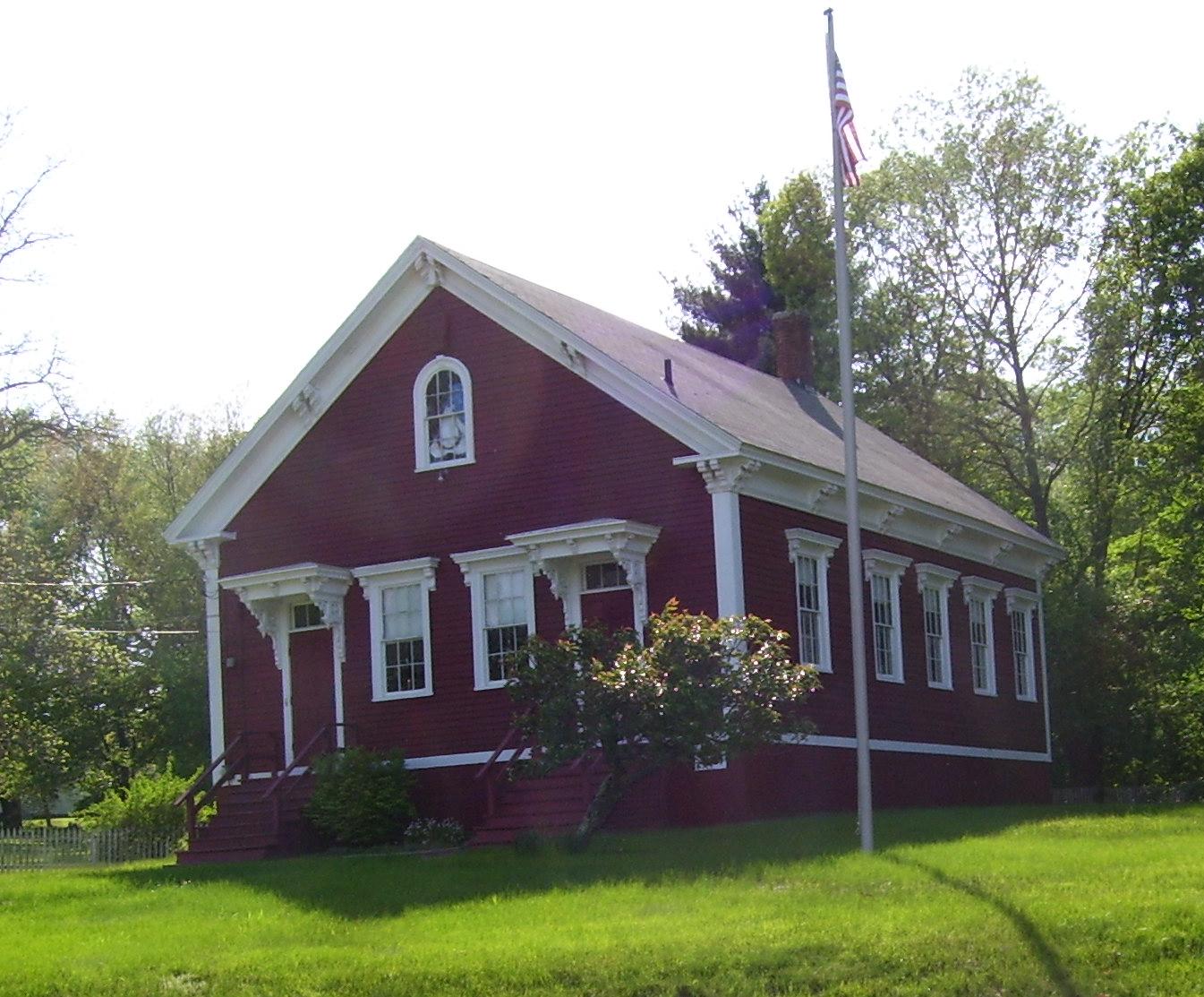
North Smithfield is a town in Providence County, Rhode Island, United States, settled as a farming community in 1666 and incorporated into its present form in 1871. North Smithfield includes the historic villages of Forestdale, Primrose, Waterford, Branch Village, Union Village, Park Square, and Slatersville. The population was 12,588 at the 2020 census.
According to the United States Census Bureau, the town has a total area of 24.7 square miles (64 km2), of which 24.0 square miles (62 km2) is land and 0.7 square miles (1.8 km2) (2.83%) is water. North Smithfield is in a New England upland region. The Branch River and Blackstone Rivers provided much of the power for the early mills in the town. The town consists mainly of temperate forests, with minor elevation changes. At 586 ft (179 m), Woonsocket Hill in North Smithfield is one of the highest points in Rhode Island. Residents can expect mild summers and harsh winters.
In the 17th century British colonists settled in North Smithfield developing a farming community that they named after Smithfield, London in England. The town was part of Smithfield, Rhode Island until it was incorporated as North Smithfield in 1871. The first colonization occurred after a Native American, "William Minnian" (also known as "Quashawannamut") a Praying Indian from Punkkupage Massachusetts Bay, on May 14, 1666, and again in 1669 with the permission of King Philip, deeded approximately 2,000 acres" to John Mowry and Edward Inman who partnered with Nathaniel Mowry, John Steere, and Thomas Walling in dividing up the purchased tract. During King Philip's War in 1676 Connecticut militia forces killed the last Narragansett sachem, Queen Quaiapen, and Stonewall John in Mattity Swamp in what is now North Smithfield in the Second Battle of Nipsachuck. In the early 18th century, a Quaker colony developed in what is now North Smithfield (then Smithfield), which extended into south Uxbridge, Massachusetts.
Today North Smithfield is part of the John H. Chaffee Blackstone River Valley National Heritage Corridor. The Blackstone Valley is the oldest industrialized region in the U.S. A local North Smithfield industry today, Berroco Yarns, is a continuation of an original family owned woolen company first established in this valley by Daniel Day in 1809.
The village of Slatersville was largely built by Samuel Slater and his brother John Slater beginning in 1803. It is a well-preserved original New England mill village with worker housing and commercial buildings and a church on a village green. This village is in fact America's first planned industrial mill village. Samuel and John's family owned this mill and the village until the turn of the 20th century.
Union Village, along Rhode Island Route 146A achieved local prominence as an important stagecoach stop on the route along Great Road. Union Village was also home to a hat shop, taverns, an academy and the Union Bank from which the village got its name. The North Smithfield Public Library was founded in 1931 with the first branch in the Union Village school. In 1965 Fogarty Hospital was constructed in the town.
In the nineteenth and early twentieth-century, North Smithfield "was served by several trolley and railroad lines; now all are gone save one. A freight-only spur line of the Providence and Worcester Railroad extends from the main line in Woonsocket and terminates [in Slatersville] at the Providence Pike" where it "primarily serves a single customer, a steel supplier called Denman and Davis," a company in Slatersville which is now part of O’Neal Steel, Inc.
As of the census of 2020, there were 12,588 people and 5,044 households in the town. The population density was 526.7 inhabitants per square mile (203.4/km2). There were 5,358 housing units in the town. The racial makeup of the town was 91.27% White, 1.20% African American, 0.07% Native American, 1.33% Asian, 1.70% from other races, and 4.40% from two or more races. Hispanic or Latino people of any race were 4.24% of the population. In 2000, 41% reported either French or French Canadian ancestry, 12% Irish, 12% Italian, and 8% English.
Hub AI
North Smithfield, Rhode Island AI simulator
(@North Smithfield, Rhode Island_simulator)
North Smithfield, Rhode Island
North Smithfield is a town in Providence County, Rhode Island, United States, settled as a farming community in 1666 and incorporated into its present form in 1871. North Smithfield includes the historic villages of Forestdale, Primrose, Waterford, Branch Village, Union Village, Park Square, and Slatersville. The population was 12,588 at the 2020 census.
According to the United States Census Bureau, the town has a total area of 24.7 square miles (64 km2), of which 24.0 square miles (62 km2) is land and 0.7 square miles (1.8 km2) (2.83%) is water. North Smithfield is in a New England upland region. The Branch River and Blackstone Rivers provided much of the power for the early mills in the town. The town consists mainly of temperate forests, with minor elevation changes. At 586 ft (179 m), Woonsocket Hill in North Smithfield is one of the highest points in Rhode Island. Residents can expect mild summers and harsh winters.
In the 17th century British colonists settled in North Smithfield developing a farming community that they named after Smithfield, London in England. The town was part of Smithfield, Rhode Island until it was incorporated as North Smithfield in 1871. The first colonization occurred after a Native American, "William Minnian" (also known as "Quashawannamut") a Praying Indian from Punkkupage Massachusetts Bay, on May 14, 1666, and again in 1669 with the permission of King Philip, deeded approximately 2,000 acres" to John Mowry and Edward Inman who partnered with Nathaniel Mowry, John Steere, and Thomas Walling in dividing up the purchased tract. During King Philip's War in 1676 Connecticut militia forces killed the last Narragansett sachem, Queen Quaiapen, and Stonewall John in Mattity Swamp in what is now North Smithfield in the Second Battle of Nipsachuck. In the early 18th century, a Quaker colony developed in what is now North Smithfield (then Smithfield), which extended into south Uxbridge, Massachusetts.
Today North Smithfield is part of the John H. Chaffee Blackstone River Valley National Heritage Corridor. The Blackstone Valley is the oldest industrialized region in the U.S. A local North Smithfield industry today, Berroco Yarns, is a continuation of an original family owned woolen company first established in this valley by Daniel Day in 1809.
The village of Slatersville was largely built by Samuel Slater and his brother John Slater beginning in 1803. It is a well-preserved original New England mill village with worker housing and commercial buildings and a church on a village green. This village is in fact America's first planned industrial mill village. Samuel and John's family owned this mill and the village until the turn of the 20th century.
Union Village, along Rhode Island Route 146A achieved local prominence as an important stagecoach stop on the route along Great Road. Union Village was also home to a hat shop, taverns, an academy and the Union Bank from which the village got its name. The North Smithfield Public Library was founded in 1931 with the first branch in the Union Village school. In 1965 Fogarty Hospital was constructed in the town.
In the nineteenth and early twentieth-century, North Smithfield "was served by several trolley and railroad lines; now all are gone save one. A freight-only spur line of the Providence and Worcester Railroad extends from the main line in Woonsocket and terminates [in Slatersville] at the Providence Pike" where it "primarily serves a single customer, a steel supplier called Denman and Davis," a company in Slatersville which is now part of O’Neal Steel, Inc.
As of the census of 2020, there were 12,588 people and 5,044 households in the town. The population density was 526.7 inhabitants per square mile (203.4/km2). There were 5,358 housing units in the town. The racial makeup of the town was 91.27% White, 1.20% African American, 0.07% Native American, 1.33% Asian, 1.70% from other races, and 4.40% from two or more races. Hispanic or Latino people of any race were 4.24% of the population. In 2000, 41% reported either French or French Canadian ancestry, 12% Irish, 12% Italian, and 8% English.
Recent media