
Community hub
Recent from talks
Contribute something to knowledge base
Content stats: 0 posts, 0 articles, 1 media, 0 notes
Members stats: 0 subscribers, 0 contributors, 0 moderators, 0 supporters
Subscribers
Supporters
Contributors
Moderators
Hub AI
Geomagnetic reversal AI simulator
(@Geomagnetic reversal_simulator)
Hub AI
Geomagnetic reversal AI simulator
(@Geomagnetic reversal_simulator)
Geomagnetic reversal
A geomagnetic reversal is a change in the Earth's dipole magnetic field such that the positions of magnetic north and magnetic south are interchanged (not to be confused with geographic north and geographic south). The Earth's magnetic field has alternated between periods of normal polarity, in which the predominant direction of the field was the same as the present direction, and reverse polarity, in which it was the opposite. These periods are called chrons.
Reversal occurrences appear to be statistically random. There have been at least 183 reversals over the last 83 million years (thus on average once every ~450,000 years). The latest, the Brunhes–Matuyama reversal, occurred 780,000 years ago with widely varying estimates of how quickly it happened. Some sources estimate the most recent four reversals took on average 7,000 years to occur. Clement (2004) suggests that this duration is dependent on latitude, with shorter durations at low latitudes and longer durations at mid and high latitudes. Others estimate the duration of full reversals to vary from between 2,000 to 12,000 years.
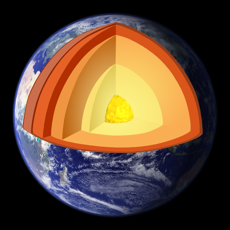
There have also been episodes in which the field inverted for only a few hundred years (such as the Laschamp excursion). These events are classified as excursions rather than full geomagnetic reversals. Stable polarity chrons often show large, rapid directional excursions, which occur more often than reversals, and could be seen as failed reversals. During such an excursion, the field reverses in the liquid outer core but not in the solid inner core. Diffusion in the outer core is on timescales of 500 years or less while that of the inner core is longer, around 3,000 years.
In the early 20th century, geologists such as Bernard Brunhes first noticed that some volcanic rocks were magnetized opposite to the direction of the local Earth's field. The first systematic evidence for and time-scale estimate of the magnetic reversals were made by Motonori Matuyama in the late 1920s; he observed that rocks with reversed fields were all of early Pleistocene age or older. At the time, the Earth's polarity was poorly understood, and the possibility of reversal aroused little interest.
Three decades later, when Earth's magnetic field was better understood, theories were advanced suggesting that the Earth's field might have reversed in the remote past. Most paleomagnetic research in the late 1950s included an examination of the wandering of the poles and continental drift. Although it was discovered that some rocks would reverse their magnetic field while cooling, it became apparent that most magnetized volcanic rocks preserved traces of the Earth's magnetic field at the time the rocks had cooled through the Curie temperature. In the absence of reliable methods for obtaining absolute ages for rocks, it was thought that reversals occurred approximately every million years.
The next major advance in understanding reversals came when techniques for radiometric dating were improved in the 1950s. Allan Cox and Richard Doell, at the United States Geological Survey, wanted to know whether reversals occurred at regular intervals, and they invited geochronologist Brent Dalrymple to join their group. They produced the first magnetic-polarity time scale in 1959. As they accumulated data, they continued to refine this scale in competition with Don Tarling and Ian McDougall at the Australian National University. A group led by Neil Opdyke at the Lamont–Doherty Earth Observatory showed that the same pattern of reversals was recorded in sediments from deep-sea cores.
During the 1950s and 1960s information about variations in the Earth's magnetic field was gathered largely by means of research vessels, but the complex routes of ocean cruises rendered the association of navigational data with magnetometer readings difficult. Only when data were plotted on a map did it become apparent that remarkably regular and continuous magnetic stripes appeared on the ocean floors.
In 1963, Frederick Vine and Drummond Matthews provided a simple explanation by combining the seafloor spreading theory of Harry Hess with the known time scale of reversals: sea floor rock is magnetized in the direction of the field when it is formed. Thus, sea floor spreading from a central ridge will produce pairs of magnetic stripes parallel to the ridge. Canadian L. W. Morley independently proposed a similar explanation in January 1963, but his work was rejected by the scientific journals Nature and Journal of Geophysical Research, and remained unpublished until 1967, when it appeared in the literary magazine Saturday Review. The Morley–Vine–Matthews hypothesis was the first key scientific test of the seafloor spreading theory of continental drift.
Geomagnetic reversal
A geomagnetic reversal is a change in the Earth's dipole magnetic field such that the positions of magnetic north and magnetic south are interchanged (not to be confused with geographic north and geographic south). The Earth's magnetic field has alternated between periods of normal polarity, in which the predominant direction of the field was the same as the present direction, and reverse polarity, in which it was the opposite. These periods are called chrons.
Reversal occurrences appear to be statistically random. There have been at least 183 reversals over the last 83 million years (thus on average once every ~450,000 years). The latest, the Brunhes–Matuyama reversal, occurred 780,000 years ago with widely varying estimates of how quickly it happened. Some sources estimate the most recent four reversals took on average 7,000 years to occur. Clement (2004) suggests that this duration is dependent on latitude, with shorter durations at low latitudes and longer durations at mid and high latitudes. Others estimate the duration of full reversals to vary from between 2,000 to 12,000 years.
There have also been episodes in which the field inverted for only a few hundred years (such as the Laschamp excursion). These events are classified as excursions rather than full geomagnetic reversals. Stable polarity chrons often show large, rapid directional excursions, which occur more often than reversals, and could be seen as failed reversals. During such an excursion, the field reverses in the liquid outer core but not in the solid inner core. Diffusion in the outer core is on timescales of 500 years or less while that of the inner core is longer, around 3,000 years.
In the early 20th century, geologists such as Bernard Brunhes first noticed that some volcanic rocks were magnetized opposite to the direction of the local Earth's field. The first systematic evidence for and time-scale estimate of the magnetic reversals were made by Motonori Matuyama in the late 1920s; he observed that rocks with reversed fields were all of early Pleistocene age or older. At the time, the Earth's polarity was poorly understood, and the possibility of reversal aroused little interest.
Three decades later, when Earth's magnetic field was better understood, theories were advanced suggesting that the Earth's field might have reversed in the remote past. Most paleomagnetic research in the late 1950s included an examination of the wandering of the poles and continental drift. Although it was discovered that some rocks would reverse their magnetic field while cooling, it became apparent that most magnetized volcanic rocks preserved traces of the Earth's magnetic field at the time the rocks had cooled through the Curie temperature. In the absence of reliable methods for obtaining absolute ages for rocks, it was thought that reversals occurred approximately every million years.
The next major advance in understanding reversals came when techniques for radiometric dating were improved in the 1950s. Allan Cox and Richard Doell, at the United States Geological Survey, wanted to know whether reversals occurred at regular intervals, and they invited geochronologist Brent Dalrymple to join their group. They produced the first magnetic-polarity time scale in 1959. As they accumulated data, they continued to refine this scale in competition with Don Tarling and Ian McDougall at the Australian National University. A group led by Neil Opdyke at the Lamont–Doherty Earth Observatory showed that the same pattern of reversals was recorded in sediments from deep-sea cores.
During the 1950s and 1960s information about variations in the Earth's magnetic field was gathered largely by means of research vessels, but the complex routes of ocean cruises rendered the association of navigational data with magnetometer readings difficult. Only when data were plotted on a map did it become apparent that remarkably regular and continuous magnetic stripes appeared on the ocean floors.
In 1963, Frederick Vine and Drummond Matthews provided a simple explanation by combining the seafloor spreading theory of Harry Hess with the known time scale of reversals: sea floor rock is magnetized in the direction of the field when it is formed. Thus, sea floor spreading from a central ridge will produce pairs of magnetic stripes parallel to the ridge. Canadian L. W. Morley independently proposed a similar explanation in January 1963, but his work was rejected by the scientific journals Nature and Journal of Geophysical Research, and remained unpublished until 1967, when it appeared in the literary magazine Saturday Review. The Morley–Vine–Matthews hypothesis was the first key scientific test of the seafloor spreading theory of continental drift.
Recent media
Recent media