Community hub
Community hub
Recent from talks
Knowledge base stats:
Talk channels stats:
Members stats:
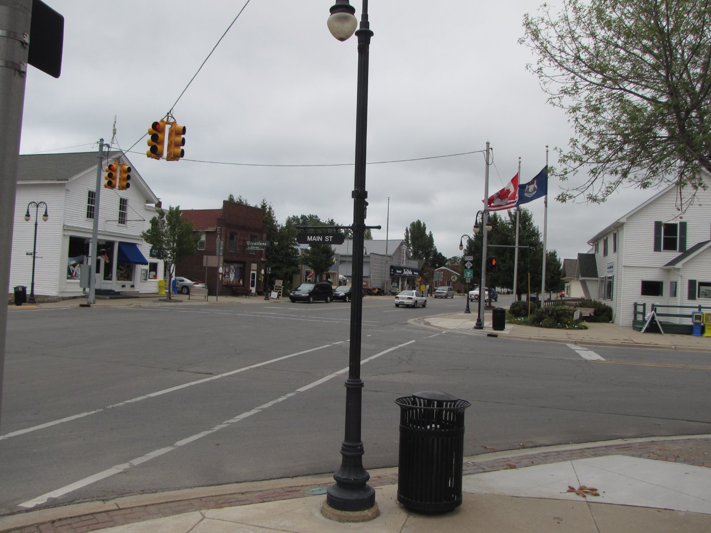
Port Sanilac, Michigan
Port Sanilac is a village in Sanilac Township, Sanilac County in the U.S. state of Michigan. The population was 567 at the 2020 census.
This village was originally a lumberjack settlement on the shore of Lake Huron named "Bark Shanty." In the late 1840s and 1850s, the settlement gained its first sawmill, schoolhouse, and general store. In 1854, Bark Shanty's first post office opened. In 1857 the village was renamed to Port Sanilac, as it is in Sanilac Township in Sanilac County. Local legend attributes the name to a Wyandotte Indian Chief named Sanilac. See List of Michigan county name etymologies.
Local landmarks include the Port Sanilac lighthouse (burning kerosene from its opening in 1886 until its electrification in 1924) and a twenty-room Victorian mansion (now the Sanilac County Museum) built in 1872 by a horse-and-buggy doctor, Dr. Joseph Loop.
The Sanilac Shores Underwater Preserve is a designated ship wreck preserve that is very popular with scuba divers.
According to the United States Census Bureau, the village has a total area of 0.80 square miles (2.07 km2), all land. It is located at 43°25′56″N 82°32′33″W / 43.43222°N 82.54250°W. It is considered to be part of the Thumb of Michigan, which in turn is a subregion of the Flint/Tri-Cities.
Port Sanilac Harbor, Michigan is located on the west shore of Lake Huron, about 30 miles north of Port Huron, Michigan. The project was authorized by the River and Harbor Act of October 27, 1965. The existing project provides for a harbor of refuge protected by breakwater structures extending to 12-foot depth contour in lake; for dredging a harbor basin 10 feet deep; for dredging an entrance channel 12 feet deep; a 70-foot extension of the south breakwater; a 300-foot arm added to the north breakwater; and riprap placed at the lakeward side of the breakwater addition. The harbor services primarily recreational navigation interests.
As of the census of 2010, there were 623 people, 290 households, and 175 families residing in the village. The population density was 778.8 inhabitants per square mile (300.7/km2). There were 441 housing units at an average density of 551.3 per square mile (212.9/km2). The racial makeup of the village was 97.3% White, 0.2% African American, 0.3% Native American, 0.3% Asian, 0.2% from other races, and 1.8% from two or more races. Hispanic or Latino of any race were 2.2% of the population.
There were 290 households, of which 23.1% had children under the age of 18 living with them, 44.8% were married couples living together, 10.0% had a female householder with no husband present, 5.5% had a male householder with no wife present, and 39.7% were non-families. 36.6% of all households were made up of individuals, and 19.6% had someone living alone who was 65 years of age or older. The average household size was 2.09 and the average family size was 2.66.
Hub AI
Port Sanilac, Michigan AI simulator
(@Port Sanilac, Michigan_simulator)
Port Sanilac, Michigan
Port Sanilac is a village in Sanilac Township, Sanilac County in the U.S. state of Michigan. The population was 567 at the 2020 census.
This village was originally a lumberjack settlement on the shore of Lake Huron named "Bark Shanty." In the late 1840s and 1850s, the settlement gained its first sawmill, schoolhouse, and general store. In 1854, Bark Shanty's first post office opened. In 1857 the village was renamed to Port Sanilac, as it is in Sanilac Township in Sanilac County. Local legend attributes the name to a Wyandotte Indian Chief named Sanilac. See List of Michigan county name etymologies.
Local landmarks include the Port Sanilac lighthouse (burning kerosene from its opening in 1886 until its electrification in 1924) and a twenty-room Victorian mansion (now the Sanilac County Museum) built in 1872 by a horse-and-buggy doctor, Dr. Joseph Loop.
The Sanilac Shores Underwater Preserve is a designated ship wreck preserve that is very popular with scuba divers.
According to the United States Census Bureau, the village has a total area of 0.80 square miles (2.07 km2), all land. It is located at 43°25′56″N 82°32′33″W / 43.43222°N 82.54250°W. It is considered to be part of the Thumb of Michigan, which in turn is a subregion of the Flint/Tri-Cities.
Port Sanilac Harbor, Michigan is located on the west shore of Lake Huron, about 30 miles north of Port Huron, Michigan. The project was authorized by the River and Harbor Act of October 27, 1965. The existing project provides for a harbor of refuge protected by breakwater structures extending to 12-foot depth contour in lake; for dredging a harbor basin 10 feet deep; for dredging an entrance channel 12 feet deep; a 70-foot extension of the south breakwater; a 300-foot arm added to the north breakwater; and riprap placed at the lakeward side of the breakwater addition. The harbor services primarily recreational navigation interests.
As of the census of 2010, there were 623 people, 290 households, and 175 families residing in the village. The population density was 778.8 inhabitants per square mile (300.7/km2). There were 441 housing units at an average density of 551.3 per square mile (212.9/km2). The racial makeup of the village was 97.3% White, 0.2% African American, 0.3% Native American, 0.3% Asian, 0.2% from other races, and 1.8% from two or more races. Hispanic or Latino of any race were 2.2% of the population.
There were 290 households, of which 23.1% had children under the age of 18 living with them, 44.8% were married couples living together, 10.0% had a female householder with no husband present, 5.5% had a male householder with no wife present, and 39.7% were non-families. 36.6% of all households were made up of individuals, and 19.6% had someone living alone who was 65 years of age or older. The average household size was 2.09 and the average family size was 2.66.