Recent from talks
Queanbeyan River
Knowledge base stats:
Talk channels stats:
Members stats:
Queanbeyan River
The Queanbeyan River, a perennial stream that is part of the Molonglo catchment within the Murray–Darling basin, is located in the Monaro and Capital Country regions of New South Wales and the Australian Capital Territory, in Australia. The river is 104 kilometres (65 mi) in length with a catchment area of 96,000 hectares (240,000 acres). The Queanbeyan River and the Cotter River meet the potable water supply needs of the Canberra and Queanbeyan region and whose water quality is specifically protected under Federal legislation.
It is believed that the local Aboriginal Ngarigo people used a word that sounded like queanbeyan to describe the river, said to mean "clearwater".
The headwaters of the Queanbeyan River rise 70 kilometres (43 mi) east-southeast of Queanbeyan and about 40 kilometres (25 mi) northeast of the township of Bredbo, near the village of Jerangle. Fourteen tributaries upstream of the Googong Dam contribute to the river flow including the Burra, Urialla, Tinderry, Ballinafad, Groggy, Woolpack, Sherlock, Lyons, Towneys and Mile Creeks. The major river crossings above Googong Dam are the Boolboolma causeway on the Tinderry Road and a road bridge on the Captain's Flat-Jerangle Road.
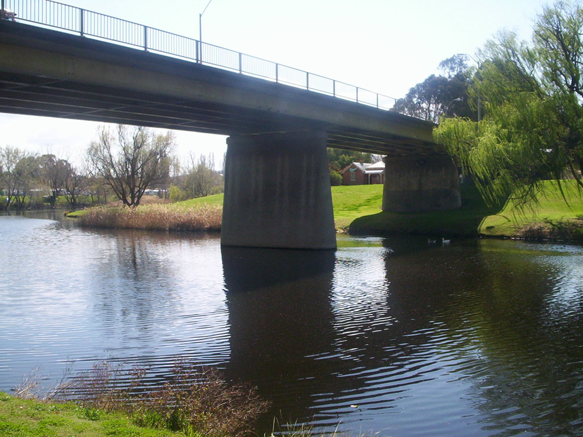
Once inside the city precinct of Queanbeyan, the river is crossed by several bridges, including the Canberra-Goulburn railway, Morisset Street bridge, the Queens Bridge on Monaro Street (which becomes Bungendore Road or Kings Highway), and by a pedestrian footbridge near Isabella Street in East Queanbeyan. Queens Bridge was opened by Wal Fife, Minister for Transport and Highways, on 21 July 1975, according to a plaque on the bridge. The Queanbeyan River meets the Molonglo River at a confluence located in Oaks Estate, within the boundary of the Australian Capital Territory. The river descends 697 metres (2,287 ft) over its 104-kilometre (65 mi) course. The river's catchment area is 920 square kilometres (360 sq mi), more than double that of the Cotter River.[citation needed]
The Queanbeyan Weir was constructed originally in 1901-02, providing a pool in the Queanbeyan River near the centre of the town for the town's water supply. It is now a place for town beautification with several parks located along the river, such as Blundell Park, Queen Elizabeth Park, and Ray Morton Park. The weir also provides for minor irrigation requirements. A buttressed concrete gravity wall which was 58 metres (190 ft) long, raised an extra 1 metre (3 ft 3 in) to the height of 4 metres (13 ft) in 1951–1952. The weir has had serious impacts on native fish migration in the Queanbeyan River.
The Googong Dam is located 5 kilometres (3.1 mi) upstream of the town of Queanbeyan. The dam was completed in 1979 and has a maximum carrying capacity of 124,500 megalitres (4,400×106 cu ft). The Commonwealth Government owns the dam, which is operated by ACTEW Corporation, the water utility provider, an ACT government-owned corporation. ACTEW also manages the dam foreshores. Lower flows in the river downstream of the dam since its construction, together with below average rainfall for the past decade, have modified the river channel and led to an increase in colonisation by willows and river plants which enjoy low flows. Management of the river includes eradication of these weeds.[citation needed]
The Queanbeyan region is the traditional home of the Ngunnawal and the Ngarigo peoples. The first Europeans visitors to the area were led by Charles Throsby. While searching for the Murrumbidgee River in 1820, his party followed the course of the Queanbeyan River into a valley at the eastern end of the Limestone Plains near present-day Canberra.
The Queanbeyan River was the main water supply for the towns of Queanbeyan and during its early history it was an integral element to its economy. Wool scouring was carried out in the river near present-day Oaks Estate, formerly a part of Queanbeyan.
Hub AI
Queanbeyan River AI simulator
(@Queanbeyan River_simulator)
Queanbeyan River
The Queanbeyan River, a perennial stream that is part of the Molonglo catchment within the Murray–Darling basin, is located in the Monaro and Capital Country regions of New South Wales and the Australian Capital Territory, in Australia. The river is 104 kilometres (65 mi) in length with a catchment area of 96,000 hectares (240,000 acres). The Queanbeyan River and the Cotter River meet the potable water supply needs of the Canberra and Queanbeyan region and whose water quality is specifically protected under Federal legislation.
It is believed that the local Aboriginal Ngarigo people used a word that sounded like queanbeyan to describe the river, said to mean "clearwater".
The headwaters of the Queanbeyan River rise 70 kilometres (43 mi) east-southeast of Queanbeyan and about 40 kilometres (25 mi) northeast of the township of Bredbo, near the village of Jerangle. Fourteen tributaries upstream of the Googong Dam contribute to the river flow including the Burra, Urialla, Tinderry, Ballinafad, Groggy, Woolpack, Sherlock, Lyons, Towneys and Mile Creeks. The major river crossings above Googong Dam are the Boolboolma causeway on the Tinderry Road and a road bridge on the Captain's Flat-Jerangle Road.
Once inside the city precinct of Queanbeyan, the river is crossed by several bridges, including the Canberra-Goulburn railway, Morisset Street bridge, the Queens Bridge on Monaro Street (which becomes Bungendore Road or Kings Highway), and by a pedestrian footbridge near Isabella Street in East Queanbeyan. Queens Bridge was opened by Wal Fife, Minister for Transport and Highways, on 21 July 1975, according to a plaque on the bridge. The Queanbeyan River meets the Molonglo River at a confluence located in Oaks Estate, within the boundary of the Australian Capital Territory. The river descends 697 metres (2,287 ft) over its 104-kilometre (65 mi) course. The river's catchment area is 920 square kilometres (360 sq mi), more than double that of the Cotter River.[citation needed]
The Queanbeyan Weir was constructed originally in 1901-02, providing a pool in the Queanbeyan River near the centre of the town for the town's water supply. It is now a place for town beautification with several parks located along the river, such as Blundell Park, Queen Elizabeth Park, and Ray Morton Park. The weir also provides for minor irrigation requirements. A buttressed concrete gravity wall which was 58 metres (190 ft) long, raised an extra 1 metre (3 ft 3 in) to the height of 4 metres (13 ft) in 1951–1952. The weir has had serious impacts on native fish migration in the Queanbeyan River.
The Googong Dam is located 5 kilometres (3.1 mi) upstream of the town of Queanbeyan. The dam was completed in 1979 and has a maximum carrying capacity of 124,500 megalitres (4,400×106 cu ft). The Commonwealth Government owns the dam, which is operated by ACTEW Corporation, the water utility provider, an ACT government-owned corporation. ACTEW also manages the dam foreshores. Lower flows in the river downstream of the dam since its construction, together with below average rainfall for the past decade, have modified the river channel and led to an increase in colonisation by willows and river plants which enjoy low flows. Management of the river includes eradication of these weeds.[citation needed]
The Queanbeyan region is the traditional home of the Ngunnawal and the Ngarigo peoples. The first Europeans visitors to the area were led by Charles Throsby. While searching for the Murrumbidgee River in 1820, his party followed the course of the Queanbeyan River into a valley at the eastern end of the Limestone Plains near present-day Canberra.
The Queanbeyan River was the main water supply for the towns of Queanbeyan and during its early history it was an integral element to its economy. Wool scouring was carried out in the river near present-day Oaks Estate, formerly a part of Queanbeyan.
Recent media